
For ocean month, let’s explore some fun facts you might not know about the ocean!
1. The ocean covers 71% of the Earth’s surface.
It also holds about 96.5% of all Earth's water – that's a volume of 320 million cubic miles! The globe illustration shows blue spheres representing relative amounts of Earth's water in comparison to the size of the Earth. Are you surprised that these water spheres look so small? Water is never sitting still. Thanks to the water cycle, our planet's water supply is constantly moving from one place to another and from one form to another.


2. 37 out of 50 critical minerals can be found in the ocean!
A critical mineral is a non-fuel mineral or mineral material that is 1) essential to the economic or national security of the U.S., and 2) has a supply chain vulnerable to disruption. “Critical minerals play a significant role in our national security, economy, renewable energy development, and infrastructure,” says Tanya Trujillo, Assistant Secretary of the Interior for Water and Science. “USGS data collection and analysis scans the horizon for emerging issues in crucial supply chains, and every three years identifies the nation’s current vulnerabilities to potential disruptions." Some of the minerals found in the ocean include antimony, cobalt, lithium, manganese, and titanium.


3. The ocean influences and regulates Earth’s climate, acting like the planet’s ‘heart.’
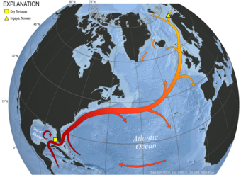
Ocean currents circulate vital heat and moisture around the globe, similar to the human circulatory system. Physical oceanic processes like the El Niño-Southern Oscillation (ENSO) in the Pacific Ocean basin and the Gulf Stream current in the Atlantic can influence climate worldwide. Just like our hearts must be monitored and cared for to ensure long-term health, USGS studies our oceans to better understand these processes and how they influence our climate. This knowledge is critical for monitoring and predicting how our ocean-climate system is shifting, affecting both people and ecosystems in our changing world.

4. There is enough salt in the ocean to cover the whole surface of the Earth.
If the salt in the ocean could be removed and spread evenly over the Earth’s land surface, it would form a layer more than 500 feet (166 meters) thick, about the height of a 40-story office building. Why is the ocean salty? This salt mostly comes from rocks on land, and is transported by rainwater runoff and riverine inputs to the sea. It can also be thrust into the ocean from hydrothermal vents on the seafloor.
5. Less than 10% of the world’s ocean, and less than 50% of U.S. waters, have been mapped.
That’s not very much coverage—and there’s a lot to explore there! Humans know more about the physical and chemical properties of outer space than about planet Earth’s deep ocean regions. The bottom of the ocean is anything but flat. In fact, it’s full of features like ridges, trenches, plateaus, and canyons. USGS maps bathymetry—the shape of the ocean floor—to better understand the resources and hazards that can be found there.
View the audio-described version.
6. The ocean floor is moving!
The ocean floor is composed mostly of basalt and other igneous rocks, forming what’s known as oceanic crust. As tectonic plates spread apart, molten magma rises up into the ocean floor, forming a mid-ocean ridge, which is part of the active tectonic processes that are shaping our planet. At these geologically active sites, hydrothermal fluids vent hot mineralogic material into the ocean water. This activity forms deep sea mineral deposits and supports chemosynthetic life forms and related ecosystems. In these areas, important discoveries about our planet and the life forms that live in these remote areas are still being made.


7. Sea level and the amount of water in the ocean change over time.
During colder climatic periods, ice caps grow, glaciers form, and water turns to ice—lessening the amounts in other parts of the water cycle like the ocean. The reverse is true during warm periods. During the last ice age, glaciers covered almost one-third of Earth's land mass, and the ocean was 400 feet lower than today—allowing humans to cross over to North America from Asia. During the last global "warm spell," about 125,000 years ago, the seas were about 18 feet higher than they are now.
USGS is involved in sea-level rise research, including forecasting the impacts of sea-level rise on our coastal communities and ecosystems. As global average temperatures increase, heat is absorbed into the ocean, sea surface temperatures rise, and water expands. This expansion adds to the volume of water in the ocean and increases global sea levels. It’s important to note that with rising seas, the ocean basins won’t just fill up like a bathtub—sea-level rise will also increase coastal hazards like erosion and flooding.


8. The number of species that live in the ocean is unknown.
Eukaryotes are the plants, animals, and fungi found on Earth. Some studies estimate that there are about ∼8.7 million eukaryotic species globally, of which ∼2.2 million are marine, meaning about a quarter of all eukaryotic life lives in the ocean! What we do know is that our ocean is home to a wealth of biodiversity and every organism plays a critical role in the structure and function of this expansive marine environment. USGS science helps inform the management and conservation of marine biodiversity and habitats, from the coastlines down to the deepest trenches.


9. The Great Lakes aren’t oceans, but they’re similar in many ways.
While the Great Lakes aren’t salty like the ocean, they are very oceanic in nature—and it takes oceanic methods to study them! These large bodies of water are facing many of the same stressors as our ocean such as overfishing, marine debris, water quality, and invasive species. The USGS conducts research and monitoring in the Great Lakes region and in other inland seas across the country to understand these large bodies of water and inform how we use and manage them. Learn about the Great Lakes and what makes them so ‘oceanic’ in our Science Explorer page on Great Lakes and Inland Seas.


10. USGS studies the ocean in many ways and using many disciplines.
USGS studies our world’s ocean to better understand the geologic framework of the marine environment, expand our knowledge about hazards, minerals and living resources within the ocean, and how processes in the marine realm can affect our communities on land. To explore our ocean research, check out our new Ocean Science Explorer pages.

Get Our News
These items are in the RSS feed format (Really Simple Syndication) based on categories such as topics, locations, and more. You can install and RSS reader browser extension, software, or use a third-party service to receive immediate news updates depending on the feed that you have added. If you click the feed links below, they may look strange because they are simply XML code. An RSS reader can easily read this code and push out a notification to you when something new is posted to our site.