
50 years of teamwork. 50 years of innovation. 50 years of resilience. In 1966, Secretary of the Interior Stewart Udall announced his vision to create a program aimed at gathering facts about the natural resources of the Earth from Earth orbiting satellites. It was a bold proclamation. It was also an idea that worked and continues to work 50 years on.
EROS 50th History, 1980-1999: Through Uncertainty to a Firm Footing
Second in a series of three EROS 50th History stories
Second in a series of three EROS 50th History stories
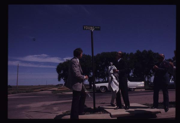
1966-1979: How Sioux Falls Ingenuity Secured the Center
First in a series of three EROS 50th History stories
First in a series of three EROS 50th History stories
2000-2023: Data and Science Surge
Third in a series of three EROS 50th History stories
Third in a series of three EROS 50th History stories
By Earth Resources Observation and Science (EROS) Center
July 5, 2023
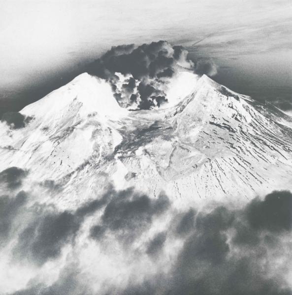
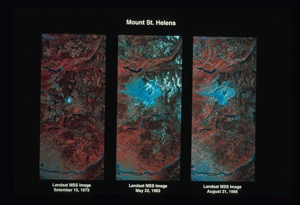
Mount St. Helens erupted May 18, 1980, spewing ash into the atmosphere, flattening forests for miles and killing 57 people.
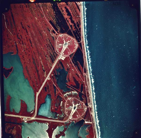
When the ash settled, Landsat captured the aftermath. And the archive at the USGS Earth Resources Observation and Science (EROS) Center proved its value once again, with vivid before and after images showing the extent of the devastation.
1966-1979: How Sioux Falls Ingenuity Secured the Center
1966-1979: How Sioux Falls Ingenuity Secured the Center
1966-1979: How Sioux Falls Ingenuity Secured the Center
2000-2023: Data and Science Surge
2000-2023: Data and Science Surge
2000-2023: Data and Science Surge
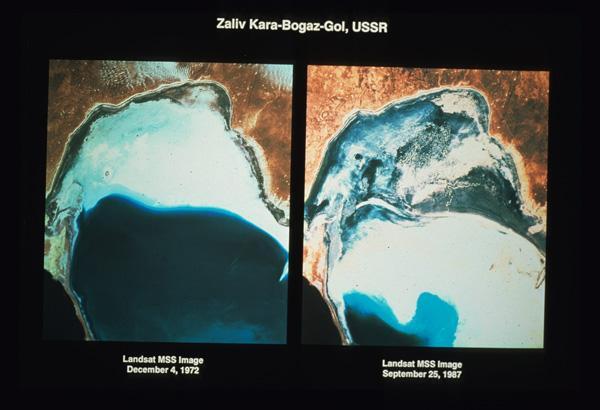
Only viewing the same site over time reveals the full story of land change, be it gradual or cataclysmic.
Despite this and other striking evidence of its benefits at the time, at EROS, the 1980s are sometimes remembered as years where the future of the center—and even of the very idea of a public civilian remote sensing satellite program—was not guaranteed.

Sources/Usage: Public Domain. View Media Details
Yet by the end of the 1990s, EROS not only had expanded its science contributions but also fulfilled the destiny dreamed of when Sioux Falls was tapped to host the center: serving as a ground station receiving data from Landsat satellites.
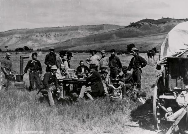
1980-1982: Growth Despite Adversity
The potential for change was in the air at the beginning of the 1980s. In November 1979, President Carter had issued a directive transferring Landsat operations from NASA to the National Oceanic and Atmospheric Administration (NOAA, part of the Department of Commerce).
The directive also recommended that the operation of satellites and data distribution be turned over to the private sector over a 10-year period and even that the archive itself might be moved. Both possibilities concerned employees and supporters of “The Little Data Center on the Prairie.”
At the same time, EROS—in tandem with the Landsat program—was expanding in many different directions:
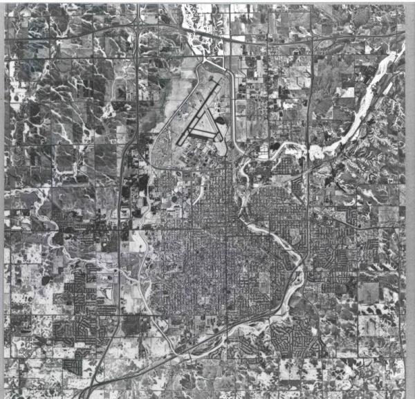
- In 1980, a solar energy water system to heat the daily 20,000 gallons of water used in photo processing was installed at EROS. The 10,000-square-foot installation of solar panels, paid for in part with a $500,000 federal grant, was one of the largest in the United States at the time.
- The EROS program’s Alaska Field Office opened in March 1980, installing the necessary equipment in an existing building in Anchorage.
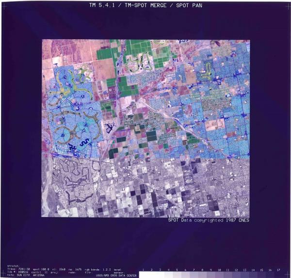
- By January 1982, there were 11 Landsat data distribution centers around the globe and more than a dozen Landsat ground stations receiving satellite imagery.

Sources/Usage: Public Domain. View Media Details
This 1987 aerial image of the USGS Earth Resources Observation and Science (EROS) Center depicts solar panels above the main building.
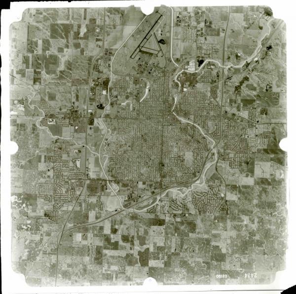
- Research and science topics abounded. To cite just one year as an example, Landsat data applications being studied by academic users in 1980 included dozens of topics, from agricultural inventories, air pollution studies, and archaeological interpretation to urban and regional planning, volcanological studies, wetland ecology and mapping, and wildlife habitat and studies.
- More and more varied content continued to be added to the EROS archive. An April 30, 1981, overview of its 6,318,181 images listed over 1.4 million from Landsat; 63,000 from the Skylab, Apollo, and Gemini space flight programs; and 4.8 million from aerial photography.
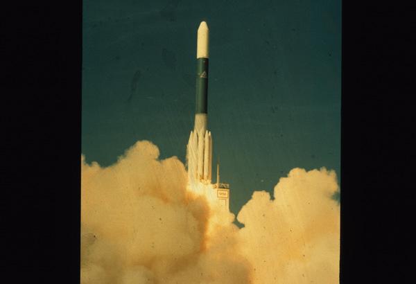
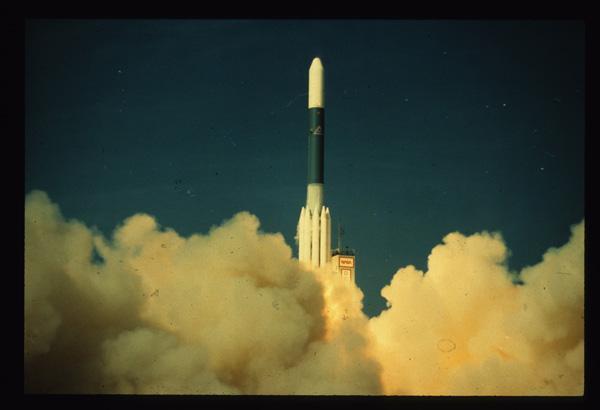
- On July 16, 1982, Landsat 4 was launched, the first satellite in the program to provide natural color images thanks to the Thematic Mapper and its additional spectral bands. The big plans for Landsat 4 included making it the first civilian aircraft with a GPS receiver, although only 4 of 24 GPS satellites were in orbit at its launch. It also was designed to be a Multimission Modular Spacecraft, retrievable by the space shuttle program.


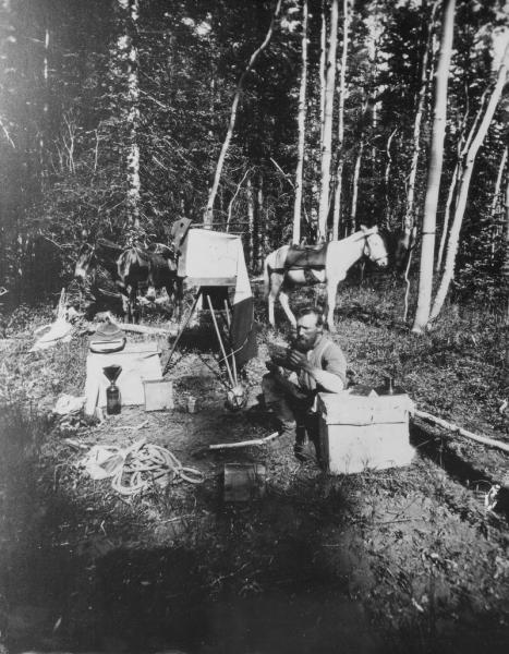
1983-1985: Looming Commercialization
Even with all this activity and innovation, bumpy roads lay ahead for EROS. In February 1983, President Reagan signed a decision memorandum authorizing a formal Landsat commercialization effort, accelerating the more gradual approach Carter started in 1979.
The move created more apprehension about the center’s future. In some ways, EROS might have been a victim of its own success. The center had a reputation for prompt customer service, with a swift turnaround from order to reception of prints or film. The prices charged for imagery covered 90% of the costs of production, a remarkable efficiency. EROS must have seemed to budget cutters like a good candidate for making its own way in the world of business.
Congress passed the Land Remote Sensing Commercialization Act in June 1984, making the commercialization of Landsat data official. In response, NOAA and USGS outlined an agreement with a key parameter that ultimately ensured EROS’ future: The center was designated as the sole archive for remotely sensed land data. Like NASA at the Landsat program’s beginning, NOAA really had no interest in taking over the archiving duties EROS already was performing so well.
Two companies emerged in the competitive process to run the program: Eastman Kodak and the Earth Observation Satellite Company (EOSAT), a joint venture between Hughes Aircraft and RCA. Kodak dropped out of the running, leaving EOSAT to be awarded the contract on September 27, 1985.


Other major events affecting EROS at the time, some with geopolitical implications, include:
- Landsat 5 was launched on March 1, 1984. Designed to last three years, Landsat 5 remained in operation for nearly 29 years, holding the Guinness World Record for Earth observation satellites. Like Landsat 4, it had an auxiliary fuel tank to enable it to navigate for a potential space shuttle repair and refuel mission. That extra fuel contributed to Landsat’s 5 extraordinary longevity.
- The Challenger space shuttle exploded 73 seconds into its launch on January 28, 1986, killing all seven crew members. The shuttle’s mission was to launch a second Tracking and Data Relay Satellite (TDRS) that, with its twin already in orbit, would have ensured a continuous stream of data to ground stations, increasing the efficiency of EROS’ image processing. After that, shuttle retrieval of a Landsat satellite, probably Landsat 4, which might have lengthened the satellite’s lifetime, was canceled along with all other 1986 shuttle missions. A second TDRS was not launched until 1988.

Sources/Usage: Public Domain. View Media Details
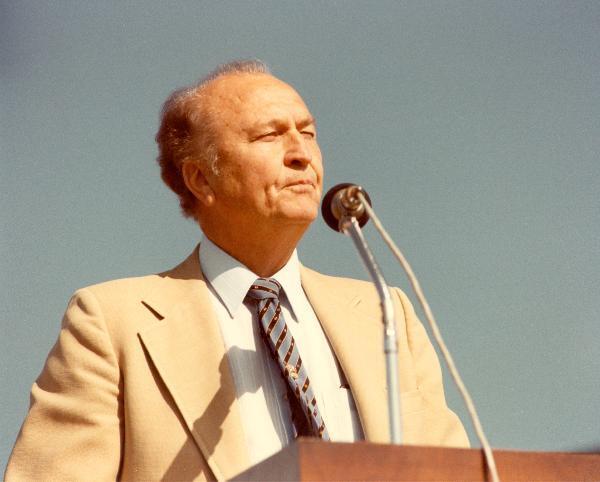
- A reactor meltdown on April 26, 1986, in Chernobyl, Ukraine, then part of the Soviet Union, led to concerns that the USSR was understating the extent of the disaster. In May, EROS director Al Watkins was interviewed by Dan Rather on CBS Evening News, explaining how scientists used Landsat imagery to assess the damage.
1986-1989: EROS Gains Support
The consequences of EOSAT’s involvement didn’t all take effect immediately. The contract included:
- The operations of Landsats 4 and 5 and a mandate to build two new satellites.
- Rights to sell all pre-1985 Landsat data, and also to sell any new data for 10 years from the date of acquisition.
- Receipt of all foreign ground station fees, plus hundreds of millions of dollars of subsidies.
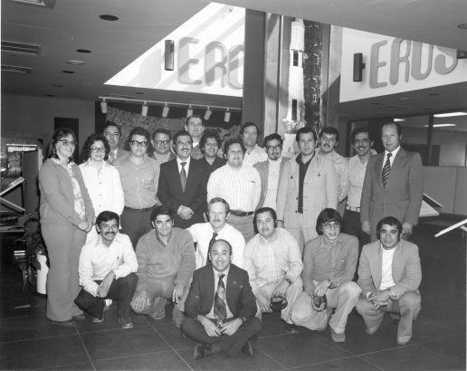
Eventually, EOSAT would build its own data and image processing facilities. Meanwhile, EROS continued receiving, processing and distributing data—but the revenue went to the new company. The center would potentially lose $6 million a year, about a third of its total budget. Cost-cutting seemed inevitable. By 1987, Watkins and his team even contemplated reducing the staff from 350 down to 150 and relocating the archive.
However, the archive, now holding an incredible 7 million images, was one of the biggest deterrents to closing EROS. Moving the materials, some fragile, on that scale would be daunting, and the archive was a resource that many felt should remain under government control. In 1988, NOAA and the USGS agreed to keep the archive at EROS, although a memo at the time noted that no funding was designated for its maintenance.

Sources/Usage: Public Domain. View Media Details
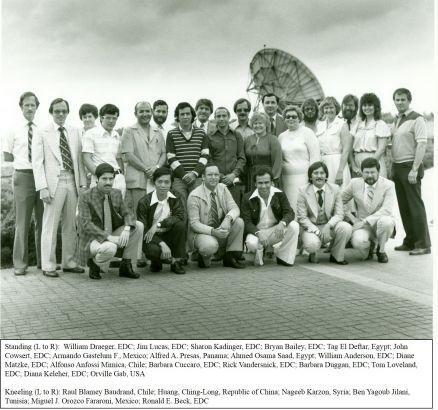
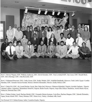
Science was the other key to EROS’ staying power. In 1987, the Advanced Very High Resolution Radiometer (AVHRR) antenna was installed on the roof at the center to receive NOAA satellite data. EROS scientists used the resulting greenness data to help predict, among other things, fire danger across the United States and crop failures in Africa.
EROS involvement in the United States Agency for International Development (USAID) Famine Early Warning System helped improve food security for millions in West Africa. The center also established a research center in Niamey, Niger, to oversee AGHRYMET (Agriculture, Hydrology and Meteorology), another USAID-supported program, in 1989, with the idea of training people how to use remote sensing data in their home countries.
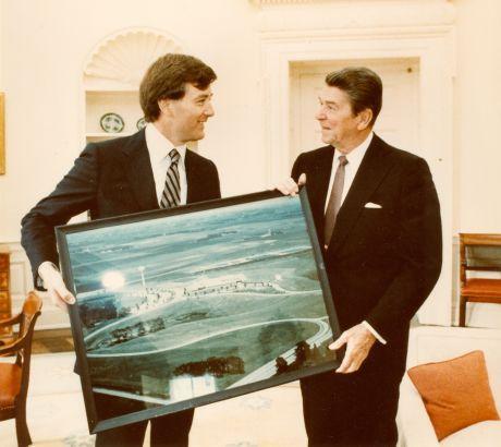
Perhaps its biggest hurdle confronted EROS just when it was being recognized worldwide for these benefits. On March 1, 1989, NOAA gave the order to begin a 30-day process to shut down Landsats 4 and 5. In response to this, 100 members of Congress sent Vice President Dan Quayle, the chair of the newly created National Space Council, a letter seeking to preserve the Landsat program.
By the middle of the month, Quayle helped secure funding for the remainder of the fiscal year. In June, thanks to a unanimous recommendation from the Space Council to provide an additional \$5 million for fiscal year 1989 and \$19 million for 1990, the Bush administration announced a civil remote sensing program would be retained.
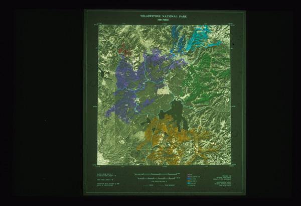
Through all of these storms, EROS maintained its watchful eye on land change in the late 1980s, including monitoring the Yellowstone National Park fires in 1988 and supporting cleanup efforts of the Exxon Valdez oil spill in Prince William Sound in 1989 through the Alaska Field Office.


1990-1992: Exciting New Prospects
In 1990, EROS employees gained a reason to not only feel secure in their existing space, but to look forward to a large building addition and increased staffing. In a NASA flag raising ceremony held August 28 at EROS, the USGS and NASA announced that, as part of NASA’s “Mission to Planet Earth” program, EROS would host the Land Processes Distributed Active Archive Center (LP DAAC).

Sources/Usage: Public Domain. View Media Details
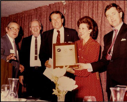
The following year, EROS learned it could add yet another flag out front when it was named the North American location for the United Nations Environment Programme’s Global Resource Information Database (UNEP/GRID) to bring data, experience and knowledge to applications of remote sensing and geospatial science to the globe. In March 1992, United Nations Undersecretary and UNEP Executive Director Mostafa Tolba welcomed EROS into the UNEP/GRID effort during a formal dedication.
Also in 1992, Congress paved a path for the future of Landsat—and EROS—that would leave commercialization behind. The Land Remote Sensing Policy Act of 1992, introduced by S.D. Sen. Larry Pressler, would not only repeal the commercialization of Landsat but also extend the life of the program beyond 2000 and designate EROS as the National Satellite Land Remote Sensing Data Archive. As a result, EROS would be asked to process, distribute and archive data from the planned Landsat 7 satellite, in addition to installing an antenna and serving as the primary ground station for Landsat 7 data. The 1993 failure of Landsat 6, the only commercial Landsat launch, to achieve orbit punctuated the decision to end commercialization as well.
In the midst of the big announcements, EROS saw plenty of other activity:

Sources/Usage: Public Domain. View Media Details
- EROS began producing biweekly greenness maps of the conterminous United States, based on composite AVHRR data, in 1990.
- From August 1990 through February 1991, EROS supplied the U.S. Department of Defense and intelligence agencies with AVHRR and Landsat imagery during Operation Desert Shield (August 1990-January 1991) and Desert Storm (January-February 1991).
- In 1991, the Multi-Resolution Land Characterization (MRLC) Consortium was initiated with the USGS, NOAA and the EPA to help pool agency resources to acquire Landsat imagery for a national land cover dataset, which eventually was produced by EROS.
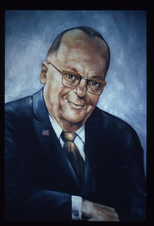
- In EROS’ first big leadership change, Al Watkins left in 1991 after 18 years as the director to become chief of the USGS National Mapping Division, and Don Lauer received a promotion to EROS director in 1992.
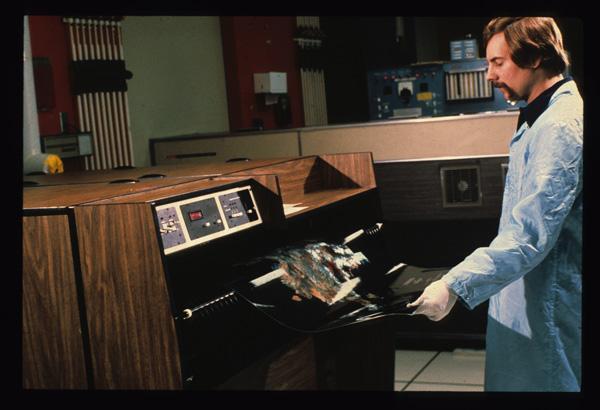
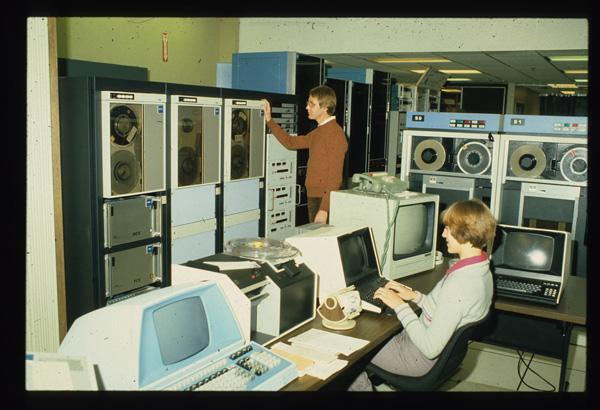
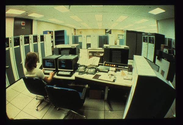
- Advances in technology helped the archive and its users. In 1991, EROS released a prototype for the Global Land Information System (GLIS), an online directory that provided PC users with remote access to EROS data for the first time. It allowed them to browse data and order products. In 1992, a new system began converting Landsat MSS data from high-density tapes to smaller digital tapes, saving images on the verge of permanent degradation.
1993-1996: A Time of Additions
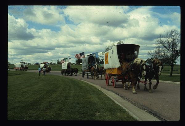
The EROS campus underwent a dramatic transformation after a May 31, 1994, groundbreaking was held for the addition to the southeast of the original building that would be necessary to help house Landsat 7 efforts and the LP DAAC. The groundbreaking itself featured the same horse-drawn plow used for the original building’s 1972 groundbreaking and also included a ceremonial burning of EROS’ 20-year mortgage.

Sources/Usage: Public Domain. View Media Details
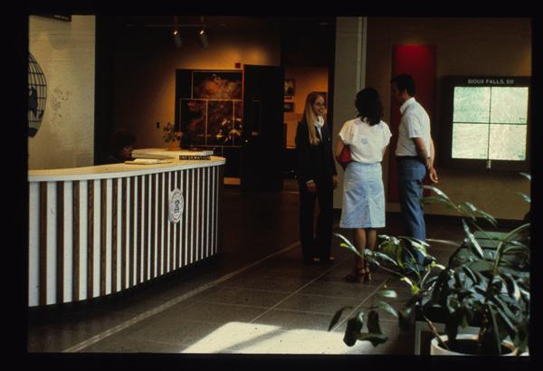
Events in 1996 to mark the opening of the new 65,000-foot, $9 million addition included an open house on April 20 that took more than 4,000 visitors on a tour. EROS had been closed to visitors during construction, but now they were invited to see the new space, which housed a reception and atrium area, 283-seat auditorium, main level and basement computer rooms, training room, offices and basement archive space. On August 19, a dedication ceremony hosted by USGS Director Gordon Eaton formally opened the new addition.
In 1995, the LP DAAC Data Distribution System was completed, with the ability to hold 2.4 terabytes and initially containing data from the Shuttle Imaging Radar-C (SIR-C) instrument, which had flown on the space shuttle Endeavor in April 1994; Global Land 1K AVHRR orbital segment and global composite products; and 30-arc-second Digital Elevation Models.
The EROS archive, meanwhile, benefited from the addition in 1996 of reconnaissance satellite imagery—more than 900,000 scenes—following the 1995 announcement by Vice President Al Gore and CIA Acting Director William O. Studeman of the declassification of the imagery, which was collected from 1960 to 1972.

Sources/Usage: Public Domain. View Media Details
Other science and technology highlights included:
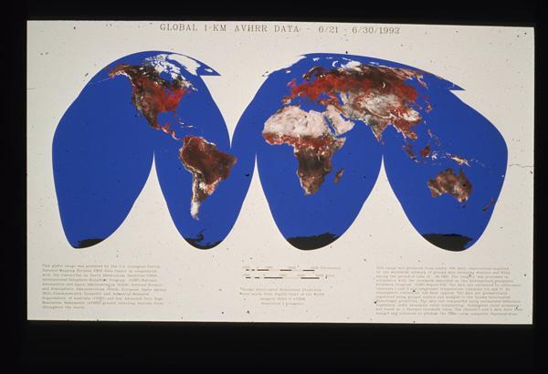
- Producing the first global AVHRR greenness map in 1993 and earning a Federal Leadership Award for it, and then in 1994, producing 10-day global AVHRR datasets.
- In 1994, debuting internet access to EROS products for the first time, allowing customers to directly download data to their computers. By Sept. 30, 1994, more than 70,000 data files were being downloaded each month.
- Hosting an 18-member Scientific Assessment and Strategy Team (SAST) made up of scientists and engineers from federal and state agencies for two months in the main conference room in early 1994 to study watershed and floodplain issues related to the Great Flood of 1993 that affected the Missouri and Mississippi rivers.
- In 1995, beginning participation by supplying remote sensing datasets to the Global Learning and Observations to Benefit the Environment (GLOBE) program, which grew into a worldwide network of students working under trained teachers to make environmental observations near their schools.
- In 1996, completing the transcription of all Landsat MSS and TM data at EROS through 1992 to digital tapes.


Sources/Usage: Public Domain. View Media Details
1997-1999: Set for a Solid Future
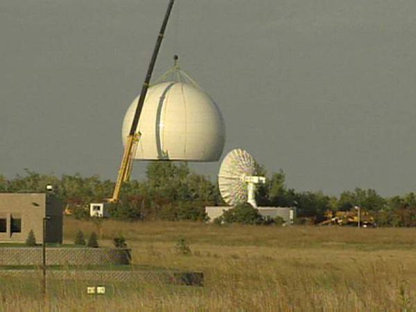
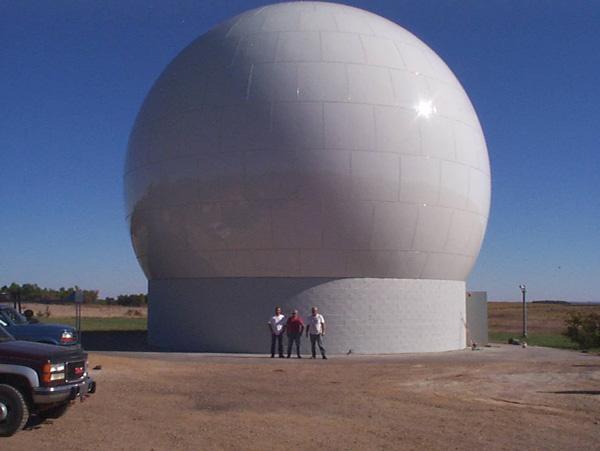
EROS finally received an antenna dedicated to Landsat satellites on June 6, 1997, in anticipation of the upcoming launch of Landsat 7. This fulfilled EROS’ long-intended purpose of being a Landsat ground station. Unfortunately, a little over a month later—on a Sunday, July 13—a storm struck EROS with hail the size of softballs, cratering the antenna beyond use. The hail also cracked atrium roof panels, demolished the solar panel system and ruined vehicles. Damages totaled more than $1 million.

Sources/Usage: Public Domain. View Media Details

Sources/Usage: Public Domain. View Media Details

Sources/Usage: Public Domain. View Media Details
When the antenna was reconstructed, EROS was ready to downlink data after Landsat 7’s long-awaited launch on April 15, 1999. Three days later, EROS processed the first signals from Landsat 7, including imagery of southeastern South Dakota.
Landsat 7 wasn’t the only satellite launch in 1999 that would affect EROS. Terra, in NASA’s Earth Observing System series, launched December 18, and data from its MODIS and ASTER instruments began to be stored at and distributed from the LP DAAC.
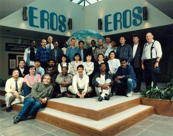
Also cause for celebration was the 25th anniversary EROS marked in 1998. An open house on September 19 drew more than 10,000 guests. Former NASA astronaut Mary Cleave was the special guest and speaker, and 350 employees served as volunteers. Activities related to the festivities included a juried art show and publication of the book “What It Took: A History of the U.S. Geological Survey’s EROS Data Center” by Rebecca Johnson.

Sources/Usage: Public Domain. View Media Details
Much more kept EROS busy, too, such as:
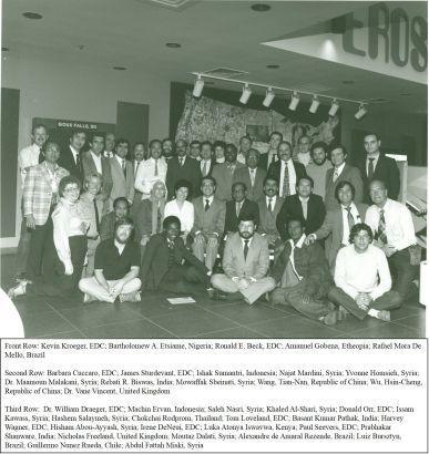
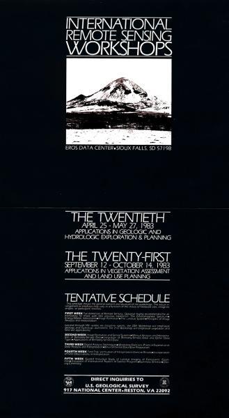
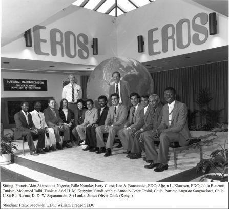
- Partnering in NASA’s Global Observation of Forest Cover and Global Observation of Land Dynamics (GOFC-GOLD), established in 1997, to help provide remote sensing skills and applications to parts of Africa, Asia, Latin America, Eastern Europe and the Mediterranean Basin. EROS hosted visiting international researchers for workshops that taught remote sensing basics.
- Establishing the Emergency Response Program in 1998, a hazard preparedness and disaster response team to improve the mechanisms of data delivery and develop partnerships with emergency response agencies.
- Completing the first version, in 1998, of the National Elevation Dataset (NED), which served as the flagship elevation product for the USGS from 1999 to 2014.
- Supporting OhioView, a pilot program with a group of Ohio universities called the OhioView Consortium intended to promote the distribution and application of government data for public use, overcoming the cost and data access problems historically faced by the research community. EROS’ role involved providing a copy of remote sensing data that could be shared by the consortium users, which necessitated enhancing the networking, information access and delivery and product generation infrastructure at EROS.
- Responding to Hurricane Mitch after it struck Central America in 1998 by sending a team of scientists to Honduras for GIS support to USAID and the data distribution and training center in Honduras, building a geospatial data library, organizing data layers for reconstruction work in municipalities and traveling throughout six countries to lay the foundation for an Internet Clearinghouse to provide access to geospatial data for reconstruction, land management and disaster mitigation work.
- Beginning work on the first assessment of land use and land cover change for the conterminous United States in 1998, based on Landsat data, through the Land Cover Characterization Program.
More Secure and Looking Ahead
EROS persevered, and the clouds that the Landsat commercialization era brought to EROS had swept clear by the end of the 1990s. EROS experienced more support for the Landsat program, increased its role in the program by downlinking and processing imagery on-site, absorbed other data sources to the archive and diversified into many other activities.
It was a time for looking forward to the future—to whatever the next Landsat satellite might be, and to whatever new science explorations the data might bring about.
Related Content
Listen to Eyes on Earth podcast episodes about EROS and history, and watch videos celebrating EROS and Landsat's 50 years, along with depicting a summary of the National Satellite Land Remote Sensing Data Archive at EROS, construction of the new addition, an EROS-produced documentary and a 1985 walk-through of EROS.
Episodes About EROS
Episodes About EROS
Episodes About EROS
Episodes Related to History
Episodes Related to History
Episodes Related to History

USGS EROS: Celebrating 50 Years of Excellence
For 50 years, the people of EROS have overcome difficulties and celebrated triumphs together, always centered on providing a perspective of the Earth that helps us better understand its condition. This video, timed with the 50th anniversary celebration at EROS in August of 2023, explores the center's history.
")
Landsat: Celebrating 50 Years (Extended Edition)
50 years of teamwork. 50 years of innovation. 50 years of resilience. In 1966, Secretary of the Interior Stewart Udall announced his vision to create a program aimed at gathering facts about the natural resources of the Earth from Earth orbiting satellites. It was a bold proclamation. It was also an idea that worked and continues to work 50 years on.

1997 NSLRSDA 14 minutes
A 1997 presentation on the National Satellite Land Remote Sensing Data Archive, led by the USGS Earth Resources Observation and Science (EROS) Center
A 1997 presentation on the National Satellite Land Remote Sensing Data Archive, led by the USGS Earth Resources Observation and Science (EROS) Center

1994 EROS Addition Construction
A 1994 video on the construction of a building addition at the USGS Earth Resources Observation and Science (EROS) Center.
A 1994 video on the construction of a building addition at the USGS Earth Resources Observation and Science (EROS) Center.

1988 GIS Man Nature and Technology Video
A 1988 short film from the USGS Earth Resources Observation and Science (EROS) Center on man, nature, and technology
A 1988 short film from the USGS Earth Resources Observation and Science (EROS) Center on man, nature, and technology

1985 EDC Walk Through
A walk through of the USGS EROS Center from 1985.
A walk through of the USGS EROS Center from 1985.
Related Content
Listen to Eyes on Earth podcast episodes about EROS and history, and watch videos celebrating EROS and Landsat's 50 years, along with depicting a summary of the National Satellite Land Remote Sensing Data Archive at EROS, construction of the new addition, an EROS-produced documentary and a 1985 walk-through of EROS.
Episodes About EROS
Episodes About EROS
Episodes About EROS
Episodes Related to History
Episodes Related to History
Episodes Related to History
USGS EROS: Celebrating 50 Years of Excellence
For 50 years, the people of EROS have overcome difficulties and celebrated triumphs together, always centered on providing a perspective of the Earth that helps us better understand its condition. This video, timed with the 50th anniversary celebration at EROS in August of 2023, explores the center's history.
Landsat: Celebrating 50 Years (Extended Edition)
50 years of teamwork. 50 years of innovation. 50 years of resilience. In 1966, Secretary of the Interior Stewart Udall announced his vision to create a program aimed at gathering facts about the natural resources of the Earth from Earth orbiting satellites. It was a bold proclamation. It was also an idea that worked and continues to work 50 years on.
50 years of teamwork. 50 years of innovation. 50 years of resilience. In 1966, Secretary of the Interior Stewart Udall announced his vision to create a program aimed at gathering facts about the natural resources of the Earth from Earth orbiting satellites. It was a bold proclamation. It was also an idea that worked and continues to work 50 years on.
1997 NSLRSDA 14 minutes
A 1997 presentation on the National Satellite Land Remote Sensing Data Archive, led by the USGS Earth Resources Observation and Science (EROS) Center
A 1997 presentation on the National Satellite Land Remote Sensing Data Archive, led by the USGS Earth Resources Observation and Science (EROS) Center
1994 EROS Addition Construction
A 1994 video on the construction of a building addition at the USGS Earth Resources Observation and Science (EROS) Center.
A 1994 video on the construction of a building addition at the USGS Earth Resources Observation and Science (EROS) Center.
1988 GIS Man Nature and Technology Video
A 1988 short film from the USGS Earth Resources Observation and Science (EROS) Center on man, nature, and technology
A 1988 short film from the USGS Earth Resources Observation and Science (EROS) Center on man, nature, and technology
1985 EDC Walk Through
A walk through of the USGS EROS Center from 1985.
A walk through of the USGS EROS Center from 1985.
Get Our News
These items are in the RSS feed format (Really Simple Syndication) based on categories such as topics, locations, and more. You can install and RSS reader browser extension, software, or use a third-party service to receive immediate news updates depending on the feed that you have added. If you click the feed links below, they may look strange because they are simply XML code. An RSS reader can easily read this code and push out a notification to you when something new is posted to our site.