
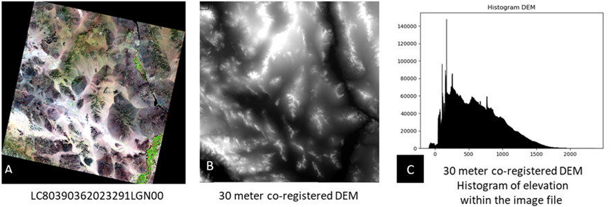
Landsat 8 OLI Reflective Image, Image of Elevation Data, and Histogram of Elevation Values
Detailed Description
This graphic displays a Landsat 8 OLI Reflective Image, an image of elevation data resampled to 30 meters to match the projection space of the reflective images, and a histogram of the elevation values within the resampled DEM image.
More details about the usage of this graphic can be found on the Calculating Terrain Error in Landsat 8-9 System Terrain Corrected Products webpage.
Sources/Usage
Public Domain.