
Quonopaug Brook at Rt 116 near North Scituate, Rhode Island. Monitoring location 01115183 is a tributary to the Scituate Reservoir in Providence County, Rhode Island. Current conditions of discharge and gage height are available.
Webcams
Webcams intro.
Filter Total Items: 28
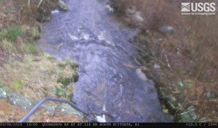
Quonopaug Brook at Rt 116 near North Scituate, Rhode Island
Quonopaug Brook at Rt 116 near North Scituate, Rhode Island. Monitoring location 01115183 is a tributary to the Scituate Reservoir in Providence County, Rhode Island. Current conditions of discharge and gage height are available.

MA-HWY-I95S-HMA-Station 00567 Needham, Massachusetts
MA-HWY-I95S-HMA-STATION 00567 Needham, MA. The highway monitoring station 421650071120401 is located along Interstate 95 in Norfolk County, Massachusetts.
MA-HWY-I95S-HMA-STATION 00567 Needham, MA. The highway monitoring station 421650071120401 is located along Interstate 95 in Norfolk County, Massachusetts.
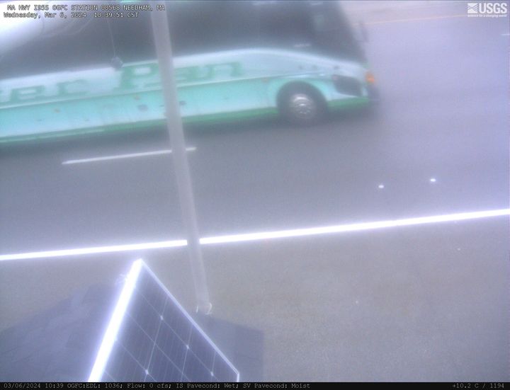
MA HWY I95S OGFC Station 00568 Needham, Massachusetts
MA-HWY-I95S-OGFC-STATION 00568 Needham, MA. The highway monitoring station 421652071120601 is located along Interstate 95 in Norfolk County, Massachusetts.
MA-HWY-I95S-OGFC-STATION 00568 Needham, MA. The highway monitoring station 421652071120601 is located along Interstate 95 in Norfolk County, Massachusetts.
West Brook near Whately, Massachusetts (01171100)
West Brook near Whately, Massachusetts. Monitoring location 01171100 is associated with a stream in Franklin County, Massachusetts. Current conditions of discharge and gage height are available. Water data back to 2019 are available online.
West Brook near Whately, Massachusetts. Monitoring location 01171100 is associated with a stream in Franklin County, Massachusetts. Current conditions of discharge and gage height are available. Water data back to 2019 are available online.
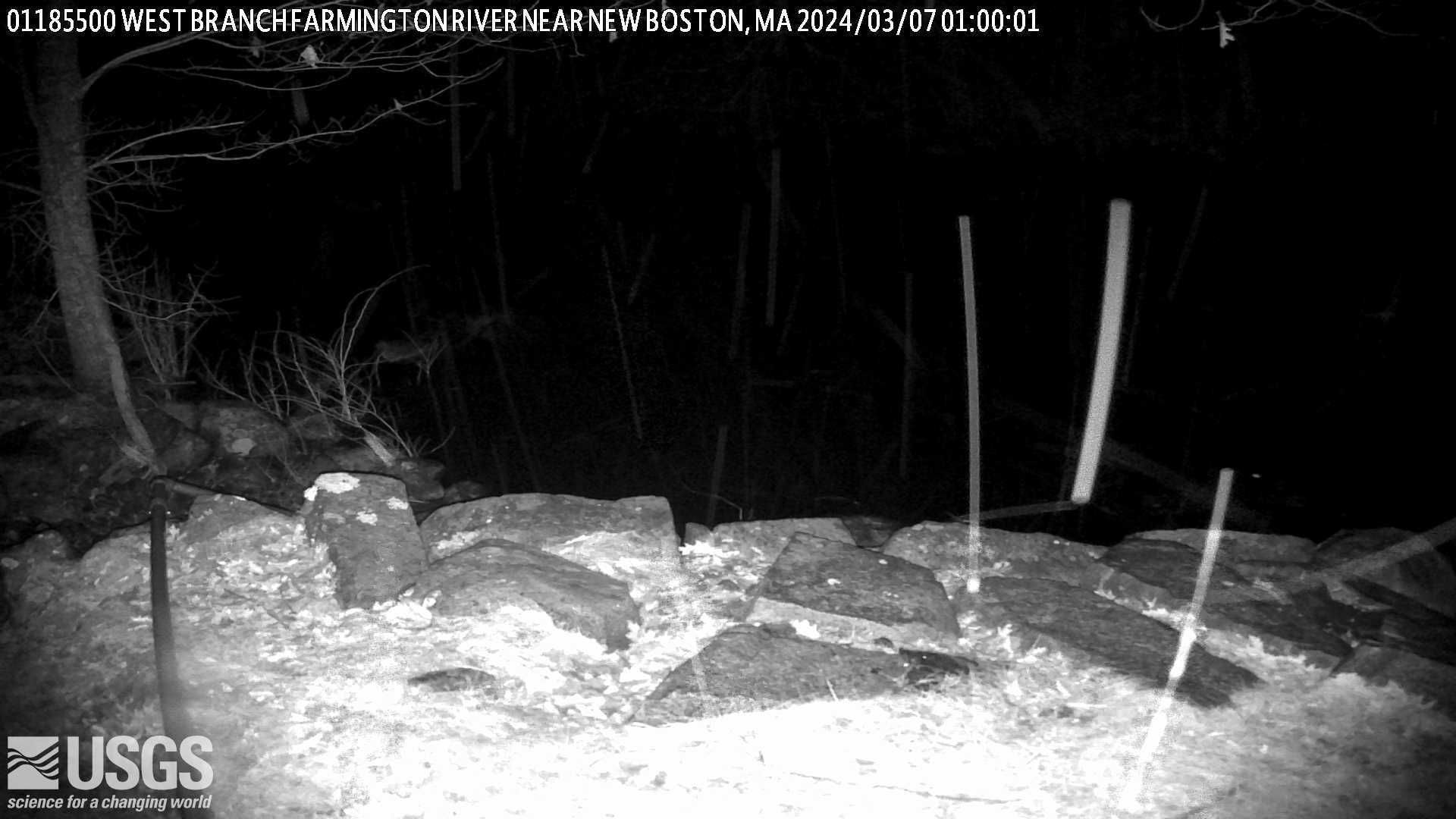
West Branch Farmington River near New Boston, Massachusetts (01185500)
West Branch Farmington River near New Boston, Massachusetts. Monitoring location 01185500 is associated with a stream in Berkshire County, Massachusetts. Current conditions of discharge and gage height are available.
West Branch Farmington River near New Boston, Massachusetts. Monitoring location 01185500 is associated with a stream in Berkshire County, Massachusetts. Current conditions of discharge and gage height are available.
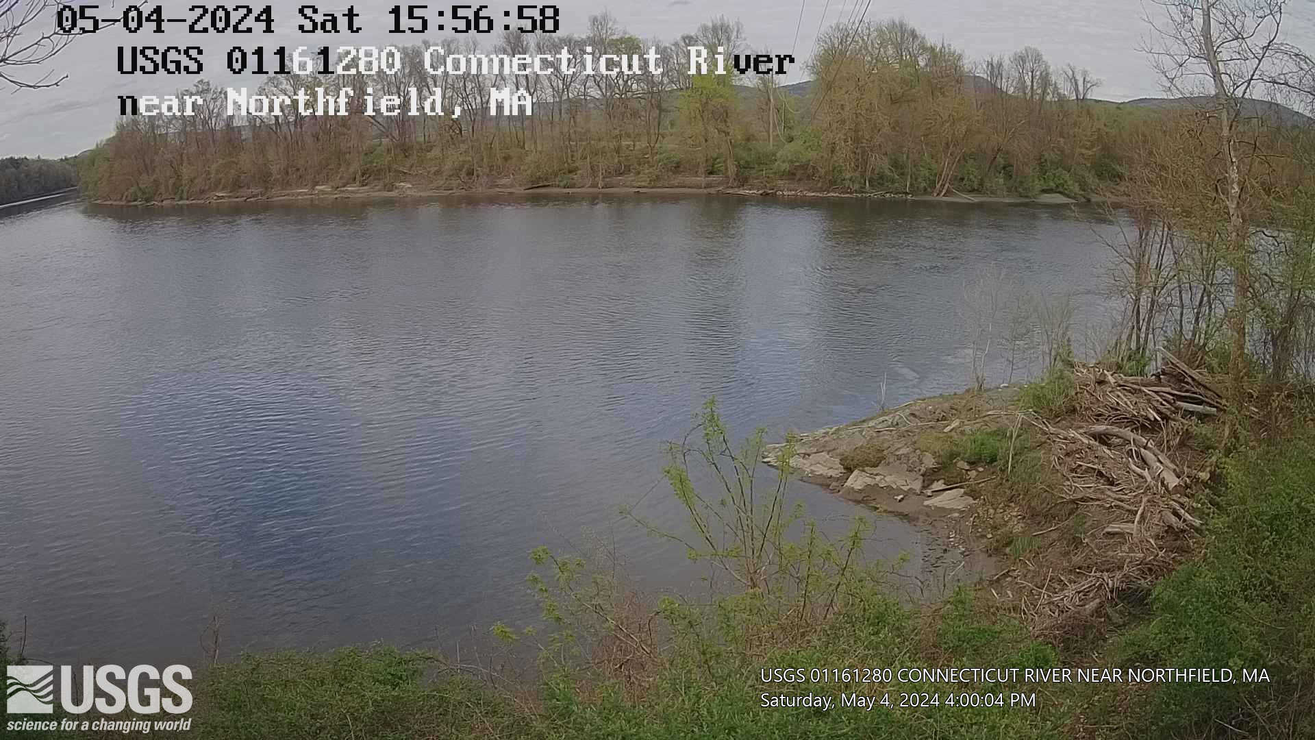
Connecticut River near Northfield, Massachusetts (01161280)
Connecticut River near Northfield, Massachusetts. Monitoring location 01161280 is associated with a stream in Franklin County, Massachusetts. Current conditions of gage height, mean water velocity for discharge computation, and nitrate plus nitrite are available.
Connecticut River near Northfield, Massachusetts. Monitoring location 01161280 is associated with a stream in Franklin County, Massachusetts. Current conditions of gage height, mean water velocity for discharge computation, and nitrate plus nitrite are available.
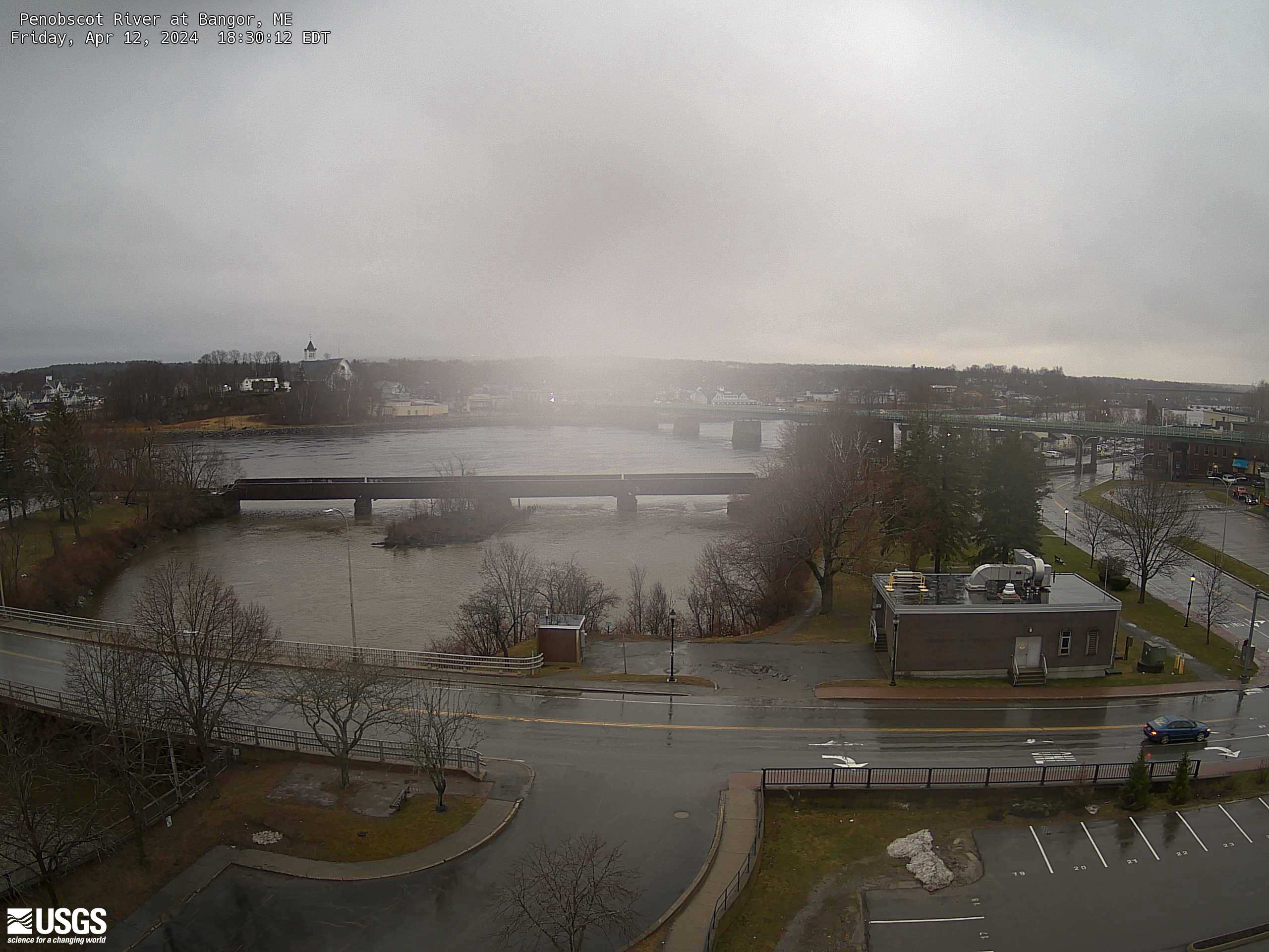
Penobscot River at Bangor, Maine (01037050)
An overhead view from a USGS webcam of Penobscot River at Bangor, Maine (01037050)
An overhead view from a USGS webcam of Penobscot River at Bangor, Maine (01037050)
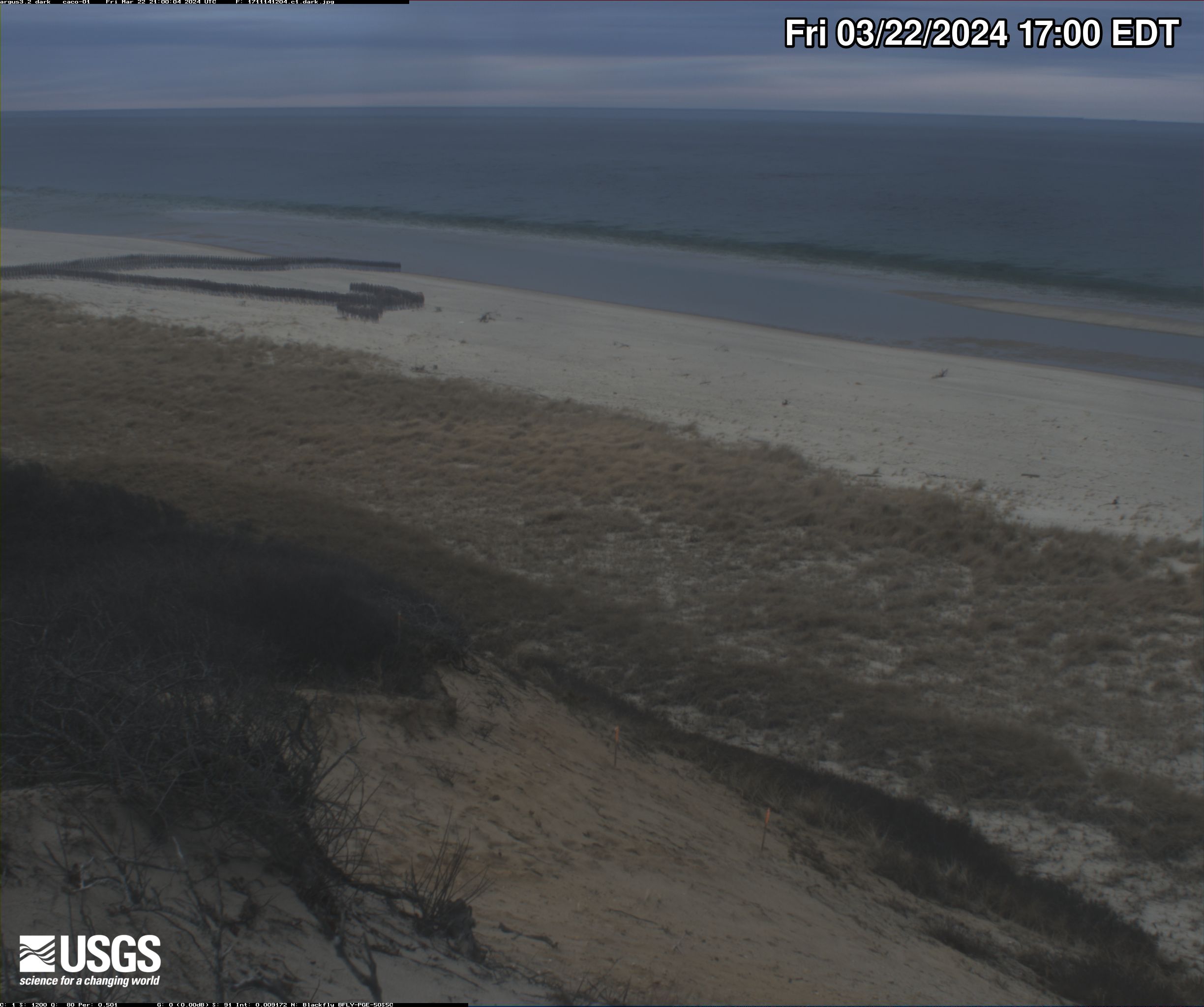
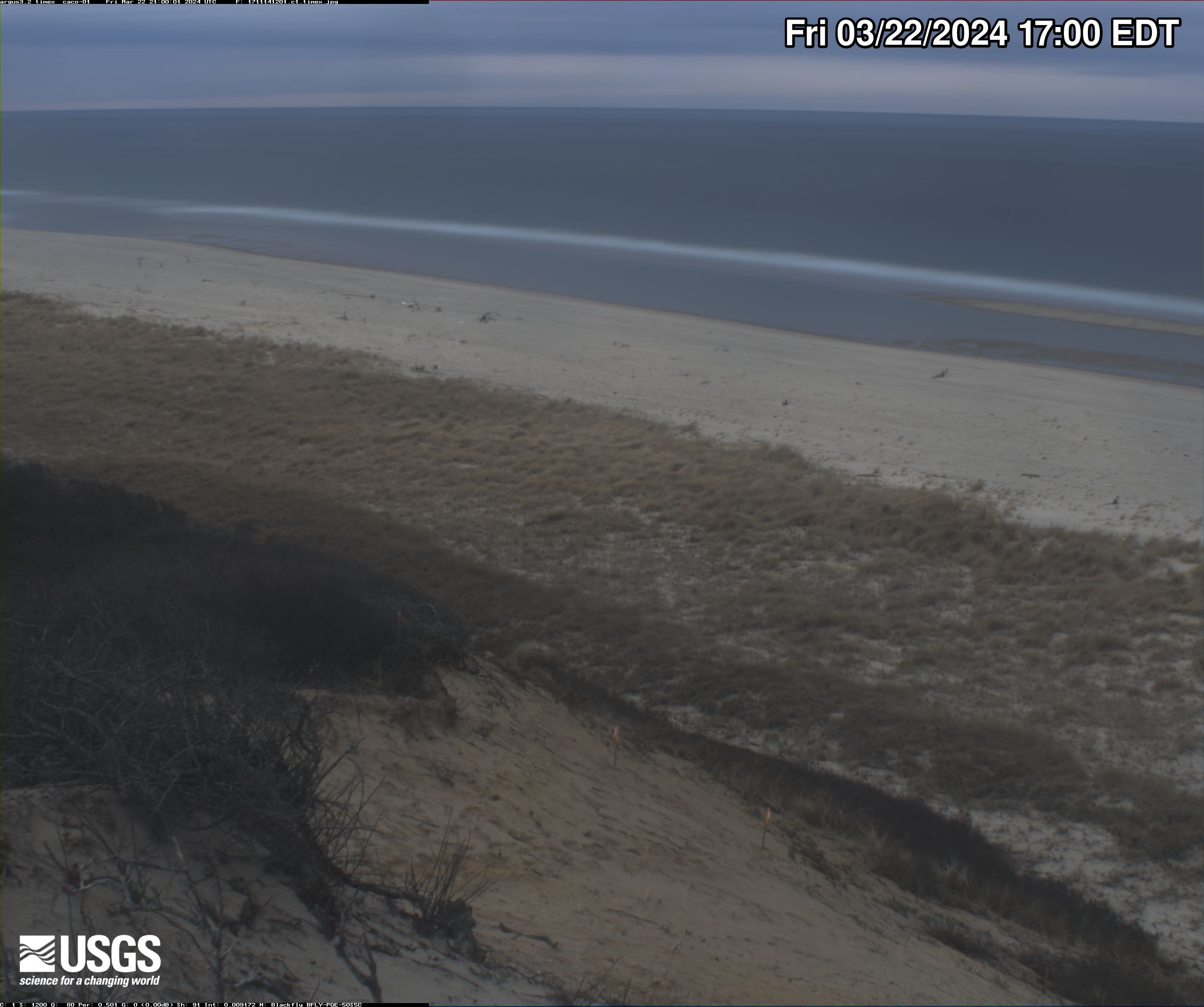
Head of the Meadow Beach video camera 1 dark image
Two video cameras are mounted on a bluff near Head of the Meadow Beach, Cape Cod National Seashore, North Truro, MA. One camera looks directly offshore (north east), and the second looks alongshore (north-northeast).
Two video cameras are mounted on a bluff near Head of the Meadow Beach, Cape Cod National Seashore, North Truro, MA. One camera looks directly offshore (north east), and the second looks alongshore (north-northeast).
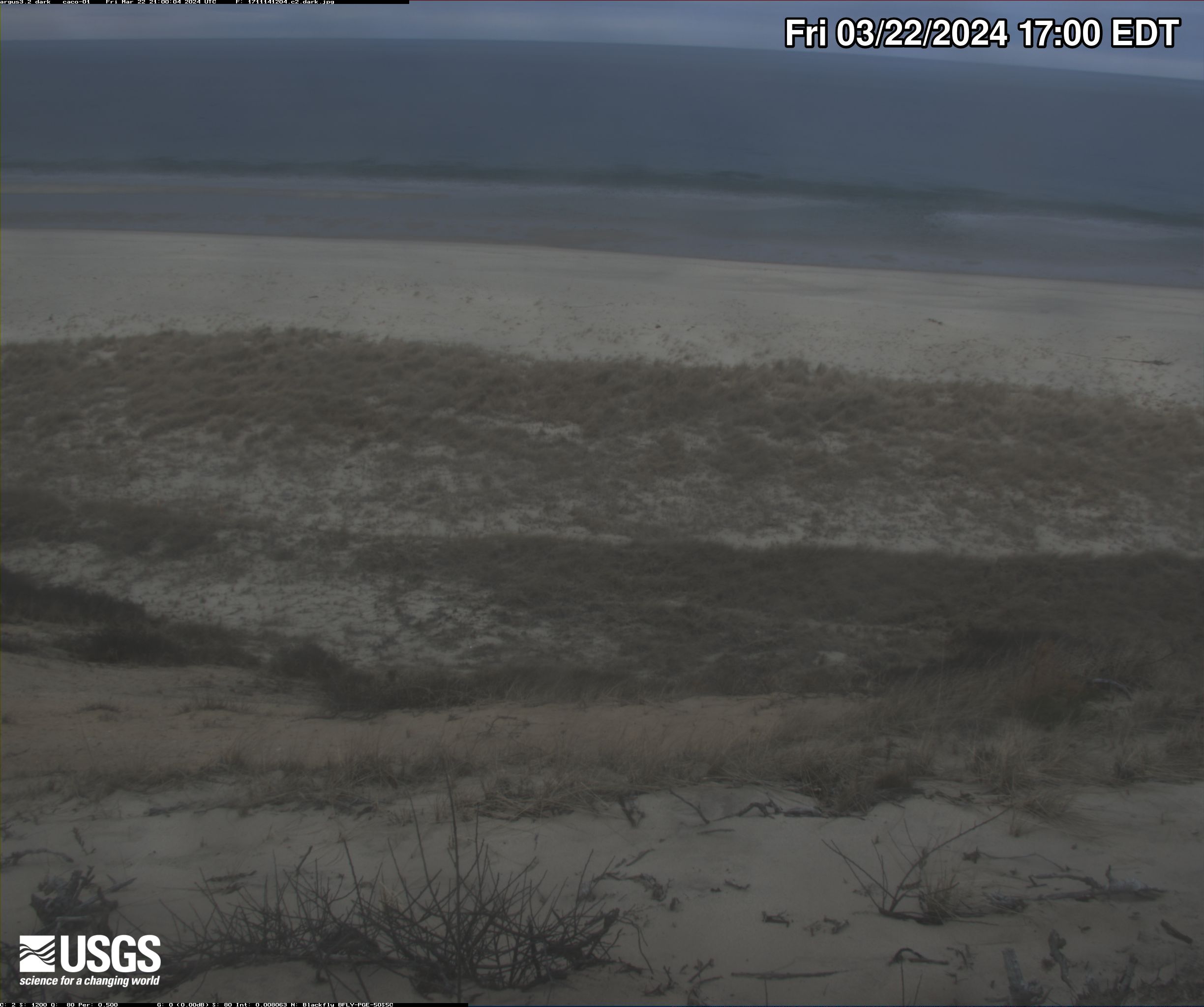
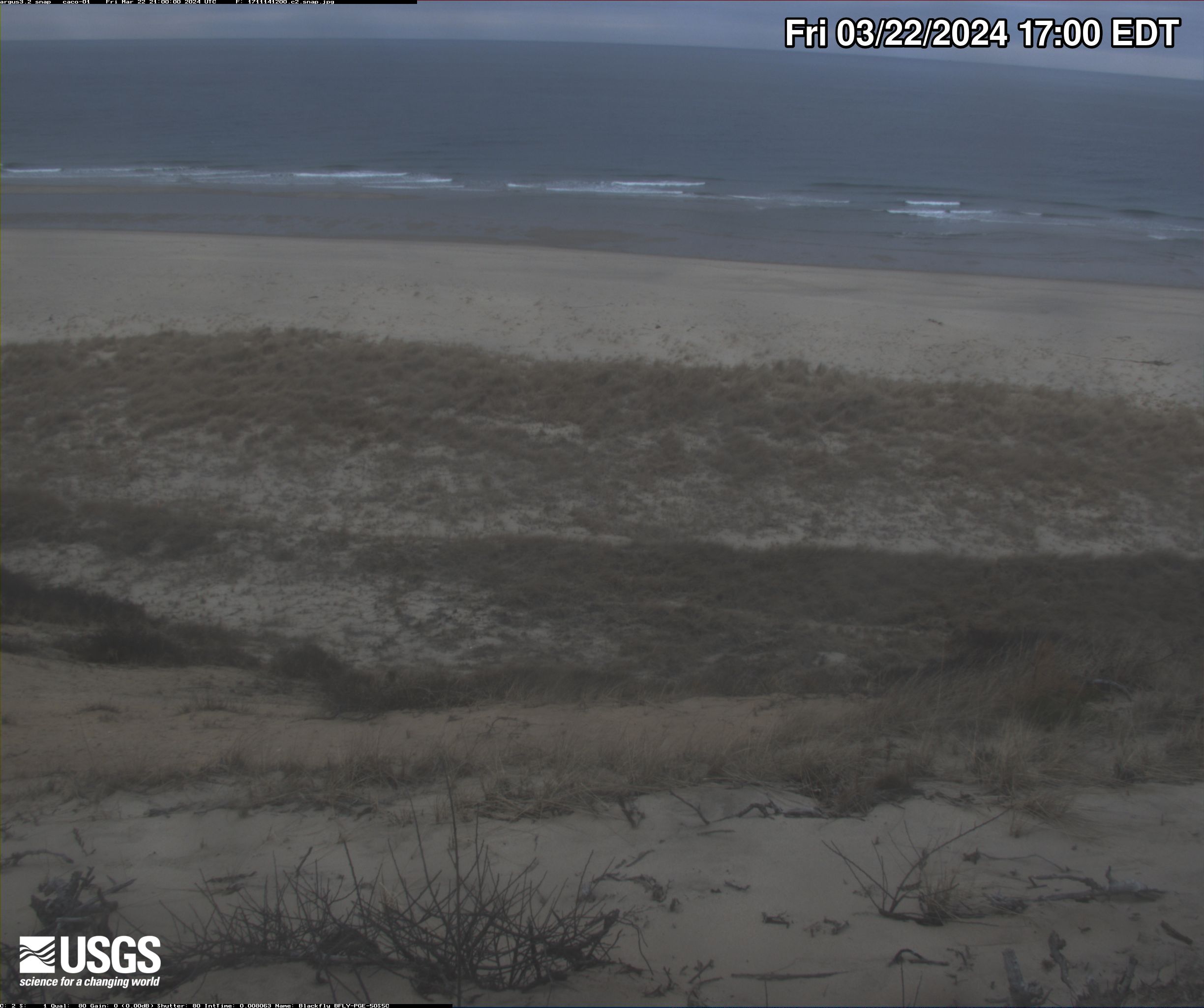
Head of the Meadow Beach video camera 2 dark image
Two video cameras are mounted on a bluff near Head of the Meadow Beach, Cape Cod National Seashore, North Truro, MA. One camera looks directly offshore (north east), and the second looks alongshore (north-northeast).
Two video cameras are mounted on a bluff near Head of the Meadow Beach, Cape Cod National Seashore, North Truro, MA. One camera looks directly offshore (north east), and the second looks alongshore (north-northeast).

Head of the Meadow Beach video camera 1 variance image
Two video cameras are mounted on a bluff near Head of the Meadow Beach, Cape Cod National Seashore, North Truro, MA. One camera looks directly offshore (north east), and the second looks alongshore (north-northeast).
Two video cameras are mounted on a bluff near Head of the Meadow Beach, Cape Cod National Seashore, North Truro, MA. One camera looks directly offshore (north east), and the second looks alongshore (north-northeast).

Head of the Meadow Beach video camera 2 variance image
Two video cameras are mounted on a bluff near Head of the Meadow Beach, Cape Cod National Seashore, North Truro, MA. One camera looks directly offshore (north east), and the second looks alongshore (north-northeast).
Two video cameras are mounted on a bluff near Head of the Meadow Beach, Cape Cod National Seashore, North Truro, MA. One camera looks directly offshore (north east), and the second looks alongshore (north-northeast).
Head of the Meadow Beach video camera 1 timex image
Two video cameras are mounted on a bluff near Head of the Meadow Beach, Cape Cod National Seashore, North Truro, MA. One camera looks directly offshore (north east), and the second looks alongshore (north-northeast).
Two video cameras are mounted on a bluff near Head of the Meadow Beach, Cape Cod National Seashore, North Truro, MA. One camera looks directly offshore (north east), and the second looks alongshore (north-northeast).

Head of the Meadow Beach video camera 2 timex image
Two video cameras are mounted on a bluff near Head of the Meadow Beach, Cape Cod National Seashore, North Truro, MA. One camera looks directly offshore (north east), and the second looks alongshore (north-northeast).
Two video cameras are mounted on a bluff near Head of the Meadow Beach, Cape Cod National Seashore, North Truro, MA. One camera looks directly offshore (north east), and the second looks alongshore (north-northeast).

Head of the Meadow Beach video camera 1 snapshot
Two video cameras are mounted on a bluff near Head of the Meadow Beach, Cape Cod National Seashore, North Truro, MA. One camera looks directly offshore (north east), and the second looks alongshore (north-northeast).
Two video cameras are mounted on a bluff near Head of the Meadow Beach, Cape Cod National Seashore, North Truro, MA. One camera looks directly offshore (north east), and the second looks alongshore (north-northeast).
Head of the Meadow Beach video camera 2 snapshot
Two video cameras are mounted on a bluff near Head of the Meadow Beach, Cape Cod National Seashore, North Truro, MA. One camera looks directly offshore (north east), and the second looks alongshore (north-northeast).
Two video cameras are mounted on a bluff near Head of the Meadow Beach, Cape Cod National Seashore, North Truro, MA. One camera looks directly offshore (north east), and the second looks alongshore (north-northeast).

Head of the Meadow Beach video camera 1 bright image
Two video cameras are mounted on a bluff near Head of the Meadow Beach, Cape Cod National Seashore, North Truro, MA. One camera looks directly offshore (north east), and the second looks alongshore (north-northeast).
Two video cameras are mounted on a bluff near Head of the Meadow Beach, Cape Cod National Seashore, North Truro, MA. One camera looks directly offshore (north east), and the second looks alongshore (north-northeast).

Head of the Meadow Beach video camera 2 bright image
Two video cameras are mounted on a bluff near Head of the Meadow Beach, Cape Cod National Seashore, North Truro, MA. One camera looks directly offshore (north east), and the second looks alongshore (north-northeast).
Two video cameras are mounted on a bluff near Head of the Meadow Beach, Cape Cod National Seashore, North Truro, MA. One camera looks directly offshore (north east), and the second looks alongshore (north-northeast).
Lake Champlain at Port Henry, NY
PLEASE NOTE: During winter months, ice and snow can affect the picture quality. The camera is cleaned as often as it is safe to do so.
Lake Champlain at Port Henry, NY (04294413)
PLEASE NOTE: During winter months, ice and snow can affect the picture quality. The camera is cleaned as often as it is safe to do so.
Lake Champlain at Port Henry, NY (04294413)
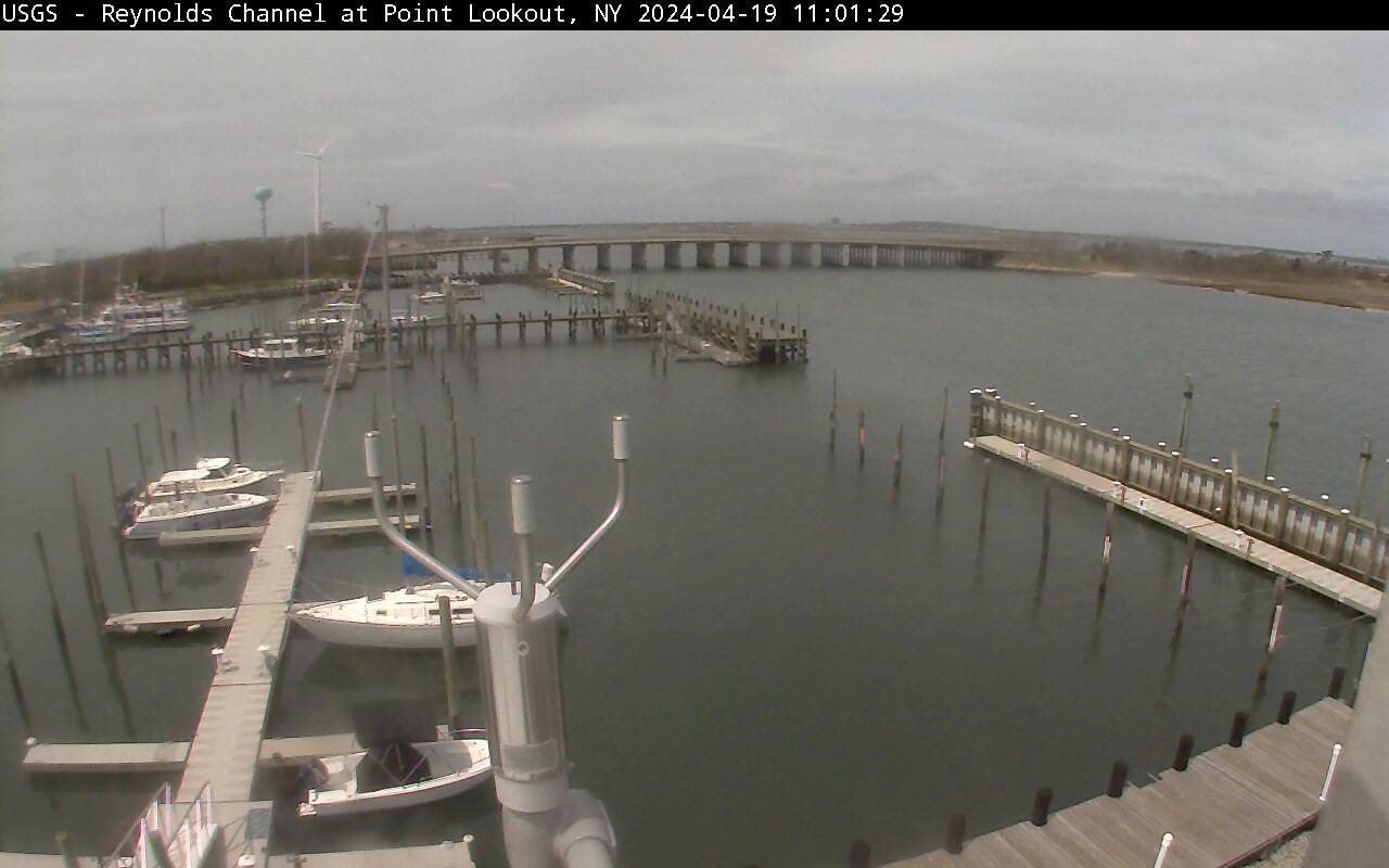
Reynolds Channel at Point Lookout, NY
Latest webcam image of Reynolds Channel (01310740).
Image timestamp is in Eastern Standard Time.
Webcam is located on tower at USGS gaging station, looking west-northwest toward Loop Parkway Bridge.
Latest webcam image of Reynolds Channel (01310740).
Image timestamp is in Eastern Standard Time.
Webcam is located on tower at USGS gaging station, looking west-northwest toward Loop Parkway Bridge.
Susquehanna River at Towanda, PA (01531500)