This graph shows the number of Landsat Collection 2 Level-1 scene-based products that are available for download from the USGS Archive. Please note that data from earlier Landsat missions, even those that have ended, continues to be added to the archive through the Landsat Global Archive Consolidation (LGAC) program.
Multimedia
Our multimedia gallery represents a collection of high-quality images, videos, webcams, posters, presentations, and documents produced by Core Science Systems.
Images
This graph shows the number of Landsat Collection 2 Level-1 scene-based products that are available for download from the USGS Archive. Please note that data from earlier Landsat missions, even those that have ended, continues to be added to the archive through the Landsat Global Archive Consolidation (LGAC) program.
This graphic displays the number of Landsat Collection 2 Level-2 scene-based science products that are available for download from the USGS Archive. Level-2 science products were first introduced with the Collection 2 release in December, 2020. The Level-2 Science Product includes surface reflection and surface temperature data.
This graphic displays the number of Landsat Collection 2 Level-2 scene-based science products that are available for download from the USGS Archive. Level-2 science products were first introduced with the Collection 2 release in December, 2020. The Level-2 Science Product includes surface reflection and surface temperature data.
In 2008 Landsat data became accessible to all users at no cost. This graphic displays the primary uses of "unique users" of Landsat data.
View more statistics on the Landsat Project Statistics page.
In 2008 Landsat data became accessible to all users at no cost. This graphic displays the primary uses of "unique users" of Landsat data.
View more statistics on the Landsat Project Statistics page.
In 2008 Landsat data became accessible to all users at no cost. This graphic displays the primary uses of Landsat data by volume.
View more statistics on the Landsat Project Statistics page.
In 2008 Landsat data became accessible to all users at no cost. This graphic displays the primary uses of Landsat data by volume.
View more statistics on the Landsat Project Statistics page.
LANDFIRE partner logos: Department of the Interior (DOI), Department of Agriculture (USDA), U.S. Geological Survey (USGS), U.S. Forest Service (USFS), and The Nature Conservancy
LANDFIRE partner logos: Department of the Interior (DOI), Department of Agriculture (USDA), U.S. Geological Survey (USGS), U.S. Forest Service (USFS), and The Nature Conservancy
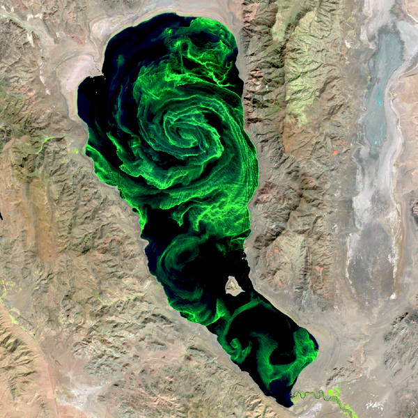
Pyramid Lake is one of the largest natural lakes in the state of Nevada, covering an area of about 188 square miles (487 square kilometers). Located entirely within the Pyramid Lake Paiute Tribe Reservation on the western margin of the Great Basin Desert, this deep terminal lake is widely regarded as a world class fishery.
Pyramid Lake is one of the largest natural lakes in the state of Nevada, covering an area of about 188 square miles (487 square kilometers). Located entirely within the Pyramid Lake Paiute Tribe Reservation on the western margin of the Great Basin Desert, this deep terminal lake is widely regarded as a world class fishery.
Videos
 The 3D Hydrography Program at one year – what was accomplished in FY24, what is planned for FY25?
The 3D Hydrography Program at one year – what was accomplished in FY24, what is planned for FY25?
linkFederal Fiscal Year 2024 was the first full operational year for the 3D Hydrography Program. We made significant progress in a number of areas, publishing final versions of legacy products, and developing processes for the new program. This presentation will provide an overview of what was accomplished in FY24 and what is planned for FY25.
The Klamath River, flowing from the high desert interior of Oregon and through the redwood forests of California, once produced large runs of salmon and trout. However, the construction of hydroelectric dams, beginning in 1918, blocked fish migration, encroached on Indigenous culture, and impacted water quality.
The Klamath River, flowing from the high desert interior of Oregon and through the redwood forests of California, once produced large runs of salmon and trout. However, the construction of hydroelectric dams, beginning in 1918, blocked fish migration, encroached on Indigenous culture, and impacted water quality.
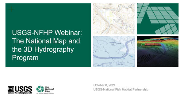
 USGS-NFHP Webinar - The National Map and the 3D Hydrography Program
The USGS-NFHP Webinar on the 3D Hydrography Program (3DHP) and The National Map (TNM) provided a deep dive into the current state and future direction of USGS hydrography and elevation data, focusing on the replacement of legacy datasets with highly accurate, 3D-enabled data.
The USGS-NFHP Webinar on the 3D Hydrography Program (3DHP) and The National Map (TNM) provided a deep dive into the current state and future direction of USGS hydrography and elevation data, focusing on the replacement of legacy datasets with highly accurate, 3D-enabled data.
The United States Geological Survey (USGS) Earth Resources Observation and Science (EROS) Center maintains one of the largest civilian collection of images of the Earth’s land surface. At EROS, we study land change and produce land change data products used by researchers, resource managers, and policymakers across the nation and around the world.
The United States Geological Survey (USGS) Earth Resources Observation and Science (EROS) Center maintains one of the largest civilian collection of images of the Earth’s land surface. At EROS, we study land change and produce land change data products used by researchers, resource managers, and policymakers across the nation and around the world.
This National Map training video is an introduction to using the LidarExplorer application to easily access lidar data and derived products. In LidarExplorer, you can search for lidar projects, digital elevation models, and lidar point cloud files to meet your needs.
This National Map training video is an introduction to using the LidarExplorer application to easily access lidar data and derived products. In LidarExplorer, you can search for lidar projects, digital elevation models, and lidar point cloud files to meet your needs.
 A Statewide Hydraulic Modeling Tool for Stream Crossing Projects in Massachusetts
The U.S. Geological Survey and the University of Massachusetts at Amherst (UMass Amherst), in cooperation with the Massachusetts Department of Environmental Protection (MassDEP), began a series of studies in 2019 to develop a web-based statewide hydraulic modeling tool to provide preliminary culvert designs for stream-crossing projects in Massachusetts.
The U.S. Geological Survey and the University of Massachusetts at Amherst (UMass Amherst), in cooperation with the Massachusetts Department of Environmental Protection (MassDEP), began a series of studies in 2019 to develop a web-based statewide hydraulic modeling tool to provide preliminary culvert designs for stream-crossing projects in Massachusetts.
Audio
In this episode of Eyes on Earth, we talk about the latest release of the National Land Cover Database (NLCD). More than just a map, NLCD is a stack of maps—a database. It has long been the foundational land cover source for scientists, resource managers, and decision-makers across the United States, and now the next generation of USGS land cover mapping is here.
In this episode of Eyes on Earth, we talk about the latest release of the National Land Cover Database (NLCD). More than just a map, NLCD is a stack of maps—a database. It has long been the foundational land cover source for scientists, resource managers, and decision-makers across the United States, and now the next generation of USGS land cover mapping is here.


In this episode of Eyes on Earth, we talk about the Landscape Fire and Resource Management Planning Tools (LANDFIRE) project, which is commemorating its 20th year of providing geospatial data to support natural resource management and wildland fire planning. LANDFIRE brings a lot of data together, over 30 data products, into one place.
In this episode of Eyes on Earth, we talk about the Landscape Fire and Resource Management Planning Tools (LANDFIRE) project, which is commemorating its 20th year of providing geospatial data to support natural resource management and wildland fire planning. LANDFIRE brings a lot of data together, over 30 data products, into one place.


In this episode of Eyes on Earth, we talk to forest ecologist Jim Lutz about the effort to map fires in Utah. Fire research in the West is dominated by the study of large fires, but the forests in Utah are different. Utah typically does not have a lot of large fires as other western states do.
In this episode of Eyes on Earth, we talk to forest ecologist Jim Lutz about the effort to map fires in Utah. Fire research in the West is dominated by the study of large fires, but the forests in Utah are different. Utah typically does not have a lot of large fires as other western states do.


This Eyes on Earth episode is the third in our series on using Landsat for coastal studies. We talk to physical geographer Jeff Danielson about bathymetry and how it is critical for coastal modeling. Bathymetry captures the shape of underwater topography, and satellite-derived bathymetry helps fill in areas where there are data gaps.
This Eyes on Earth episode is the third in our series on using Landsat for coastal studies. We talk to physical geographer Jeff Danielson about bathymetry and how it is critical for coastal modeling. Bathymetry captures the shape of underwater topography, and satellite-derived bathymetry helps fill in areas where there are data gaps.


In this episode of Eyes on Earth, we talked with some of the interns who worked at EROS this summer. They shared their experiences learning about the cloud, AI, wildland fire research, terrestrial lidar scanning, and more. The common theme among them was recognizing the value of the EROS mission and noticing the passion their co-workers demonstrated in their work.
In this episode of Eyes on Earth, we talked with some of the interns who worked at EROS this summer. They shared their experiences learning about the cloud, AI, wildland fire research, terrestrial lidar scanning, and more. The common theme among them was recognizing the value of the EROS mission and noticing the passion their co-workers demonstrated in their work.


This episode of Eyes on Earth is the second in a series about how Landsat is helping researchers study coastal changes. The first one was about mapping changes to beaches in California and using Landsat to create models to predict how the coastline may change in the future because of sea level rise and coastal erosion.
This episode of Eyes on Earth is the second in a series about how Landsat is helping researchers study coastal changes. The first one was about mapping changes to beaches in California and using Landsat to create models to predict how the coastline may change in the future because of sea level rise and coastal erosion.


