
Red Cloud River at Anton Larsen Bay near Kodiak, AK Monitoring location 15297476 is associated with a STREAM in KODIAK ISLAND BOROUGH, ALASKA. Current conditions of GAGE HEIGHT and STREAMBED ELEVATION AT MEASUREMENT POINT are available. Water data back to 2022 are available online.
All Multimedia
Access all multimedia to include images, video, audio, webcams, before-after imagery, and more. Filter and explore with filtering options to refine search.
Filter Total Items: 26007
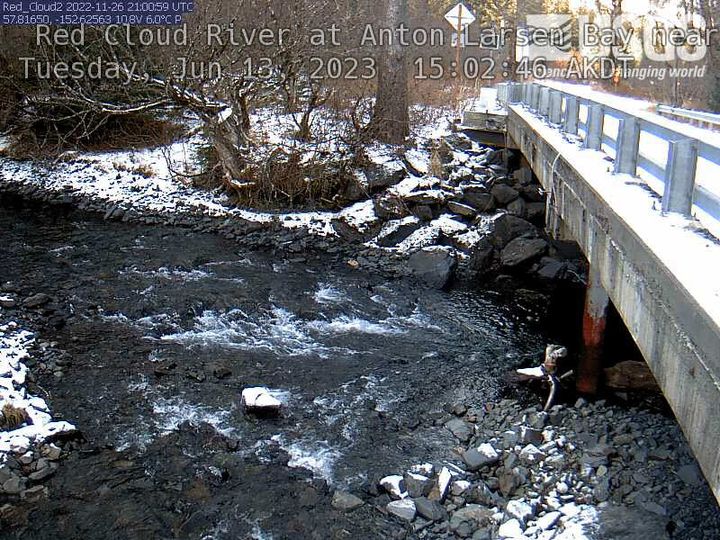
Red Cloud River at Anton Larsen Bay near Kodiak
Red Cloud River at Anton Larsen Bay near Kodiak, AK Monitoring location 15297476 is associated with a STREAM in KODIAK ISLAND BOROUGH, ALASKA. Current conditions of GAGE HEIGHT and STREAMBED ELEVATION AT MEASUREMENT POINT are available. Water data back to 2022 are available online.
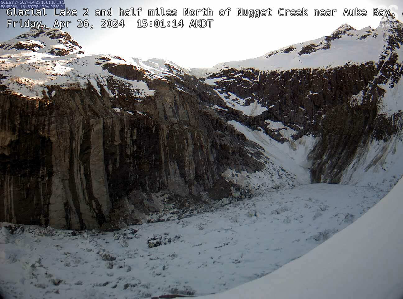
Glacial Lake 2 and half miles
An overlook view of Glacial Lake 2.5 miles North of Nugget Creek near Auke Bay, Alaska.
An overlook view of Glacial Lake 2.5 miles North of Nugget Creek near Auke Bay, Alaska.
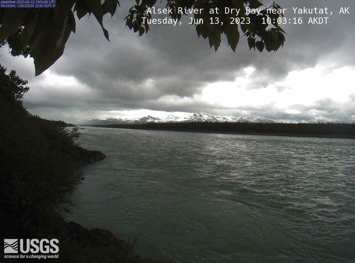
Alsek River at Dry Bay near Yakutat
Alsek River at Dry Bay near Yakutat, AK Monitoring location 15129120 is associated with a STREAM in CITY AND BOROUGH OF YAKUTAT, ALASKA. Current conditions of DISCHARGE, DISSOLVED OXYGEN, GAGE HEIGHT, and MORE are available. Water data back to 2011 are available online.
Alsek River at Dry Bay near Yakutat, AK Monitoring location 15129120 is associated with a STREAM in CITY AND BOROUGH OF YAKUTAT, ALASKA. Current conditions of DISCHARGE, DISSOLVED OXYGEN, GAGE HEIGHT, and MORE are available. Water data back to 2011 are available online.

National Ocean Month: 10 Ocean Field Sites You’ve Got to “Sea” to Believe
The ocean is a beautiful, dynamic, and sometimes dangerous place. Unsurprisingly, this is probably why a lot of USGS researchers spend their entire careers studying it. In celebration of National Ocean Month, we thought it would be a good time to dive in and feature ten ocean field sites you’ve got to “sea” to believe.
The ocean is a beautiful, dynamic, and sometimes dangerous place. Unsurprisingly, this is probably why a lot of USGS researchers spend their entire careers studying it. In celebration of National Ocean Month, we thought it would be a good time to dive in and feature ten ocean field sites you’ve got to “sea” to believe.
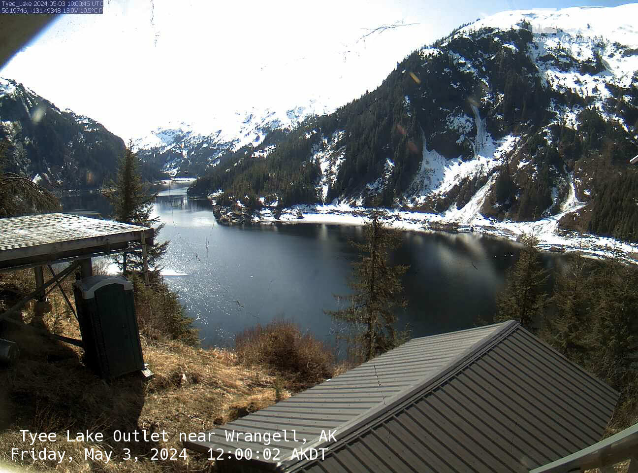
Tyee Lake Outlet near Wrangell
Tyee Lake Outlet near Wrangell, AK Monitoring location 15019990 is associated with a STREAM in CITY AND BOROUGH OF WRANGELL, ALASKA. Current conditions of DCP BATTERY VOLTAGE and GAGE HEIGHT are available. Water data back to 1979 are available online. This camera is telemetered by satellite and updates at approximately 19:00 UTC (+/- 60 minutes) each day.
Tyee Lake Outlet near Wrangell, AK Monitoring location 15019990 is associated with a STREAM in CITY AND BOROUGH OF WRANGELL, ALASKA. Current conditions of DCP BATTERY VOLTAGE and GAGE HEIGHT are available. Water data back to 1979 are available online. This camera is telemetered by satellite and updates at approximately 19:00 UTC (+/- 60 minutes) each day.
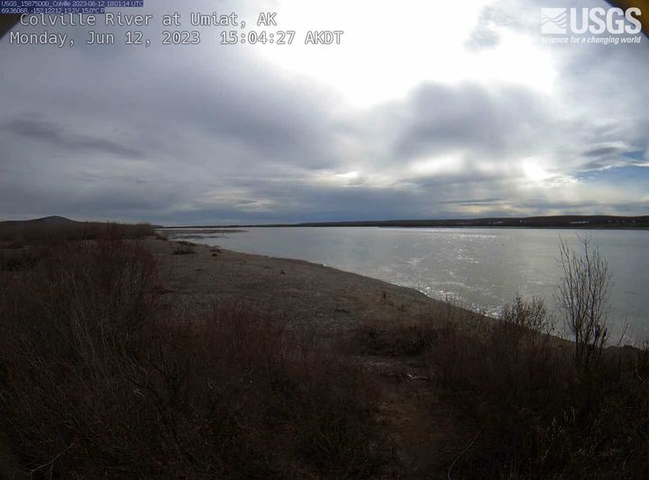
Colville River at Umiat
Colville River at Umiat, AK Monitoring location 15875000 is associated with a STREAM in NORTH SLOPE BOROUGH, ALASKA. Current conditions of DISCHARGE, GAGE HEIGHT, PRECIPITATION, and MORE are available. Water data back to 1953 are available online. This camera is telemetered by satellite and updates at approximately 22:00 UTC (+/- 60 minutes) each day.
Colville River at Umiat, AK Monitoring location 15875000 is associated with a STREAM in NORTH SLOPE BOROUGH, ALASKA. Current conditions of DISCHARGE, GAGE HEIGHT, PRECIPITATION, and MORE are available. Water data back to 1953 are available online. This camera is telemetered by satellite and updates at approximately 22:00 UTC (+/- 60 minutes) each day.
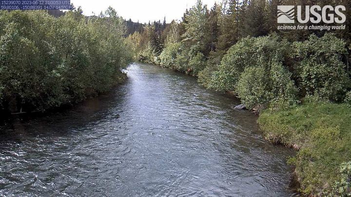
Bradly River near Tidewater near Homer
Bradly River near Tidewater near Homer, AK Monitoring location 15239070 is associated with a STREAM in KENAI PENINSULA BOROUGH, ALASKA. Current conditions of DISCHARGE, GAGE HEIGHT, and TEMPERATURE are available. Water data back to 1983 are available online. This camera is telemetered by satellite and updates at approximately 21:00 UTC (+/- 60 minutes) each day.
Bradly River near Tidewater near Homer, AK Monitoring location 15239070 is associated with a STREAM in KENAI PENINSULA BOROUGH, ALASKA. Current conditions of DISCHARGE, GAGE HEIGHT, and TEMPERATURE are available. Water data back to 1983 are available online. This camera is telemetered by satellite and updates at approximately 21:00 UTC (+/- 60 minutes) each day.
Gavilan Canyon at Skunk Canyon, NM
This is the most recent webcam image of Gavilan Canyon at Skunk Canyon near Hollywood, NM
This is the most recent webcam image of Gavilan Canyon at Skunk Canyon near Hollywood, NM

Flying Over Valles Marineris, Mars with Analysis-Ready Data
Flyover of Valles Marineris, the "Grand Canyon" of Mars, highlighting two analysis-ready datasets provided by USGS. The canyon is more than 4,000 km (2,500 miles) long and up to 7 km (23,000 ft) deep.
Flyover of Valles Marineris, the "Grand Canyon" of Mars, highlighting two analysis-ready datasets provided by USGS. The canyon is more than 4,000 km (2,500 miles) long and up to 7 km (23,000 ft) deep.

HVO moves B1cam away from eruption in Halema‘uma‘u crater, Kīlauea volcano — June 8, 2023
The Hawaiian Volcano Observatory's B1cam was located on the east rim of the down-dropped block within Kīlauea’s summit caldera, overlooking Halema‘uma‘u crater to the west. The eruption that began within Halema‘uma‘u crater in the early morning of June 7, 2023, flooded the crater floor with lava and the B1cam was exposed to intense heat.
The Hawaiian Volcano Observatory's B1cam was located on the east rim of the down-dropped block within Kīlauea’s summit caldera, overlooking Halema‘uma‘u crater to the west. The eruption that began within Halema‘uma‘u crater in the early morning of June 7, 2023, flooded the crater floor with lava and the B1cam was exposed to intense heat.

June 8, 2023 — Low lava fountaining continues in Halema‘uma‘u crater, Kīlauea volcano
Low fountaining has been active where lava upwells into Halema‘uma‘u crater, at the summit of Kīlauea. This video shows a series of small fountains in the southern portion of the crater floor. Camera shake is due to high winds at the time.
Low fountaining has been active where lava upwells into Halema‘uma‘u crater, at the summit of Kīlauea. This video shows a series of small fountains in the southern portion of the crater floor. Camera shake is due to high winds at the time.

Kīlauea summit eruption overflight — June 8, 2023
The eruption in Halema‘uma‘u crater, at the summit of Kīlauea, continues, as shown in this aerial video taken on June 8, 2023. Several lava fountains were active, with lava covering much of the western portion of the crater. The area of active lava on the surface has diminished over the past day, with lower lava fountains compared to yesterday.
The eruption in Halema‘uma‘u crater, at the summit of Kīlauea, continues, as shown in this aerial video taken on June 8, 2023. Several lava fountains were active, with lava covering much of the western portion of the crater. The area of active lava on the surface has diminished over the past day, with lower lava fountains compared to yesterday.
Low lava fountaining continues in Halema‘uma‘u crater, Kīlauea volcano — June 8, 2023
Low fountaining has been active where lava upwells into Halema‘uma‘u crater, at the summit of Kīlauea. This video shows a series of small fountains in the southern portion of the crater floor. Camera shake is due to high winds at the time.
Low fountaining has been active where lava upwells into Halema‘uma‘u crater, at the summit of Kīlauea. This video shows a series of small fountains in the southern portion of the crater floor. Camera shake is due to high winds at the time.

Aerial video of Kīlauea summit eruption in Halema‘uma‘u - June 7, 2023
HVO scientists conducted an overflight of the new eruption within Halemaʻumaʻu crater at the summit of Kīlauea volcano, within began the morning of June 7, 2023. This aerial video shows that multiple vent sources are active on the crater floor, much of which has been covered with new lava over the past several hours.
HVO scientists conducted an overflight of the new eruption within Halemaʻumaʻu crater at the summit of Kīlauea volcano, within began the morning of June 7, 2023. This aerial video shows that multiple vent sources are active on the crater floor, much of which has been covered with new lava over the past several hours.

Eyes on Earth Episode 95 – EROS 50th: Landsat Science Team
The members of the five-year Landsat Science Teams, led jointly by the USGS and NASA with a strong tie to EROS, have brought a wide breadth of expertise, backgrounds and geographic locations to the table.
The members of the five-year Landsat Science Teams, led jointly by the USGS and NASA with a strong tie to EROS, have brought a wide breadth of expertise, backgrounds and geographic locations to the table.

June 7, 2023 — Video of eruption onset in Halemaʻumaʻu
The B1cam webcam on the east rim of Halemaʻumaʻu crater captured the opening of the eastern eruptive vent in the first hour of the new Kīlauea summit eruption on June 7, 2023. The video shows a brief pulse of gas before lava blasts apart a section of the crater floor when fountaining begins.
The B1cam webcam on the east rim of Halemaʻumaʻu crater captured the opening of the eastern eruptive vent in the first hour of the new Kīlauea summit eruption on June 7, 2023. The video shows a brief pulse of gas before lava blasts apart a section of the crater floor when fountaining begins.
Kīlauea eruption overflight video - June 7, 2023
A new eruption began in Halema‘uma‘u crater, at the summit of Kīlauea, on the morning of June 7. This overflight occurred about two hours after the eruption onset and shows extensive lava fountaining supplying a rising lava lake within the crater. All lava is contained within the summit caldera. USGS video by M. Patrick.
A new eruption began in Halema‘uma‘u crater, at the summit of Kīlauea, on the morning of June 7. This overflight occurred about two hours after the eruption onset and shows extensive lava fountaining supplying a rising lava lake within the crater. All lava is contained within the summit caldera. USGS video by M. Patrick.

Kīlauea summit eruption in Halema‘uma‘u - June 7, 2023
A summit eruption of Kīlauea volcano, within Halemaʻumaʻu crater, began at approximately 4:44 a.m. on June 7, 2023. Lava is flowing on the crater floor and there are several active vent sources. The eruption at Kīlauea’s summit is occurring within a closed area of Hawai'i Volcanoes National Park and high levels of volcanic gas are the primary hazard of concern.
A summit eruption of Kīlauea volcano, within Halemaʻumaʻu crater, began at approximately 4:44 a.m. on June 7, 2023. Lava is flowing on the crater floor and there are several active vent sources. The eruption at Kīlauea’s summit is occurring within a closed area of Hawai'i Volcanoes National Park and high levels of volcanic gas are the primary hazard of concern.

Kīlauea summit whirlwind in Halema‘uma‘u - June 7, 2023
This video, taken from the south rim of Halema‘uma‘u crater, shows a wind vortex or whirlwind above the eruption site at the summit of Kīlauea. These features have been observed during eruptions and form due to the extreme heat.
This video, taken from the south rim of Halema‘uma‘u crater, shows a wind vortex or whirlwind above the eruption site at the summit of Kīlauea. These features have been observed during eruptions and form due to the extreme heat.

KWcam captures Kīlauea summit eruption onset in Halema‘uma‘u - June 7, 2023
This video, captured by the Hawaiian Volcano Observatory's KWcam on the northwest rim of the caldera, shows the opening phase of the eruption that began within Halemaʻumaʻu crater the early morning of June 7, 2023. A lava fountain bursts from a vent in the central part of the crater floor and lava floods the surrounding area.
This video, captured by the Hawaiian Volcano Observatory's KWcam on the northwest rim of the caldera, shows the opening phase of the eruption that began within Halemaʻumaʻu crater the early morning of June 7, 2023. A lava fountain bursts from a vent in the central part of the crater floor and lava floods the surrounding area.

The Kīlauea summit eruption in Halema‘uma‘u - June 7, 2023
The summit eruption of Kīlauea volcano, within Halemaʻumaʻu crater, began at approximately 4:44 a.m. on June 7, 2023. This video, captured by the Hawaiian Volcano Observatory's V1cam on the northwest rim of the caldera, shows the opening phase of the eruption.
The summit eruption of Kīlauea volcano, within Halemaʻumaʻu crater, began at approximately 4:44 a.m. on June 7, 2023. This video, captured by the Hawaiian Volcano Observatory's V1cam on the northwest rim of the caldera, shows the opening phase of the eruption.