

LANDFIRE, short for Landscape Fire and Resource Management Planning Tools, is a key national data source for the management of wildfires, management of the plant materials that fuel fires, and planning for prescribed fires across all 50 states and the U.S. territories.
All Multimedia
Access all multimedia to include images, video, audio, webcams, before-after imagery, and more. Filter and explore with filtering options to refine search.
Filter Total Items: 26006
LANDFIRE, short for Landscape Fire and Resource Management Planning Tools, is a key national data source for the management of wildfires, management of the plant materials that fuel fires, and planning for prescribed fires across all 50 states and the U.S. territories.

USGS EROS: Celebrating 50 Years of Excellence
For 50 years, the people of EROS have overcome difficulties and celebrated triumphs together, always centered on providing a perspective of the Earth that helps us better understand its condition. This video, timed with the 50th anniversary celebration at EROS in August of 2023, explores the center's history.
For 50 years, the people of EROS have overcome difficulties and celebrated triumphs together, always centered on providing a perspective of the Earth that helps us better understand its condition. This video, timed with the 50th anniversary celebration at EROS in August of 2023, explores the center's history.

Eyes on Earth Episode 101 – EROS 50th: Director Pete Doucette Looks Ahead
EROS Center Director Pete Doucette has been at EROS for a fairly short stretch of the center’s 50-year history, but his passion for the mission of EROS and its opportunities in the future are clear in this episode of Eyes on Earth.
EROS Center Director Pete Doucette has been at EROS for a fairly short stretch of the center’s 50-year history, but his passion for the mission of EROS and its opportunities in the future are clear in this episode of Eyes on Earth.

Eyes on Earth Episode 100 – EROS 50th: Our Legacy
As USGS EROS turns 50 this month, our Eyes on Earth podcast also marks a big moment: Episode 100. To celebrate, we bring together some treasured moments from previous episodes in which people inside and outside of EROS share their thoughts on EROS and its role in the world of remote sensing, including as keeper of all Landsat satellite data.
As USGS EROS turns 50 this month, our Eyes on Earth podcast also marks a big moment: Episode 100. To celebrate, we bring together some treasured moments from previous episodes in which people inside and outside of EROS share their thoughts on EROS and its role in the world of remote sensing, including as keeper of all Landsat satellite data.

Yellowstone Volcano Update — August 2023: MONUMENT TO A TRAGEDY. The origin of Hebgen Lake
What geologic hazard is most likely to occur in the Yellowstone region on human timescales?
What geologic hazard is most likely to occur in the Yellowstone region on human timescales?

Eyes on Earth Episode 99 – EROS 50th: Interns Who Stayed
EROS has a long history of reaching out to universities to welcome interns who can both contribute to the center and gain valuable skills and experience. A good number of them went on to spend their careers at EROS, some for more than three decades.
EROS has a long history of reaching out to universities to welcome interns who can both contribute to the center and gain valuable skills and experience. A good number of them went on to spend their careers at EROS, some for more than three decades.
")
Lava sampling in Halemaʻumaʻu (June 22, 2023)
During a monitoring overflight of the Kīlauea summit on June 22, 2023, Hawaiian Volcano Observatory scientists briefly stopped on the Halema‘uma‘u crater floor to collect a lava sample. Afterward, they departed via helicopter with a low-angle view of the recent eruption area from the east.
During a monitoring overflight of the Kīlauea summit on June 22, 2023, Hawaiian Volcano Observatory scientists briefly stopped on the Halema‘uma‘u crater floor to collect a lava sample. Afterward, they departed via helicopter with a low-angle view of the recent eruption area from the east.

Science of Surfing
Join USGS Research Geologist and lifelong surfer Jon Warrick at the Pacific Coastal and Marine Science Center Santa Cruz as he discusses how coastal and ocean geoscience contributes to a better understanding of how waves form and behave as they approach the shore—critical information with a broad range of applications, not least of which is surfing!
Join USGS Research Geologist and lifelong surfer Jon Warrick at the Pacific Coastal and Marine Science Center Santa Cruz as he discusses how coastal and ocean geoscience contributes to a better understanding of how waves form and behave as they approach the shore—critical information with a broad range of applications, not least of which is surfing!

Eyes on Earth Episode 98 – EROS 50th: Conservation
In this episode of Eyes on Earth, we talk about the 50-year history of EROS efforts to preserve the environment and conserve energy. EROS was born in the ’70s, the same decade as Earth Day, the EPA, and the oil crisis.
In this episode of Eyes on Earth, we talk about the 50-year history of EROS efforts to preserve the environment and conserve energy. EROS was born in the ’70s, the same decade as Earth Day, the EPA, and the oil crisis.

Saildrone Deployment on Lake Erie, July 2023
This video shows a Saildrone Explorer in the harbor and being towed out onto Lake Erie for the beginning of a mission to collect data to improve fishery surveys on July 14, 2023.
This video shows a Saildrone Explorer in the harbor and being towed out onto Lake Erie for the beginning of a mission to collect data to improve fishery surveys on July 14, 2023.

Eyes on Earth Episode 97 – EROS 50th: Earth As Art
Satellites capture an incredible variety of views of Earth. In this episode of Eyes on Earth, we talk with the three engineers at USGS EROS who started the USGS Earth As Art project. The Earth As Art origin story is an example of the initiative and creativity of EROS staff.
Satellites capture an incredible variety of views of Earth. In this episode of Eyes on Earth, we talk with the three engineers at USGS EROS who started the USGS Earth As Art project. The Earth As Art origin story is an example of the initiative and creativity of EROS staff.
Eyes on Earth Episode 97 – EROS 50th: Earth As Art Bonus
In this bonus material for episode 97 of the Eyes on Earth podcast, the three guests, all engineers at USGS EROS who started the Earth As Art project, talk about their favorite Earth As Art images.
In this bonus material for episode 97 of the Eyes on Earth podcast, the three guests, all engineers at USGS EROS who started the Earth As Art project, talk about their favorite Earth As Art images.

Yellowstone Volcano Update — July 2023 — NEW THERMAL FEATURES at Yellowstone!
Geysers and hot springs are some of the most dynamic geologic features on the planet. They are always changing and sometimes that change happens in places where we can see and appreciate it. This has been the case on Geyser Hill, near Old Faithful, in Yellowstone National Park.
Geysers and hot springs are some of the most dynamic geologic features on the planet. They are always changing and sometimes that change happens in places where we can see and appreciate it. This has been the case on Geyser Hill, near Old Faithful, in Yellowstone National Park.

Image of the Week: Fires in Canada, May 2023
Smoke filled the skies over western Canada and even much of the United States in May 2023. The source was several wildfires in Alberta and British Columbia.
Near the end of May, rain and cooler temperatures finally brought some relief for the out-of-control fires.
Smoke filled the skies over western Canada and even much of the United States in May 2023. The source was several wildfires in Alberta and British Columbia.
Near the end of May, rain and cooler temperatures finally brought some relief for the out-of-control fires.

Eyes on Earth Episode 96 – Generational Science
In this episode of Eyes on Earth, we talk with Peder Nelson about generational science and the responsibility we have to future generations to study our changing planet. It takes more than just data to make sense of land change.
In this episode of Eyes on Earth, we talk with Peder Nelson about generational science and the responsibility we have to future generations to study our changing planet. It takes more than just data to make sense of land change.

June 18, 2023 — Video of southwest wall vent in Halemaʻumaʻu
This video was captured from the western rim of Halemaʻumaʻu crater at the summit of Kīlauea on June 18, 2023. The video shows fountaining at the southwest wall eruptive vent, and lava pouring into a channel at the base of the spatter cone to spread onto the crater floor.
This video was captured from the western rim of Halemaʻumaʻu crater at the summit of Kīlauea on June 18, 2023. The video shows fountaining at the southwest wall eruptive vent, and lava pouring into a channel at the base of the spatter cone to spread onto the crater floor.

June 16, 2023 — Video from Kīlauea summit overflight
This video was captured during a Hawaiian Volcano Observatory helicopter overflight at the Kīlauea summit eruption on June 16, 2023. Activity is focused at the eruptive vent on the southwest wall of Halemaʻumaʻu crater, with lava fountaining visible at the top of the spatter cone.
This video was captured during a Hawaiian Volcano Observatory helicopter overflight at the Kīlauea summit eruption on June 16, 2023. Activity is focused at the eruptive vent on the southwest wall of Halemaʻumaʻu crater, with lava fountaining visible at the top of the spatter cone.

June 16, 2023 — Video of recent fountaining in Halemaʻumaʻu
This video was captured June 16, 2023 from the western rim of Halemaʻumaʻu crater at the summit of Kīlauea. Lava fountaining can be seen at the top of the spatter cone built around the southwest wall eruptive vent, with lava erupting from the base of the cone as well.
This video was captured June 16, 2023 from the western rim of Halemaʻumaʻu crater at the summit of Kīlauea. Lava fountaining can be seen at the top of the spatter cone built around the southwest wall eruptive vent, with lava erupting from the base of the cone as well.
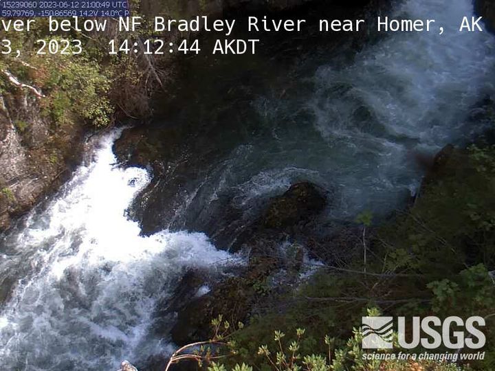
MF Bradley River below NF Bradley River near Homer
MF Bradley River below NF Bradley River near Homer, AK Monitoring location 15239060 is associated with a STREAM in KENAI PENINSULA BOROUGH, ALASKA. Current conditions of DISCHARGE, GAGE HEIGHT, and TEMPERATURE are available. Water data back to 1991 are available online.
MF Bradley River below NF Bradley River near Homer, AK Monitoring location 15239060 is associated with a STREAM in KENAI PENINSULA BOROUGH, ALASKA. Current conditions of DISCHARGE, GAGE HEIGHT, and TEMPERATURE are available. Water data back to 1991 are available online.
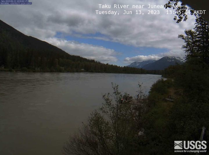
Taku River near Juneau
Taku River near Juneau, AK Monitoring location 15041200 is associated with a STREAM in CITY AND BOROUGH OF JUNEAU, ALASKA. Current conditions of DCP BATTERY VOLTAGE, DISCHARGE, DISSOLVED OXYGEN, and MORE are available. Water data back to 1987 are available online.
Taku River near Juneau, AK Monitoring location 15041200 is associated with a STREAM in CITY AND BOROUGH OF JUNEAU, ALASKA. Current conditions of DCP BATTERY VOLTAGE, DISCHARGE, DISSOLVED OXYGEN, and MORE are available. Water data back to 1987 are available online.
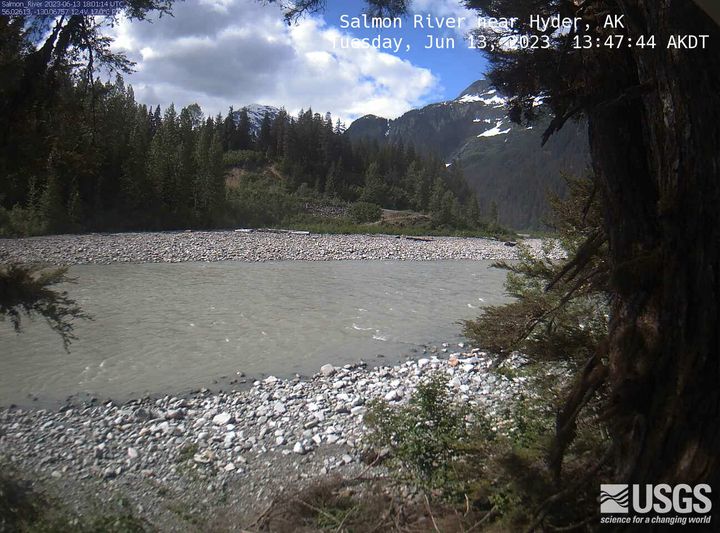
Salmon River near Hyder
Salmon River near Hyder, AK Monitoring location 15008000 is associated with a STREAM in PRINCE OF WALES-HYDER CENSUS AREA, ALASKA. Current conditions of DISCHARGE, DISSOLVED OXYGEN, GAGE HEIGHT, and MORE are available. Water data back to 1963 are available online.
Salmon River near Hyder, AK Monitoring location 15008000 is associated with a STREAM in PRINCE OF WALES-HYDER CENSUS AREA, ALASKA. Current conditions of DISCHARGE, DISSOLVED OXYGEN, GAGE HEIGHT, and MORE are available. Water data back to 1963 are available online.