
Creating range-wide predictive maps of Greater Sage-Grouse seasonal habitats Active
Through a collaborative effort with multiple state and federal agencies, university researchers, and individual stakeholders, we are producing a set of predictive seasonal habitat maps for greater sage-grouse (Centrocercus urophasianus) spanning the entirety of the species’ U.S. distribution. This is the largest habitat modeling effort of its kind for the species and uses a large, compiled spatial dataset of locations collected from individually tracked sage-grouse. A set of raster layers that predict sage-grouse habitats across the species’ range in five discrete seasons and life-history stages (spring, summer, winter, nest, and brood-rearing) will be released on ScienceBase upon completion.
Identifying habitats needed for animals to survive and reproduce is a critical component of wildlife management. The greater sage-grouse (Centrocercus urophasianus) occupies areas within 11 U.S. states and uses a range of distinct habitats in different seasons throughout the year. For example, birds use different types of habitat during periods of nesting, raising young, and winter flocking. Currently, no range-wide maps exist that predict these discrete seasonal habitat areas for greater sage-grouse. Predictive mapping is a critical component of land management planning because it provides a tool to prioritize important areas for conservation and further helps identify areas where management actions may recover habitats. The goal of this project is to use a large spatial dataset of individual greater sage-grouse locations collected across the species’ range to create habitat models and a corresponding set of predictive habitat maps. These maps will aid the Bureau of Land Management in their efforts to identify, conserve, and enhance critical greater sage-grouse habitats.
This project is advancing in three phases. First, beginning in 2021, we compiled a large spatial database of greater sage-grouse locations covering many parts of the species’ U.S. distribution. This dataset consists of locations collected and contributed by over 70 collaborators and has provided the foundation for habitat modeling. Second, we are defining seasons in a biologically relevant way so that terms such as ‘summer’ and ‘winter’ seasons have the same meaning in different parts of the range. To accomplish this, we are using individual-based models to identify the timing of behavioral transitions that reflect when birds move to different habitats. Finally, we are modeling species-habitat associations between bird locations and associated environmental conditions using resource selection functions (RSFs). RSFs simply quantify the degree to which animals select or avoid different habitat conditions. The RSF models are then used to spatially predict greater sage-grouse seasonal habitat areas.
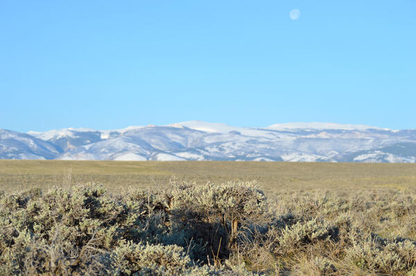