
History of the Texas Water Science Center
History of the Texas Water Science Center
The USGS water science presence in Texas began in 1898 with measurements of Colorado River at Austin, Texas. The Texas Water Science Center was founded in 1915 as the Texas District in Austin, Texas. By the 2019 merger with Oklahoma WSC, the Texas WSC had grown to nine offices located in Austin, Corpus Christi, El Paso, Fort Worth, Houston, Lubbock, San Angelo, San Antonio, and Wichita Falls
The U.S. Geological Survey (USGS) was established by Congress to provide the Nation with reliable scientific information to describe and understand the Earth; minimize loss of life and property from natural disasters; manage water, biological, energy, and mineral resources; and enhance and protect our quality of life.

The U.S. Geological Survey (USGS) was established by Congress to provide the Nation with reliable scientific information to describe and understand the Earth; minimize loss of life and property from natural disasters; manage water, biological, energy, and mineral resources; and enhance and protect our quality of life.
In 1915 the USGS Texas District Office (now Oklahoma-Texas Water Science Center) opened a permanent office in Austin.
The first USGS District Engineer was Glenn A. Gray. At that time, 18 streamgages were being maintained. A few years later, in acknowledging the flashy nature of some streams and the large size of the state, G.A. Gray foretold: “The importance of stream-flow data in Texas will warrant the installation of several hundred stations...”
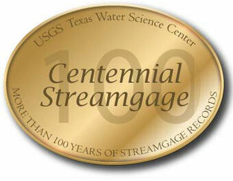
As of 2018 USGS operated more than 850 real-time (continuously monitored) sites that include streams (627 sites), lakes (161), canals and estuaries (11), groundwater and extensometer wells (45), springs (10), and atmospheric (18) locations. Of the streamflow sites, 19 "centennial" streamgages have operated mostly continuously for more than 100 years.
► Expanded History of the Texas Water Science Center

Texas Water Science Center Directors
- Glenn A. Gray District Engineer, 1915-1918
- Clarence E. Ellsworth District Engineer, 1918-1953
- Trigg Twichell District Engineer; title changed to District Chief, 1953-70
- Dale Yost District Chief, 1971-80
- Bill Boning District Chief, 1980 - 1989
- Bob Burchett District Chief, 1989 - 1996
- Rich Hawkinson District Chief, 1996 - 2001
- Jess Weaver District Chief, 2001 - 2004
- Bob Joseph District Chief; title changed to Center Director, 2004 - 2017
- Tim Raines, Center Director, 2017 - 2019
REFERENCES
USGS History -
Follansbee, Robert, 1994, A History of the Water Resources Branch, U.S. Geological Survey: Volume I, From Predecessor Surveys to June 30, 1919: U.S. Geological Survey unnumbered report, 303 p.
Rabbitt, M.C., 1989, The United States Geological Survey: 1879-1989: U.S. Geological Survey Circular 1050, 52 p.
Topography -
The National Map: More than 130 Years of Topographic Mapping
Evans, R.T., and Frye, H.M., 2009, History of the topographic branch (division): U.S. Geological Survey Circular 1341, 196 p.
Geology -
Hill, R.T. 1901. Geography and geology of the Black and Grand prairies, Texas with detailed descriptions of the Cretaceous formations and special reference to artesian waters. Twenty-First Annual Report of the United States Geological Survey to the Secretary of the Interior, 1899-1900, Part VII - Texas, 666 pp.
Hill, R.T. and Vaughan, T.W. 1902. Austin folio, Texas. United States Department of the Interior, U.S. Geological Survey, Geological Atlas of the United States, Folio 76.
The Handbook of Texas Online: Hill, Robert Thomas; Accessed June 12, 2018 at URL https://tshaonline.org/handbook/online/articles/fhi26.
Water -
Gould, Charles Newton, 1906, The geology and water resources of the eastern portion of the Panhandle of Texas, U.S. Geological Survey Water Supply 154.
Slichter, Charles Sumner, 1905, Observations on the ground waters of Rio Grande Valley, U.S. Geological Survey Water Supply Paper 141.
T. U. Taylor Papers, Dolph Briscoe Center for American History, University of Texas at Austin. Vertical Files, Dolph Briscoe Center for American History, University of Texas at Austin.
The Handbook of Texas Online: Gould, Charles Newton; Accessed June 12, 2018 at URL https://tshaonline.org/handbook/online/articles/fgo37
The Handbook of Texas Online: Taylor, Thomas Ulvan; Accessed June 12, 2018 at URL https://tshaonline.org/handbook/online/articles/fta27
Banner image description
1963 water level measurement. G.E. Koberg, USGS hydrologist, examining a water-stage recorder which records the stage of a water impoundment located twelve miles northwest of Laredo.