


The USGS uses a variety of survey tools—including personal watercraft (jet skis) equipped with GPS and sonar—to measure how sandy coastlines change over time. Sandy coastlines are a valuable resource that protect human-made structures from waves, serve as habitat for important species, and provide a variety of recreational opportunities.
USGS Resources for Coastal Sediments 2023
Who’s presenting at Coastal Sediments 2023?
Check out the line-up of USGS-led sessions, presentations, and posters
Check out the line-up of USGS-led sessions, presentations, and posters
Coastal research to address resilience
Explore USGS employment opportunities
Our commitment to Diversity, Equity, Inclusion, and Accessibility
The USGS St. Petersburg Coastal and Marine Science Center is proud to be an exhibitor and sponsor at the 2023 Coastal Sediments Conference. Here you can explore USGS resources related to the conference, employment and postdoc information, and our bureau Diversity, Equity, Inclusion, and Accessibility (DEIA) priorities.
Sources/Usage: Some content may have restrictions. View Media Details
We are excited to share our research and culture with you at the 2023 Coastal Sediments Conference. Explore science, employment, and DEIA resources in the links below or contact us for more information.
View our line-up of presentations at the Coastal Sediments 2023
Coastal Research
At the Department of the Interior, our mission is to ensure that our coasts are resilient and prosperous for current and future generations.
To address our constantly changing coastal landscapes, the USGS conducts a wide range of research and monitoring along our coasts and works with stakeholders throughout the data lifecycle to identify needs and data gaps and address coastal resilience challenges. In turn, USGS science supports coastal communities by providing information and tools that can be used by decision makers to conserve and sustainably use our coastal landscapes and resources.

Sources/Usage: Public Domain. View Media Details
This work helps to assess and predict coastal change and associated hazards so our Nation’s communities, infrastructure, wildlife, and the coastal ecosystems on which they rely can adapt to a changing world.

Sources/Usage: Public Domain. View Media Details
Coastal Science Navigator Now Available!
We are actively prototyping a guided coastal science discovery hub that serves as an entry point to assist users in finding USGS Coastal Change Hazards (CCH) products and tools that meet their specific needs. The product provides an aggregation space where users can find, filter, compare, and explore CCH resources. The “guided search” function of this product allows users to search by desired information characteristics, serving products that may meet their requirements geographically, temporally, and in terms of the hazards (e.g., future flooding, storm impacts, shoreline change) they are concerned about.
Sign up for updates and announcements on the public launch of the USGS Coastal Science Navigator!
Examples of how we work with stakeholders to inform USGS research:
Caribbean Natural Hazards
Caribbean Natural Hazards
Caribbean Natural Hazards
Puerto Rico Coastal Vulnerability Assessments
Puerto Rico Coastal Vulnerability Assessments
Puerto Rico Coastal Vulnerability Assessments
State of Our Nation’s Coast
State of Our Nation’s Coast
State of Our Nation’s Coast
USGS Coastal Research Highlights
Coastal Sediment Availability and Flux
Coastal Sediment Availability and Flux
Coastal Sediment Availability and Flux
Estuarine and Marsh Geology
Estuarine and Marsh Geology
Estuarine and Marsh Geology
Hurricane Coastal Impacts
Hurricane Coastal Impacts
Hurricane Coastal Impacts
Climate Impacts to Arctic Coasts
Climate Impacts to Arctic Coasts
Climate Impacts to Arctic Coasts
Real-time Coastal Change Forecasts
Real-time Coastal Change Forecasts
Real-time Coastal Change Forecasts
Coral Reef Project
Coral Reef Project
Coral Reef Project
Massachusetts Integrated Coastal Studies
Massachusetts Integrated Coastal Studies
Massachusetts Integrated Coastal Studies
South Atlantic Salt Marsh Evolution
South Atlantic Salt Marsh Evolution
South Atlantic Salt Marsh Evolution
Alabama Barrier Island Restoration Assessment
Alabama Barrier Island Restoration Assessment
Alabama Barrier Island Restoration Assessment
Other USGS Coastal Resources
Coastal Change Hazards
Coastal Change Hazards
Coastal Change Hazards
Our Coasts Geonarratives
Our Coasts Geonarratives
Our Coasts Geonarratives
Coasts Science Explorer
Coasts Science Explorer
Coasts Science Explorer
Sponsor Highlight: USGS St. Petersburg Coastal and Marine Science Center
The U.S. Geological Survey St. Petersburg Coastal and Marine Science Center (SPCMSC) conducts coastal and marine research to ensure that our Nation has the information it needs to understand, protect, and restore coastal and ocean resources and support the communities that depend on them. Learn more about our research, capabilities, and history of our center in the resources below.
Visit our Webpage
Visit our Webpage
Visit our Webpage
Download our Booklet
Download our Booklet
Download our Booklet
Explore our Story Map
Explore our Story Map
Explore our Story Map
Take a Virtual Tour
Take a Virtual Tour
Take a Virtual Tour
Employment and Postdoctoral Opportunities
Sources/Usage: Public Domain. View Media Details
The USGS offers numerous opportunities at all levels of education from early college through post-doctoral research. Check out some of our employment resources below.
- SPCMSC Employment page
- USGS Employment and Information Center
- USAJOBS - The Federal Government's official employment site
- Youth and Education in Science (YES) student opportunities
- Mendenhall Postdoctoral Fellowship information
- Event Recordings: USGS Science Careers in Florida and the Caribbean
Our Commitment to Diversity, Equity, Inclusion, and Accessibility

Sources/Usage: Public Domain. View Media Details
The USGS has numerous initiatives and committees from the bureau level to individual science centers striving to attract and retain a USGS workforce that reflects the demographics of our Nation, to conceive new ways to serve the communities that need our science the most, and to create and maintain an environment which is open and accepting of individual differences. Check out some of our initiatives below.
- Educational Partnerships with Minority Serving Institutions
- Recruiting a Diverse Workforce - USGS staff attend, sponsor, and host events like the HBCU Climate Change conference, the SACNAS Diversity in STEM conference, and the Explore USGS Careers in Florida and the Caribbean event to showcase the diversity of USGS science and encourage potential new hires with a wide range of backgrounds to consider USGS as a future employer.
- The Office of Diversity and Equal Opportunity (DEO) is dedicated to ensuring equal employment opportunity. USGS is devoted to building an inclusive and diverse workforce by creating an environment where all employees are respected, valued, and able to develop and perform to their maximum potential.
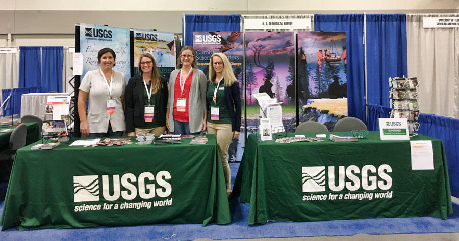
Meet the USGS Attendees at Coastal Sediments
Interested in learning more about USGS, our postdoc or employment opportunities, or DEIA efforts? Come chat with us at the conference or send us an email! We’d love to hear from you.
St. Petersburg Coastal and Marine Science Center
Jenna Brown
Jenna Brown
Jenna Brown
Daniel Ciarletta
Daniel Ciarletta
Daniel Ciarletta
James Flocks
James Flocks
James Flocks
Donya Frank-Gilchrist
Donya Frank-Gilchrist
Donya Frank-Gilchrist
Michael Itzkin
Michael Itzkin
Michael Itzkin
Jennifer Miselis
Jennifer Miselis
Jennifer Miselis
Rose Palermo
Rose Palermo
Rose Palermo
Margaret "Meg" Palmsten
Margaret "Meg" Palmsten
Margaret "Meg" Palmsten
Davina Passeri
Davina Passeri
Davina Passeri
Nathaniel Plant
Nathaniel Plant
Nathaniel Plant
Christopher Smith
Christopher Smith
Christopher Smith
Emily Wei
Emily Wei
Emily Wei
Olivia Cheriton
Olivia Cheriton
Olivia Cheriton
Li Erikson
Li Erikson
Li Erikson
Ann Gibbs
Ann Gibbs
Ann Gibbs
Bruce Jaffe
Bruce Jaffe
Bruce Jaffe
Kurt Rosenberger
Kurt Rosenberger
Kurt Rosenberger
Curt Storlazzi
Curt Storlazzi
Curt Storlazzi
Christopher Sherwood
Christopher Sherwood
Christopher Sherwood
John Warner
John Warner
John Warner
Nicholas Enwright
Nicholas Enwright
Nicholas Enwright
Wetland and Aquatic Research Center
Wetland and Aquatic Research Center
Wetland and Aquatic Research Center
Follow us on social media!
Sources/Usage: Some content may have restrictions. View Media Details
Sources/Usage: Some content may have restrictions. View Media Details
Sources/Usage: Some content may have restrictions. View Media Details
Related Content
Explore some USGS science related to the Coastal Sediments conference:
St. Pete Coastal Science
St. Pete Coastal Science
St. Pete Coastal Science
Pacific Coastal Science
Pacific Coastal Science
Pacific Coastal Science
Woods Hole Coastal Science
Woods Hole Coastal Science
Woods Hole Coastal Science
Wetland and Aquatic Science
Wetland and Aquatic Science
Wetland and Aquatic Science
Sediment Transport in Coastal Environments
Our research goals are to provide the scientific information, knowledge, and tools required to ensure that decisions about land and resource use, management practices, and future development in the coastal zone and adjacent watersheds can be evaluated with a complete understanding of the probable effects on coastal ecosystems and communities, and a full assessment of their vulnerability to natural...
Coral Reef Project
Explore the fascinating undersea world of coral reefs. Learn how we map, monitor, and model coral reefs so we can better understand, protect, and preserve our Nation's reefs.
Coastal Change Hazards
Natural processes such as waves, tides, and weather, continually change coastal landscapes. The integrity of coastal homes, businesses, and infrastructure can be threatened by hazards associated with event-driven changes, such as extreme storms and their impacts on beach and dune erosion, or longer-term, cumulative changes associated with coastal and marine processes, such as sea-level rise...
Coastal Sediment Availability and Flux (CSAF)
Sediments are the foundation of coastal systems, including barrier islands. Their behavior is driven by not only sediment availability, but also sediment exchanges between barrier island environments. We collect geophysical, remote sensing, and sediment data to estimate these parameters, which are integrated with models to improve prediction of coastal response to extreme storms and sea-level rise...
National Assessment of Coastal Change Hazards
The National Assessment of Coastal Change Hazards (NACCH) project develops hindcast, real-time, and forecast assessments of the magnitude or probability of coastal landscape change in response to persistent processes (e.g., shoreline change), extreme storms (e.g., Hurricane Sandy), and sea level rise. This effort depends on parallel collection of long- and short-term observations of coastal change...
Operational Total Water Level and Coastal Change Forecasts
The viewer shows predictions of the timing and magnitude of water levels at the shoreline and potential impacts to coastal dunes.
Explore USGS multimedia related to the Coastal Sediments conference:

Jet Ski Bathymetric Surveying
The USGS uses a variety of survey tools—including personal watercraft (jet skis) equipped with GPS and sonar—to measure how sandy coastlines change over time. Sandy coastlines are a valuable resource that protect human-made structures from waves, serve as habitat for important species, and provide a variety of recreational opportunities.

Tracking Coastal Change with Photogrammetry
Monitoring coastal changes is important for the millions of people that live along coasts in the United States, particularly as climate change hastens coastal erosion by raising sea levels and fueling powerful storms.
Monitoring coastal changes is important for the millions of people that live along coasts in the United States, particularly as climate change hastens coastal erosion by raising sea levels and fueling powerful storms.

Sediment Transport in San Francisco Bay
The Sacramento and San Joaquin Rivers deliver half the amount of sediment they did 50 years ago to San Francisco Bay. Just as sea-level rise is accelerating, the demand for sediment is growing.
The Sacramento and San Joaquin Rivers deliver half the amount of sediment they did 50 years ago to San Francisco Bay. Just as sea-level rise is accelerating, the demand for sediment is growing.

Deploying the Marine Sediment Sampler in Gulf of Mexico
Video of scientific and ship crew deploying a sediment trap in the Gulf of Mexico off of a research vessel.
Video of scientific and ship crew deploying a sediment trap in the Gulf of Mexico off of a research vessel.

Puerto Rico Coastal Hazards
The island of Puerto Rico is subject to numerous natural hazards including hurricanes and coastal erosion. Information on how the island’s coastal environments respond to these events is critical for bolstering coastal resilience. Dr.
The island of Puerto Rico is subject to numerous natural hazards including hurricanes and coastal erosion. Information on how the island’s coastal environments respond to these events is critical for bolstering coastal resilience. Dr.


USGS Woods Hole Coastal and Marine Science Center
This video provides an overview of the science and products produced by the U.S. Geological Survey Woods Hole Coastal and Marine Science Center, as well as the use and value of the knowledge, data, and tools produced by the Center. It additionally highlights the Center’s location, where we conduct research, and collaborator/stakeholder types.
This video provides an overview of the science and products produced by the U.S. Geological Survey Woods Hole Coastal and Marine Science Center, as well as the use and value of the knowledge, data, and tools produced by the Center. It additionally highlights the Center’s location, where we conduct research, and collaborator/stakeholder types.

Curt Storlazzi - Coral Reefs as National, Natural Infrastructure
Coral reefs act like submerged breakwaters by breaking waves and dissipating their energy offshore before they flood coastal properties and communities. This is an enormously valuable function: In 2017, Hurricanes Harvey, Irma and Maria alone caused over $265 billion in damage across the nation.
Coral reefs act like submerged breakwaters by breaking waves and dissipating their energy offshore before they flood coastal properties and communities. This is an enormously valuable function: In 2017, Hurricanes Harvey, Irma and Maria alone caused over $265 billion in damage across the nation.

Coastal Wetlands
Coastal wetlands are among the most productive and valuable ecosystems in the world—comparable to even rainforests and coral reefs.
Coastal wetlands are among the most productive and valuable ecosystems in the world—comparable to even rainforests and coral reefs.

Coastal Change in Arctic Alaska
The Arctic region is warming faster than anywhere else in the nation. Understanding the rates and causes of coastal change in Alaska is needed to identify and mitigate hazards that might affect people and animals that call Alaska home.
The Arctic region is warming faster than anywhere else in the nation. Understanding the rates and causes of coastal change in Alaska is needed to identify and mitigate hazards that might affect people and animals that call Alaska home.

Secrets of the Sediment on Barrier Islands
Join the USGS St. Petersburg Coastal and Marine Science Center as they uncover the secrets of the sediment on barrier islands in Pinellas County, Florida. This video was originally created for use at the 2021 virtual St. Petersburg Science Festival.
Join the USGS St. Petersburg Coastal and Marine Science Center as they uncover the secrets of the sediment on barrier islands in Pinellas County, Florida. This video was originally created for use at the 2021 virtual St. Petersburg Science Festival.

What is Bathymetry?
Bathymetry is the science of measuring the depth of water in ocean, river and lake environments. Learn how USGS measures bathymetry in this video by the St. Petersburg Coastal and Marine Science Center, originally created for the 2021 virtual St. Petersburg Science Festival.
Bathymetry is the science of measuring the depth of water in ocean, river and lake environments. Learn how USGS measures bathymetry in this video by the St. Petersburg Coastal and Marine Science Center, originally created for the 2021 virtual St. Petersburg Science Festival.

Installing Coastal Camera Tower
Time-lapse of USGS researchers raising a mechanical mast with a high-resolution camera mounted on top, which was deployed atop a dune in the U.S.
Time-lapse of USGS researchers raising a mechanical mast with a high-resolution camera mounted on top, which was deployed atop a dune in the U.S.

USGS Coastal Change Hazards
The USGS Coastal Change Hazards team works to identify and address the Nation’s coastal change hazards problems. By integrating research, technical capabilities and applications, and stakeholder engagement and communications, the Coastal Change Hazards team develops robust and accessible coastal change assessments, forecasts, and tools that help improve the lives,
The USGS Coastal Change Hazards team works to identify and address the Nation’s coastal change hazards problems. By integrating research, technical capabilities and applications, and stakeholder engagement and communications, the Coastal Change Hazards team develops robust and accessible coastal change assessments, forecasts, and tools that help improve the lives,

We are the Coastal and Marine Hazards and Resources Program
We are the USGS Coastal and Marine Hazards and Resources Program. Our mission is to provide science for sustainable stewardship of Earth’s precious resources.
We are the USGS Coastal and Marine Hazards and Resources Program. Our mission is to provide science for sustainable stewardship of Earth’s precious resources.

Studying How the Beach Changes at Madeira Beach, Florida
The importance of our Nation’s coasts is indisputable. They provide homes for people and animals alike, and support the Nation’s economy. The USGS Coastal Change Hazards team studies how our shorelines change over time, especially following extreme events such as storms and hurricanes.
The importance of our Nation’s coasts is indisputable. They provide homes for people and animals alike, and support the Nation’s economy. The USGS Coastal Change Hazards team studies how our shorelines change over time, especially following extreme events such as storms and hurricanes.
Explore news related to the Coastal Sediments conference:
Sound Waves Newsletter
Sound Waves Newsletter
Sound Waves Newsletter
Coastal and Marine News
Coastal and Marine News
Coastal and Marine News

USGS will sponsor, attend, and present at the 2023 Coastal Sediments conference in New Orleans
Staff from four science centers will represent USGS at this year’s Coastal Sediments conference and exhibit how current bureau initiatives are addressing this year’s theme of, "Inclusive coastal science and engineering for resilient communities."
Related Content
Explore some USGS science related to the Coastal Sediments conference:
St. Pete Coastal Science
St. Pete Coastal Science
St. Pete Coastal Science
Pacific Coastal Science
Pacific Coastal Science
Pacific Coastal Science
Woods Hole Coastal Science
Woods Hole Coastal Science
Woods Hole Coastal Science
Wetland and Aquatic Science
Wetland and Aquatic Science
Wetland and Aquatic Science
Sediment Transport in Coastal Environments
Our research goals are to provide the scientific information, knowledge, and tools required to ensure that decisions about land and resource use, management practices, and future development in the coastal zone and adjacent watersheds can be evaluated with a complete understanding of the probable effects on coastal ecosystems and communities, and a full assessment of their vulnerability to natural...
Coral Reef Project
Explore the fascinating undersea world of coral reefs. Learn how we map, monitor, and model coral reefs so we can better understand, protect, and preserve our Nation's reefs.
Coastal Change Hazards
Natural processes such as waves, tides, and weather, continually change coastal landscapes. The integrity of coastal homes, businesses, and infrastructure can be threatened by hazards associated with event-driven changes, such as extreme storms and their impacts on beach and dune erosion, or longer-term, cumulative changes associated with coastal and marine processes, such as sea-level rise...
Coastal Sediment Availability and Flux (CSAF)
Sediments are the foundation of coastal systems, including barrier islands. Their behavior is driven by not only sediment availability, but also sediment exchanges between barrier island environments. We collect geophysical, remote sensing, and sediment data to estimate these parameters, which are integrated with models to improve prediction of coastal response to extreme storms and sea-level rise...
National Assessment of Coastal Change Hazards
The National Assessment of Coastal Change Hazards (NACCH) project develops hindcast, real-time, and forecast assessments of the magnitude or probability of coastal landscape change in response to persistent processes (e.g., shoreline change), extreme storms (e.g., Hurricane Sandy), and sea level rise. This effort depends on parallel collection of long- and short-term observations of coastal change...
Operational Total Water Level and Coastal Change Forecasts
The viewer shows predictions of the timing and magnitude of water levels at the shoreline and potential impacts to coastal dunes.
Explore USGS multimedia related to the Coastal Sediments conference:
Jet Ski Bathymetric Surveying
The USGS uses a variety of survey tools—including personal watercraft (jet skis) equipped with GPS and sonar—to measure how sandy coastlines change over time. Sandy coastlines are a valuable resource that protect human-made structures from waves, serve as habitat for important species, and provide a variety of recreational opportunities.
The USGS uses a variety of survey tools—including personal watercraft (jet skis) equipped with GPS and sonar—to measure how sandy coastlines change over time. Sandy coastlines are a valuable resource that protect human-made structures from waves, serve as habitat for important species, and provide a variety of recreational opportunities.
Tracking Coastal Change with Photogrammetry
Monitoring coastal changes is important for the millions of people that live along coasts in the United States, particularly as climate change hastens coastal erosion by raising sea levels and fueling powerful storms.
Monitoring coastal changes is important for the millions of people that live along coasts in the United States, particularly as climate change hastens coastal erosion by raising sea levels and fueling powerful storms.
Sediment Transport in San Francisco Bay
The Sacramento and San Joaquin Rivers deliver half the amount of sediment they did 50 years ago to San Francisco Bay. Just as sea-level rise is accelerating, the demand for sediment is growing.
The Sacramento and San Joaquin Rivers deliver half the amount of sediment they did 50 years ago to San Francisco Bay. Just as sea-level rise is accelerating, the demand for sediment is growing.
Deploying the Marine Sediment Sampler in Gulf of Mexico
Video of scientific and ship crew deploying a sediment trap in the Gulf of Mexico off of a research vessel.
Video of scientific and ship crew deploying a sediment trap in the Gulf of Mexico off of a research vessel.
Puerto Rico Coastal Hazards
The island of Puerto Rico is subject to numerous natural hazards including hurricanes and coastal erosion. Information on how the island’s coastal environments respond to these events is critical for bolstering coastal resilience. Dr.
The island of Puerto Rico is subject to numerous natural hazards including hurricanes and coastal erosion. Information on how the island’s coastal environments respond to these events is critical for bolstering coastal resilience. Dr.
USGS Woods Hole Coastal and Marine Science Center
This video provides an overview of the science and products produced by the U.S. Geological Survey Woods Hole Coastal and Marine Science Center, as well as the use and value of the knowledge, data, and tools produced by the Center. It additionally highlights the Center’s location, where we conduct research, and collaborator/stakeholder types.
This video provides an overview of the science and products produced by the U.S. Geological Survey Woods Hole Coastal and Marine Science Center, as well as the use and value of the knowledge, data, and tools produced by the Center. It additionally highlights the Center’s location, where we conduct research, and collaborator/stakeholder types.
Curt Storlazzi - Coral Reefs as National, Natural Infrastructure
Coral reefs act like submerged breakwaters by breaking waves and dissipating their energy offshore before they flood coastal properties and communities. This is an enormously valuable function: In 2017, Hurricanes Harvey, Irma and Maria alone caused over $265 billion in damage across the nation.
Coral reefs act like submerged breakwaters by breaking waves and dissipating their energy offshore before they flood coastal properties and communities. This is an enormously valuable function: In 2017, Hurricanes Harvey, Irma and Maria alone caused over $265 billion in damage across the nation.
Coastal Wetlands
Coastal wetlands are among the most productive and valuable ecosystems in the world—comparable to even rainforests and coral reefs.
Coastal wetlands are among the most productive and valuable ecosystems in the world—comparable to even rainforests and coral reefs.
Coastal Change in Arctic Alaska
The Arctic region is warming faster than anywhere else in the nation. Understanding the rates and causes of coastal change in Alaska is needed to identify and mitigate hazards that might affect people and animals that call Alaska home.
The Arctic region is warming faster than anywhere else in the nation. Understanding the rates and causes of coastal change in Alaska is needed to identify and mitigate hazards that might affect people and animals that call Alaska home.
Secrets of the Sediment on Barrier Islands
Join the USGS St. Petersburg Coastal and Marine Science Center as they uncover the secrets of the sediment on barrier islands in Pinellas County, Florida. This video was originally created for use at the 2021 virtual St. Petersburg Science Festival.
Join the USGS St. Petersburg Coastal and Marine Science Center as they uncover the secrets of the sediment on barrier islands in Pinellas County, Florida. This video was originally created for use at the 2021 virtual St. Petersburg Science Festival.
What is Bathymetry?
Bathymetry is the science of measuring the depth of water in ocean, river and lake environments. Learn how USGS measures bathymetry in this video by the St. Petersburg Coastal and Marine Science Center, originally created for the 2021 virtual St. Petersburg Science Festival.
Bathymetry is the science of measuring the depth of water in ocean, river and lake environments. Learn how USGS measures bathymetry in this video by the St. Petersburg Coastal and Marine Science Center, originally created for the 2021 virtual St. Petersburg Science Festival.
Installing Coastal Camera Tower
Time-lapse of USGS researchers raising a mechanical mast with a high-resolution camera mounted on top, which was deployed atop a dune in the U.S.
Time-lapse of USGS researchers raising a mechanical mast with a high-resolution camera mounted on top, which was deployed atop a dune in the U.S.
USGS Coastal Change Hazards
The USGS Coastal Change Hazards team works to identify and address the Nation’s coastal change hazards problems. By integrating research, technical capabilities and applications, and stakeholder engagement and communications, the Coastal Change Hazards team develops robust and accessible coastal change assessments, forecasts, and tools that help improve the lives,
The USGS Coastal Change Hazards team works to identify and address the Nation’s coastal change hazards problems. By integrating research, technical capabilities and applications, and stakeholder engagement and communications, the Coastal Change Hazards team develops robust and accessible coastal change assessments, forecasts, and tools that help improve the lives,
We are the Coastal and Marine Hazards and Resources Program
We are the USGS Coastal and Marine Hazards and Resources Program. Our mission is to provide science for sustainable stewardship of Earth’s precious resources.
We are the USGS Coastal and Marine Hazards and Resources Program. Our mission is to provide science for sustainable stewardship of Earth’s precious resources.
Studying How the Beach Changes at Madeira Beach, Florida
The importance of our Nation’s coasts is indisputable. They provide homes for people and animals alike, and support the Nation’s economy. The USGS Coastal Change Hazards team studies how our shorelines change over time, especially following extreme events such as storms and hurricanes.
The importance of our Nation’s coasts is indisputable. They provide homes for people and animals alike, and support the Nation’s economy. The USGS Coastal Change Hazards team studies how our shorelines change over time, especially following extreme events such as storms and hurricanes.
Explore news related to the Coastal Sediments conference:
Sound Waves Newsletter
Sound Waves Newsletter
Sound Waves Newsletter
Coastal and Marine News
Coastal and Marine News
Coastal and Marine News
USGS will sponsor, attend, and present at the 2023 Coastal Sediments conference in New Orleans
Staff from four science centers will represent USGS at this year’s Coastal Sediments conference and exhibit how current bureau initiatives are addressing this year’s theme of, "Inclusive coastal science and engineering for resilient communities."