
Earth's Pulse

Detailed Description
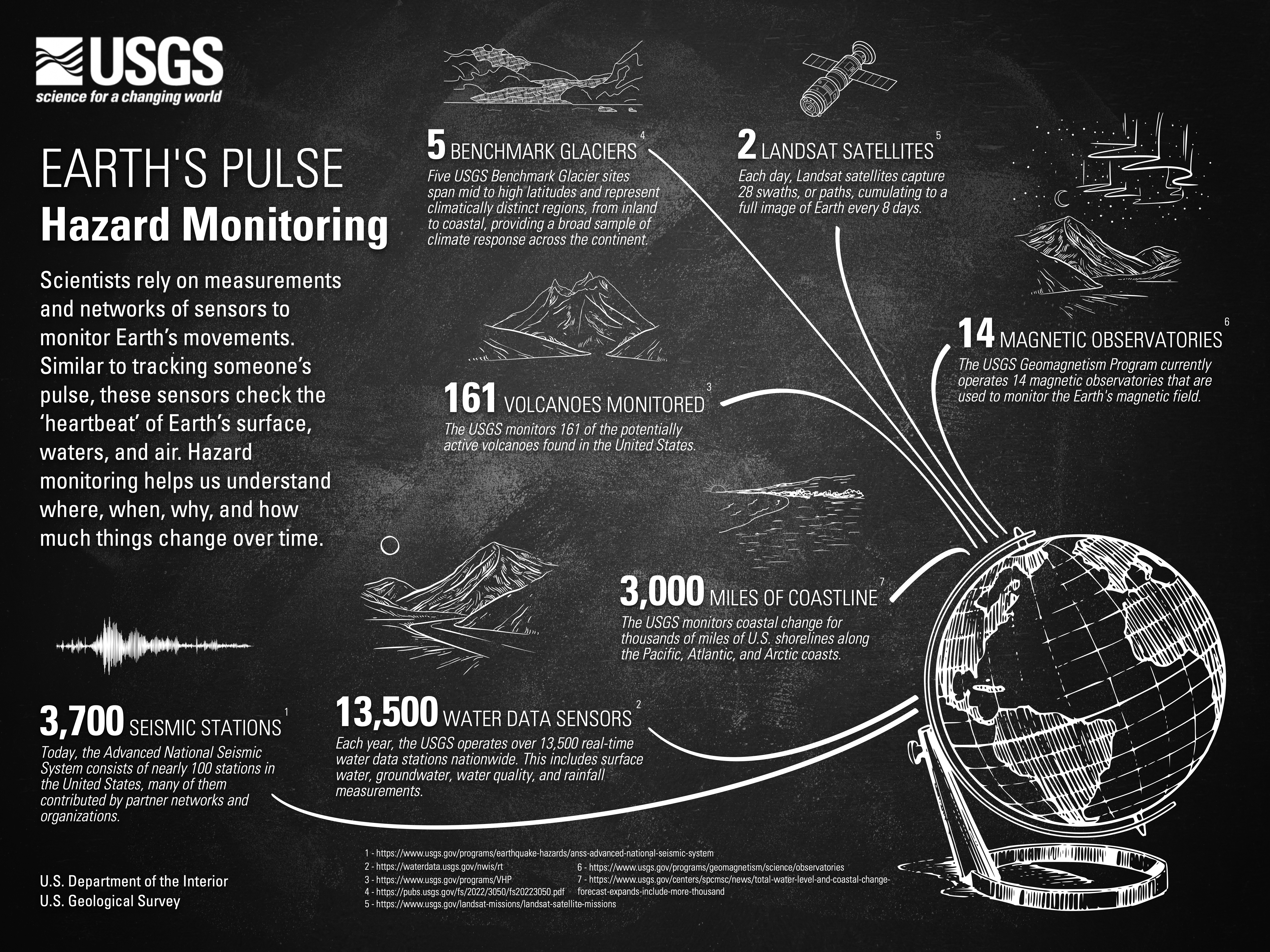
EARTH'S PULSE
Hazard Monitoring
Scientists rely on measurements and networks of sensors to monitor Earth’s movements. Similar to tracking someone’s pulse, these sensors check the ‘hazard heartbeat’ of Earth’s surface, waters, and air. Hazard monitoring helps us understand where, when, why, and how much things change over time.
- 100 SEISMIC STATIONS - Today, the Advanced National Seismic System consists of nearly 100 stations in the United States, many of them contributed by partner networks and organizations.
-
13,500 WATER DATA SENSORS - Each year, the USGS operates over 13,500 real-time water data stations nationwide. This includes surface water, groundwater, water quality, and rainfall measurements.
-
161 VOLCANOES MONITORED - The USGS monitors 161 of the potentially active volcanoes found in the United States.
-
5 BENCHMARK GLACIERS -Five USGS Benchmark Glacier sites span mid to high latitudes and represent climatically distinct regions, from inland to coastal, providing a broad sample of climate response across the continent.
-
3 LANDSAT SATELLITES - Each day, Landsat satellites capture 28 swaths, or paths, cumulating to a full image of Earth every 8 days.
-
14 MAGNETIC OBSERVATORIES - The USGS Geomagnetism Program currently operates 14 magnetic observatories that are used to monitor the Earth's magnetic field.
- 1 - https://www.usgs.gov/programs/earthquake-hazards/anss-advanced-national…
- 2 - https://waterdata.usgs.gov/nwis/rt
- 3 - https://www.usgs.gov/programs/VHP
- 4 - https://pubs.usgs.gov/fs/2022/3050/fs20223050.pdf
- 5 - https://www.usgs.gov/landsat-missions/landsat-satellite-missions
- 6 - https://www.usgs.gov/programs/geomagnetism/science/observatories
Sources/Usage
Public Domain.