
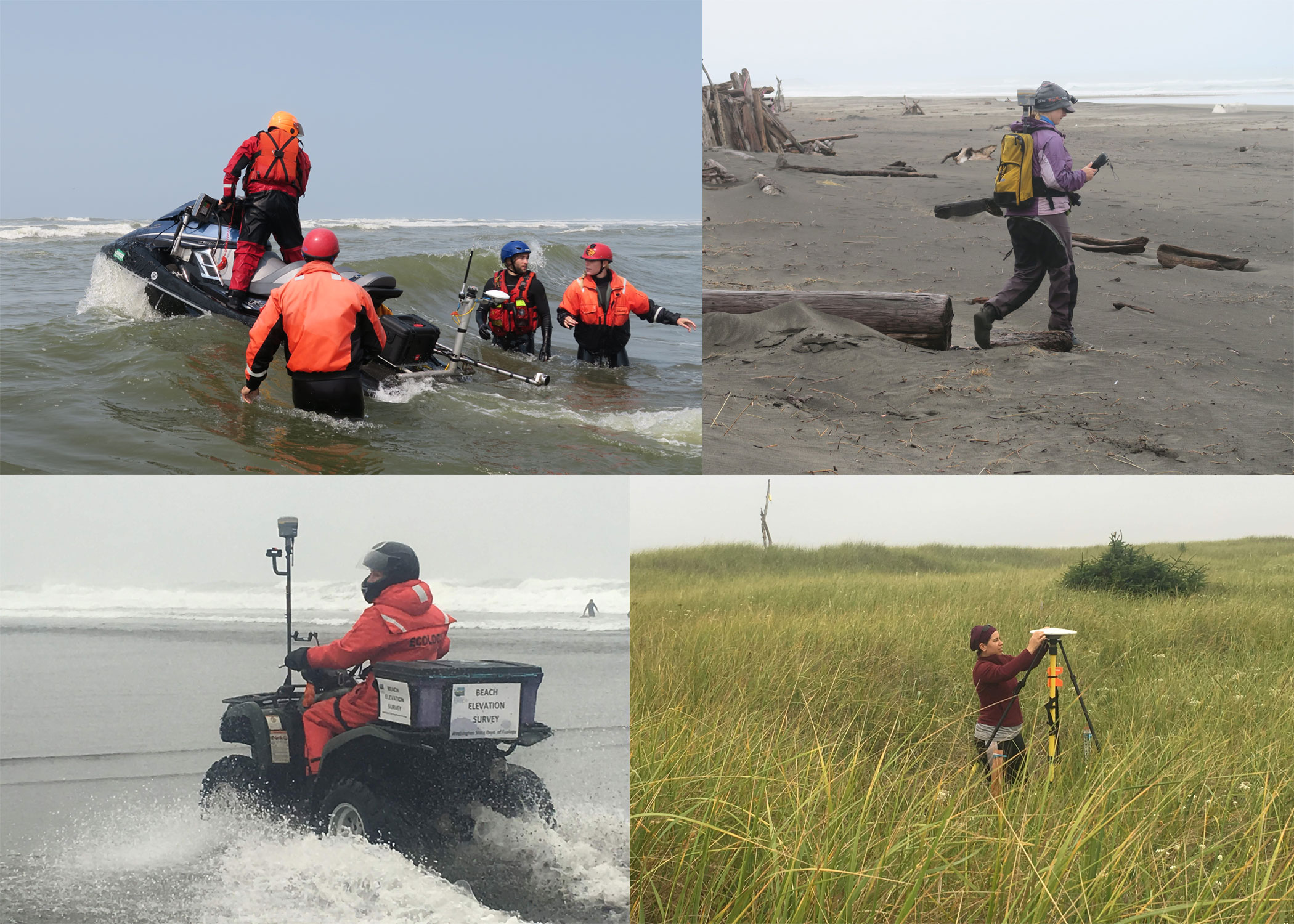
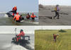
Equipment used during surveys in Columbia River littoral cell

Detailed Description
Photographs showing equipment used during bathymetric and topographic surveys along the Columbia River littoral cell, Washington and Oregon.
Sources/Usage
Public Domain.
Data Release: Beach topography and nearshore bathymetry of the Columbia River littoral cell, Washington and Oregon
This data release presents beach topography and nearshore bathymetry data from repeated surveys performed by a team of scientists from the U.S. Geological Survey, Washington State Department of Ecology, and Oregon State University in the Columbia River littoral cell (CRLC), Washington and Oregon. The CRLC extends approximately 165 kilometers between Point Grenville (PG), Washington, and Tillamook Head (TH), Oregon.
Columbia River estuary: Sediment Transport in Coastal Environments
USGS PCMSC is working closely with the states of Washington and Oregon, the U.S. Army Corps of Engineers, and others to bring the best available scientific information on sediment management to decision makers. USGS PCMSC has developed a state-of-the-art process-based numerical model of hydrodynamics and sediment transport for the lower Columbia River, Columbia River Estuary, and adjacent coast, and works closely with partners to develop, calibrate and verify the model. Because of the expertise developed over the years, USGS is sought by others to perform field work and modeling at the mouth of the Columbia River.