
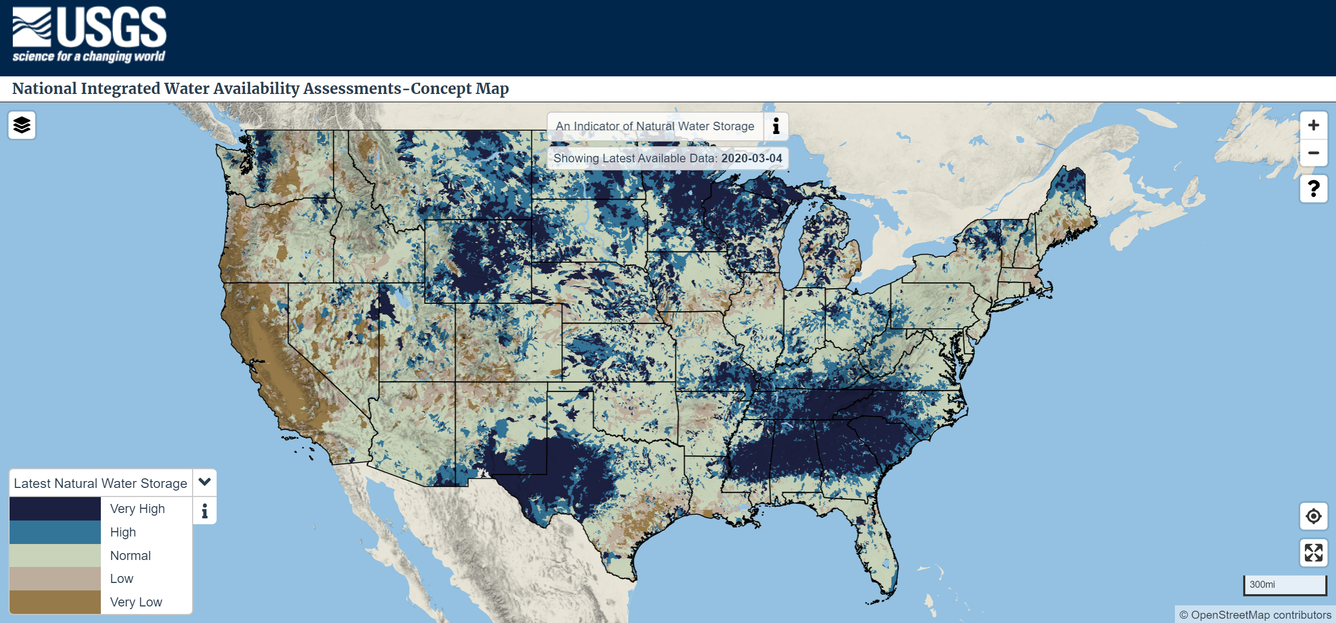
National Integrated Water Availability Assessments concept map
Detailed Description
The USGS National Integrated Water Availability Assessments (IWAAs) concept map shows daily estimates of natural water storage (water present on the landscape such as standing water, snowpack, soil water, and shallow groundwater) for approximately 110,000 regions across the conterminous United States. While the demonstration map is not ready for decision making, it can be used to compare an individual region’s current water storage to its historical storage.
Sources/Usage
Public Domain.