
NHD Newsletter Monthly Quiz - May/June 2021

Detailed Description
This Month’s Quiz
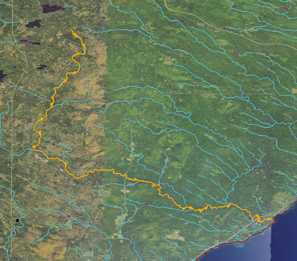
With no lake or reservoir serving as its headwaters, this stream forms almost entirely from runoff, rising in a gully before falling 1100 feet over 23 miles to its mouth along one of the Great Lakes. Its most distinctive feature is a series of three waterfalls in close succession, which are located within a highly visited state park. The park itself was named after the river and contains structures built by the Civilian Conservation Corps during 1934-1941 from local red, blue, brown, and black basalt. The stream's English name, designated in 1823, is translated from either the Ojibwe name for a food source found along the stream, or the name of a French explorer who visited the region in the 1660s.
► Please email your answer to Becci Anderson (rdanderson@usgs.gov).
Last Month’s Hydro Quiz Winner
Congratulations to last month’s Hydro Quiz Winner, Robert Thomas, with the correct answer of Hagoi Susupi (aka Lake Susupi, Lake Susupe) on Saipan, CNMI. Robert was the USFS Region 2 NHD/WBD editor in Colorado, who now is a part of the USFS CIO Geospatial Branch. He continues to encourage the use and stewardship of USFS NHD/WBD layers where he is able. He appreciates the quizzes in the newsletters to keep things fun, especially during the pandemic.
Thanks to Evan Hammer as the only other person to play along this month!
Sources/Usage
Public Domain.