
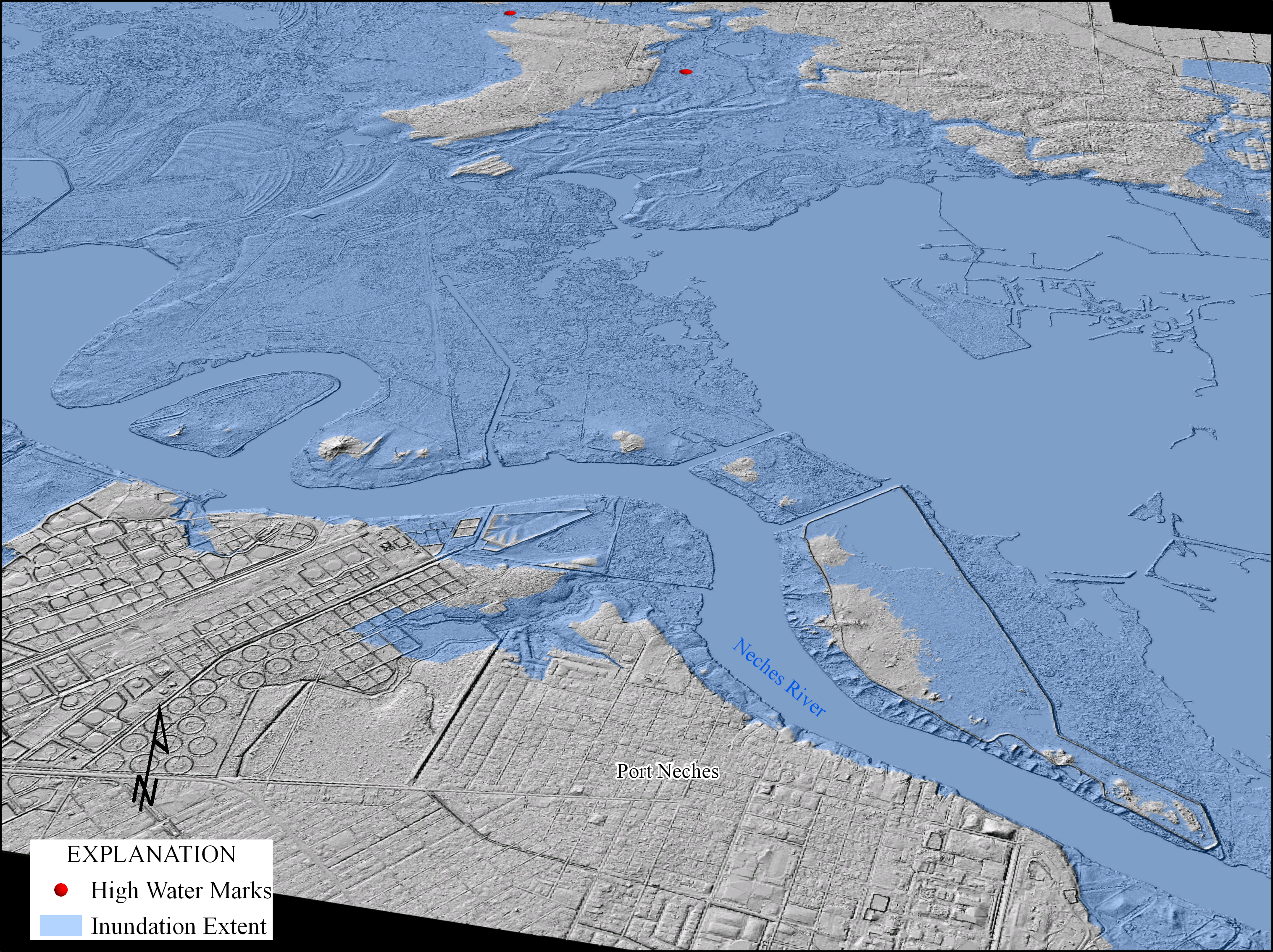
Port Neches Flood Inundation
By National Geospatial Program
2017 (approx.)

Detailed Description
The image shows flood inundation in southeastern Texas from Hurricane Harvey in 2017. High-water marks and peak-stage data from USGS streamflow-gaging stations were used to create a flood-elevation surface. This surface was compared to a lidar-based digital elevation model to map where flooding occurred and calculate water depth.
Sources/Usage
Public Domain.