
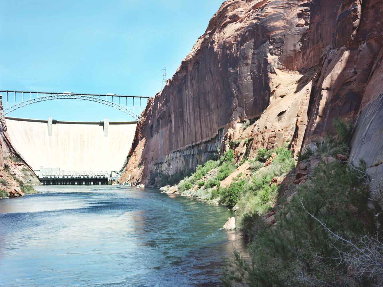
Repeat color photograph taken in 2011 of Glen Canyon Dam, a match to the 1889 Stanton Expedition & 1992 USGS images
Detailed Description
A USGS repeat photograph of Glen Canyon Dam taken on April 20, 2011 as a match to the 1889 Franklin Nims image of the site before the dam was built, at Colorado River mile -14.7, during the Stanton Expedition. This view was also matched in 1992 by the USGS. The view is taken upstream from river left. Stake (camera point) s2638 in the SBSC's Southwest Repeat Photography Collection.
Excerpt of the Stanton Survey History by Robert H. Webb, USGS, public domain (from the now unavailable webpage on the subject):
In May 1889, railroad engineer Robert Brewster Stanton, in collaboration with real estate investor Frank M. Brown, began a survey of the Green and Colorado River corridors. Their goal was to construct a railroad line from Grand Junction, Colorado to San Diego, California, one that would wind at river-level through several of the Colorado River’s canyons. While that expedition ended in disaster in July after three men—one of them Brown—drowned in Grand Canyon, Stanton successfully completed the survey that winter (1889-1890). The expedition quickly discovered that conducting the survey by instrument was far too time-consuming for their allotted time, so the men turned to line-of-site photographs taken on newfangled flexible roll film (rather than the cumbersome glass plates used by their predecessors). Although the railroad project never got past the planning stages, the photographs would prove to be invaluable as the basis for repeat photography a century later. From 1989 to 1995, the USGS re-photographed nearly all of the images that the expedition’s photographers—Franklin A. Nims and, after Nims was injured and left the expedition, Stanton himself—took in both Grand and Cataract Canyons. The photographs reveal changes in desert and riparian vegetation, rapids, and beaches, as a result of both natural and human-caused processes. Many of the Grand Canyon images were published in the book “Grand Canyon, A Century of Change,” by Robert Webb, and a selection of the Cataract Canyon images appeared in “Cataract Canyon: A Human and Environmental History of the Rivers in Canyonlands,” by Robert Webb, Jayne Belnap, and John Weisheit. In 2010, the USGS re-matched many of the images, both in Grand Canyon and Cataract Canyon.
The vegetation growing along the shoreline has increased in both size and stature, particularly the netleaf hackberry. Many of the individual plants persist, and a new netleaf hackberry is visible in the lower right corner of the image.
Sources/Usage
Public Domain.