
Timeline of South Pole Seismic Station

Detailed Description
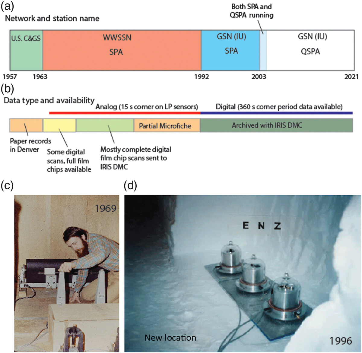
(a) Timeline of network and station name and (b) availability and format of seismic data from South Pole, Antarctica (SPA) since 1957. (c) Charles Hutt (U.S. Geological Survey) adjusts a long-period galvanometer to reflect light onto a photosensitive recording drum during the late fall of 1969 (photo courtesy of Charles Hutt). (d) Collapse of the seismic vault in 1996 forced the primary STS-1 sensors to be relocated to the hallway in the tunnel leading to the vault. The three components shown here are covered in vacuum-sealed glass bell jars to mitigate recording pressure variations, and the vertical component is additionally covered in a mu-metal shield to reduce magnetic field fluctuations observed by the seismometer (photo courtesy of Dave Krukar). U.S. C&GS, U.S. Coast and Geodetic Survey; WWSSN, World-Wide Standardized Seismographic Network. (from Anthony et al., 2021)
Sources/Usage
Public Domain.
Anthony, R. E., A. T. Ringler, M. DuVernois, K. R. Anderson, and D. C. Wilson (2021). Six Decades of Seismology at South Pole, Antarctica: Current Limitations and Future Opportunities to Facilitate New Geophysical Observations, Seismol. Res. Lett. XX, 1–18, doi: 10.1785/ 0220200448.