
Wasatch Fault - how big how frequent - EQ
Detailed Description
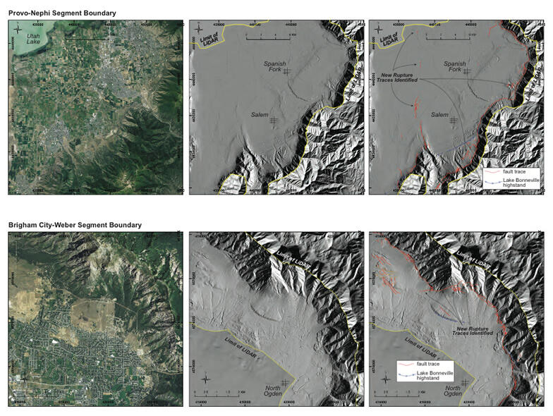
Satellite images (left), uninterpreted LiDAR hillshade maps (center) and interpreted LiDAR hillshade maps (right) of the Provo-Nephi segment boundary (top row) and the Brigham City-Weber segment boundary (bottom row). The red lines on the interpreted maps are faults that could be identified with the LiDAR images. Several of these faults are newly identified, revealed for the first time with this LiDAR data.
Sources/Usage
Public Domain.