
Z-values too low lidar error
By NGP Standards and Specifications
2021 (approx.)
Detailed Description
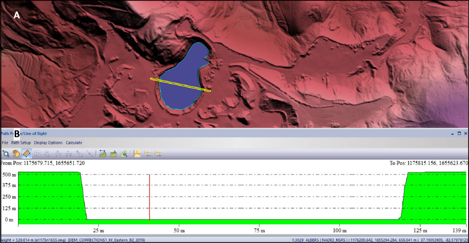
Lidar error dictionary figure 6. Elevation cross section (B) showing Z-values that are well below the terrain instead of being at or immediately below the surrounding land surface. Top image (A) is a digital elevation model showing the waterbody (blue), breakline (blue line) and cross section location (yellow double line).
Sources/Usage
Public Domain.