
Repeat photography of Colorado River Mile 197, originally photographed by E.C. LaRue during the 1923 Birdseye Expedition


Detailed Description
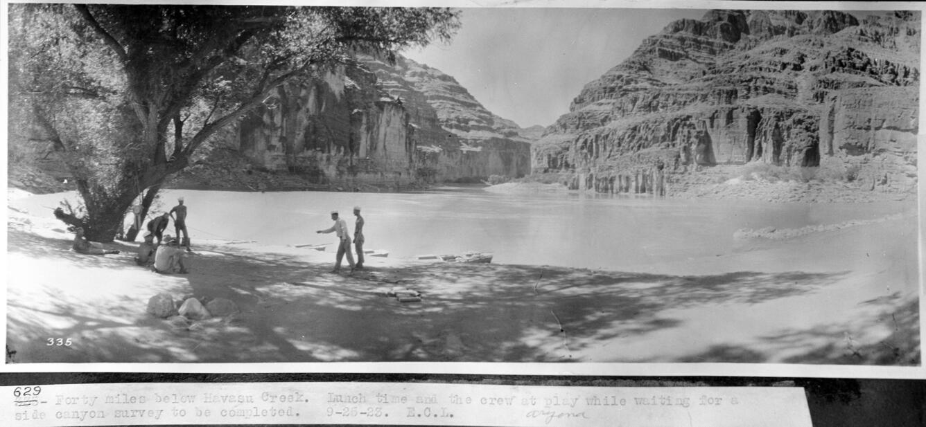
This repeat photographic series was taken in Grand Canyon at Colorado River Mile 197, from the left bank. The first image is by E.C. LaRue. Eugene Clyde LaRue was an engineer for the USGS until 1927. He conducted investigations for potential dam sites, irrigation systems, and power generation. He was interested in Colorado River water development, and became the chairman of the Arizona Engineering Commission in 1922. In 1923, the Birdseye Expedition surveyed the 251-mile stretch of the Colorado River between Lees Ferry and Diamond Creek. E.C. LaRue served as the expedition's hydrologist and photographer. The two major goals of the expedition were to locate potential dam sites and create a series of maps and profiles of the area. Eventually, the expedition published 14 maps that were used in the creation of Hoover and Parker Dams, as well as the Colorado River Aqueduct and the Central Arizona Project (courtesy of ArchivesWest, Orbis Cascade Alliance). The USGS took repeat photographs at the 1923 location in 1972, 1983, 1994, and 2016. The series is stored in the SBSC's Southwest Repeat Photography Collection, stake (camera point) s0720, original numbers (LaRue) 628 and 629. Dates and descriptions of each image are below.
9/25/1923: Historic images taken on September 25, 1923, by E.C. LaRue during a survey trip on the Colorado River during the Birdseye Expedition. The image captions say, "Forty miles below Havasu Creek. Lunch time and the crew at play while waiting for a side canyon survey to be completed" (the men are playing horseshoes under willow trees) and "Downstream view of the Grand Canyon from left bank, 38.2 miles below Havasu Creek."
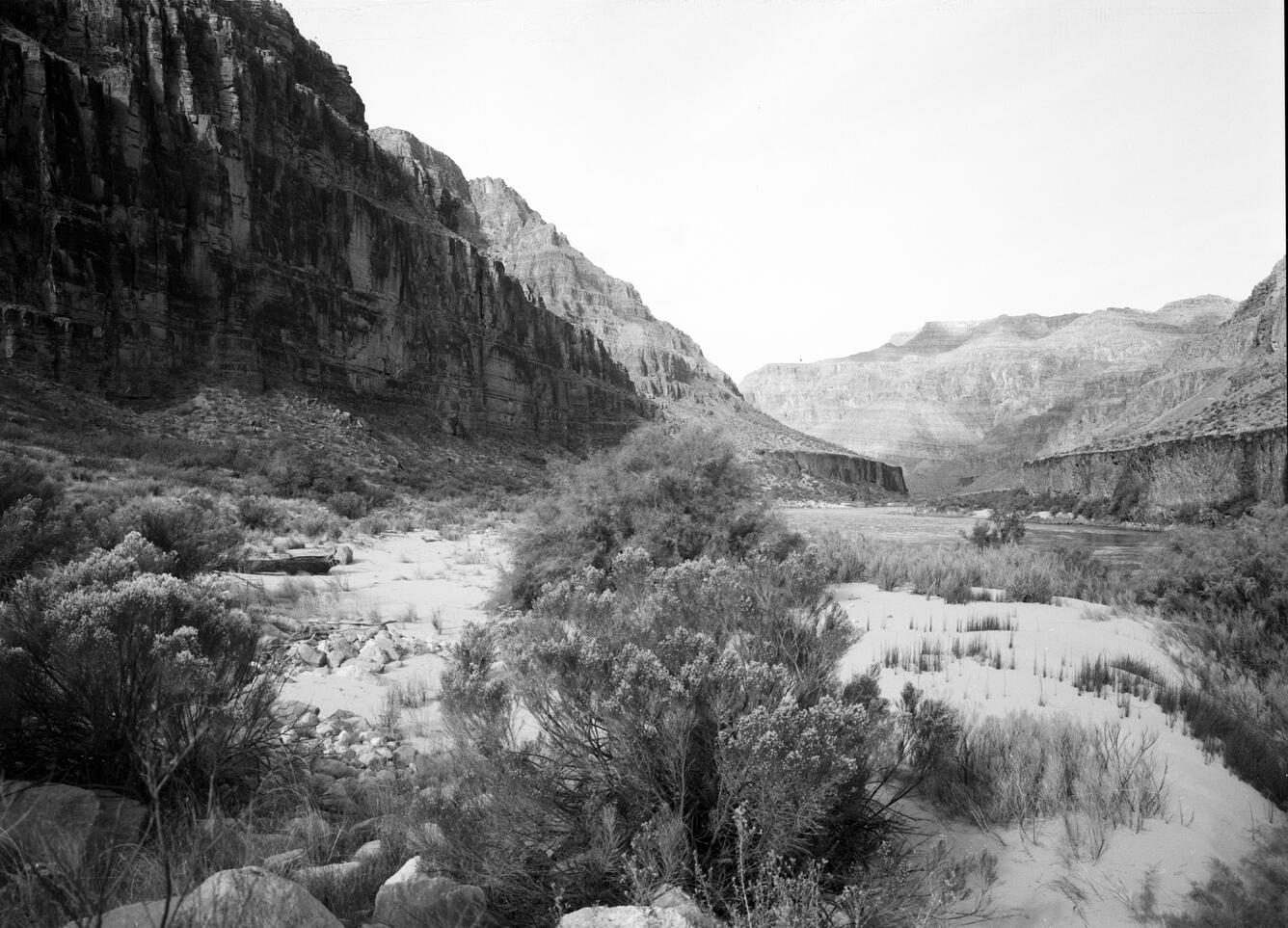
8/25/1972 and 11/01/1983: Note the increase in vegetation in these images.
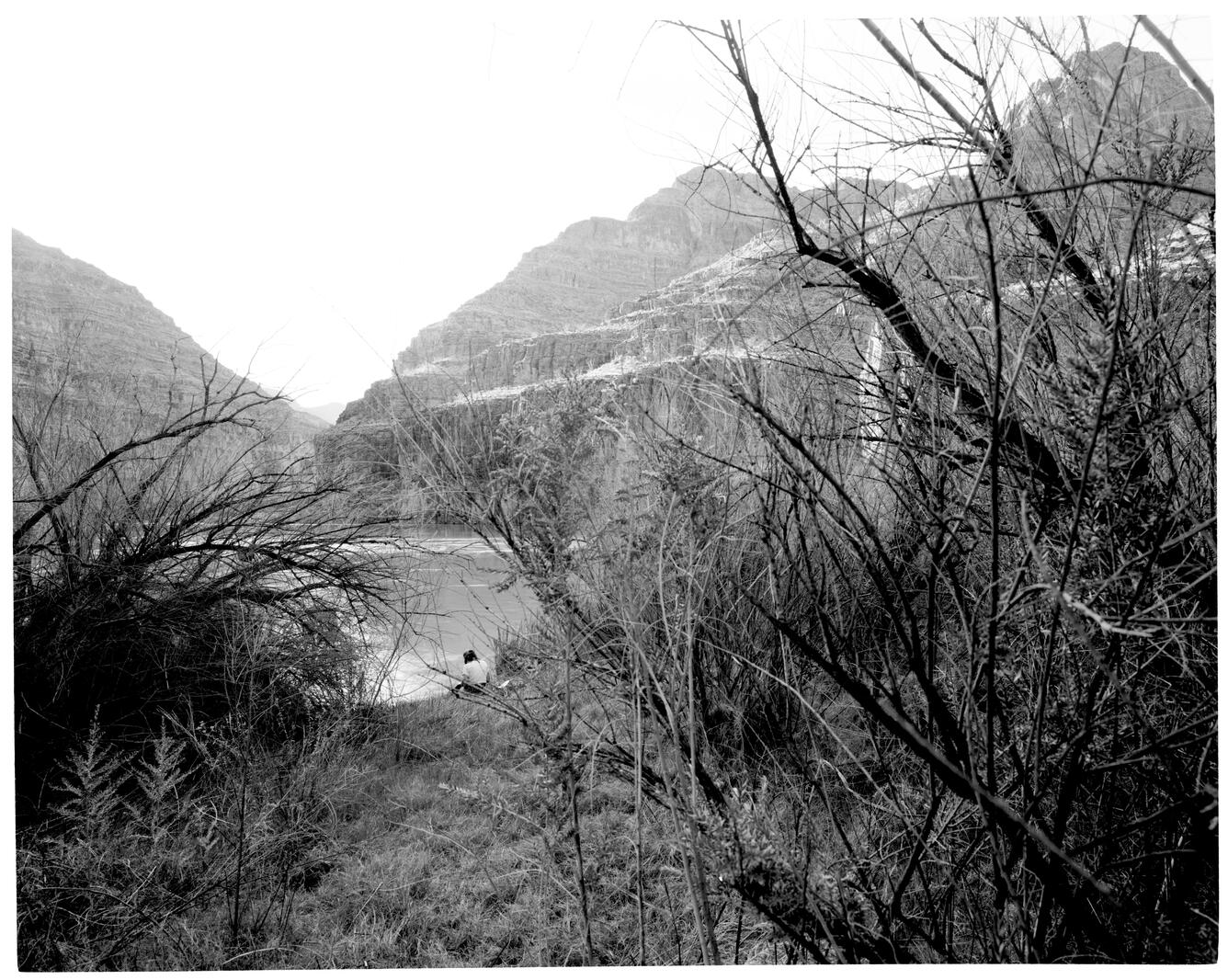
3/14/1994: Note the significant increase in vegetation in this image, compared to 1972 and 1983. After Glen Canyon Dam completion, there were changes in vegetation species and their abundance along the Colorado River in Grand Canyon. Vegetation now partially or fully covers many once open sandbars and beaches. Field notes written in 1994 state that Tamarisk, reeds, Baccharis shrubs, and Andropogon, Bromus, and Bermuda grass species were growing at the site. Compared to historic 1923 images, the view is now partially obscured.
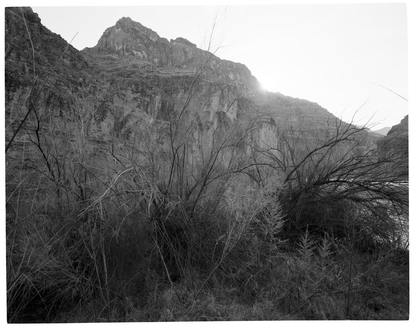
5/12/2016: Note the vegetation encroachment in these images compared to earlier images. Images taken in 2016 are courtesy of A.H. Fairley.
Sources/Usage
Public Domain.