
Take a Tour of the Earthquake Hazards Program Site
Or...How to Find USGS Earthquake Information Quickly!
An earthquake just happened, and I want more information. Why do earthquakes happen more in this place than in that place? I want to find out more about a specific earthquake that happened a long time ago in Montana. What are the earthquake hazards where I live? The USGS Earthquake Hazards Program can answer all these questions and so much more! In fact, with the latest updates to the website and so much information, you may be overwhelmed, so we’re giving you a roadmap to help you navigate. Enjoy the tour!
Most Popular Destination–Stop #1: Latest Earthquakes
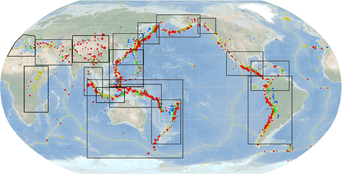
If a large earthquake just occurred anywhere in the world, your best bet is the Latest Earthquakes webpage. Here you’ll find a map and a list of all the latest earthquakes around the globe, all within a few minutes after they happen. The one that just happened will probably be at or near the top of the list, and if you select it and click on the link in the pop-up window, you can see all the details about that earthquake.

Latest Earthquakes will present you with the quick-to-load version that you can then customize and bookmark for future earthquake browsing. The first thing to notice is that the default view is showing you magnitude 2.5+ earthquakes for the past 24 hours, and the gray-scale map is focused on the United States. If you want to view another location in the world (or see the whole globe), you can zoom and pan, or click on the small “globe icon” in the upper left of the map to jump to popular locations. The list of earthquakes will reflect only those in your map view if you check the “Only list earthquakes shown on map” button above the list. You can also change the list information and order, and under the list there is a button to download to list in a variety of formats. The “layers icon” in the upper right of the map lets you choose a different basemap and which map data you want to see, including the U.S. faults. The small “key icon” underneath is the map legend.
To view earthquakes during the past 7 days or 30 days, and to change other settings, click on the “gear icon” in the upper right in the banner. Prefer your local time zone to UTC, and miles rather than kilometers? Here’s where you can change those settings. Back on the map, clicking on an earthquake symbol will highlight it in the list and pop up the window to navigate to the ”event page”. (Note that Latest Earthquakes doesn’t include events smaller than about magnitude 4.5 outside the U.S.). Looking for earthquakes older than 30 days ago? Try the online Search Earthquake Catalog tool.
Stop #2: Earthquake “Event Page”
The “event page” contains all the information about the earthquake, plus provides access to download many of the images and much of the data. (See this example of an earthquake event page.)

The Interactive Map should be your first stop to view various data layers on a map centered on the earthquake location. View the shaking intensity overlain on the population distribution as well as historic seismicity, among the many choices (click on the “layers icon”). If you felt the earthquake, you can provide your citizen scientist information on Felt Report – Tell Us! and then view the citizen-science-created map on Did You Feel It? Other information and products on the event page include the Shakemap showing measured shaking at seismic instruments, the estimated landslide or liquefaction activity, and the data used to location and assign a magnitude to the earthquake. For significant earthquakes, a summary of the event and the tectonic setting is written by a scientist and added at the bottom of the Overview page. Information is added and updated as more data is received and processed, so reload the page for the first few hours to see the latest content. Note that if the National Earthquake Information Center receives a tsunami notification from NOAA, there will be a “Tsunami card” with a link to the Tsunami Warning Center for more information. The presence of a card could mean a notification of a tsunami warning or a notification that there is no tsunami expected.
A key feature of Stop #2 is the PAGER overview for each earthquake event. “PAGER” stands for Prompt Assessment of Global Earthquakes for Response, and its function is to rapidly estimate earthquake shaking and the scope and impact of earthquakes around the world. These estimates are generally available within 30 minutes and are updated as more information becomes available.
Neither earthquake magnitude nor seismic intensity provides sufficient information to judge the overall impact of an earthquake, because the “loss” from an earthquake depends directly on the exposure and vulnerability of a population to specific levels of shaking (i.e., factors such as population density, vulnerability of built infrastructure, etc.) PAGER provides a quick estimate of the event impact shown as probabilities of economic losses and fatalities – red is “bad” and green is “okay.” One critical point to remember, however, is that PAGER serves as an analytical tool only; the public can refer to it as a guide, but they should follow all local municipal / emergency management guidance in their area on how to respond in an earthquake event, as local conditions on the ground may not always reflect PAGER predictions.
Stop #3: FAQs
The Frequently Asked Questions (FAQs), and their answers, are based on the thousands of questions that we’ve gotten over the years from web visitors. The answer to your question or where to find certain information is probably among the FAQs, so make this your first stop on the website.
Stop #4: Earthquake Lists and Information by Region
A list of magnitude 8 earthquakes each year, statistics for numbers of earthquakes each year, and more earthquake lists and statistics – these can be found on the Lists, Maps, and Statistics webpage.
Want to know what the earthquake activity looks like in different parts of the world or want to find information about earthquakes in your State? Head over to Information by Region, where you can look up your State or browse various regions in the world.
Stop #5: Learn About Earthquakes
By now your curiosity is piqued, and you’re ready to learn more about the science of earthquakes. The Education section has an abundance of information written by the USGS, as well as curated links to awesome educational webpages on other academic and partner websites. You might want to start with the primer, “The Science of Earthquakes,” and then read some plain-language summaries of recent research under the collection of Science for Everyone web articles. The interactive geonarratives (Esri Story Maps) under Web Tools provides fun explorations of some earthquake science topics too. If you want to really dig in to some specific earthquake science topics, you can search by topic, grade level, and other parameters, or simply browse the many links to resources at Earthquake Topics.

Optional Excursions
If you want to browse special earthquake collections, you can choose from a number of noteworthy earthquakes on Special Earthquakes, Earthquake Sequences, and Fault Zones. Or you may want to see photos of earthquake features and damage on the Earthquake Photo Collections webpage.

To read about the instruments that record earthquakes in the U.S. and worldwide, see Monitoring. And last, if you’re a data geek, you can subscribe to one or more of the earthquake feeds at Real-time Notifications, Feeds, and Web Services.
Next time there’s an earthquake, you’ll be ready!
Get Our News
These items are in the RSS feed format (Really Simple Syndication) based on categories such as topics, locations, and more. You can install and RSS reader browser extension, software, or use a third-party service to receive immediate news updates depending on the feed that you have added. If you click the feed links below, they may look strange because they are simply XML code. An RSS reader can easily read this code and push out a notification to you when something new is posted to our site.