
Cambodia Experiences Rapid Rate of Forest Loss
USGS Image of the Week
In this week's Landsat view, Landsat 5 and Landsat 8 show how significant Cambodia's deforestation has been in the last few decades.
USGS Image of the Week is a continuing series in which we repost an image from the USGS Earth Resources and Observation Science Center. From the artistry of Earth imagery to natural and human-caused land change over time, check back every Saturday to finish your week with a visual flourish!

The Image: Cambodia Experiences Rapid Rate of Forest Loss
Description:
When it comes to forest loss on a global scale, Cambodia is notable for how rapidly its forests are being cleared.
Among countries with accelerated rates of deforestation—Sierra Leone, Madagascar, Uruguay, and Paraguay among them—Cambodia ranks above them all with an annual loss of 14.4 percent of its forests between 2001 and 2014, according to researchers at the University of Maryland(link is external), who used Landsat data to track their rates. In that time period, Cambodia lost 5,560 square miles of forests.
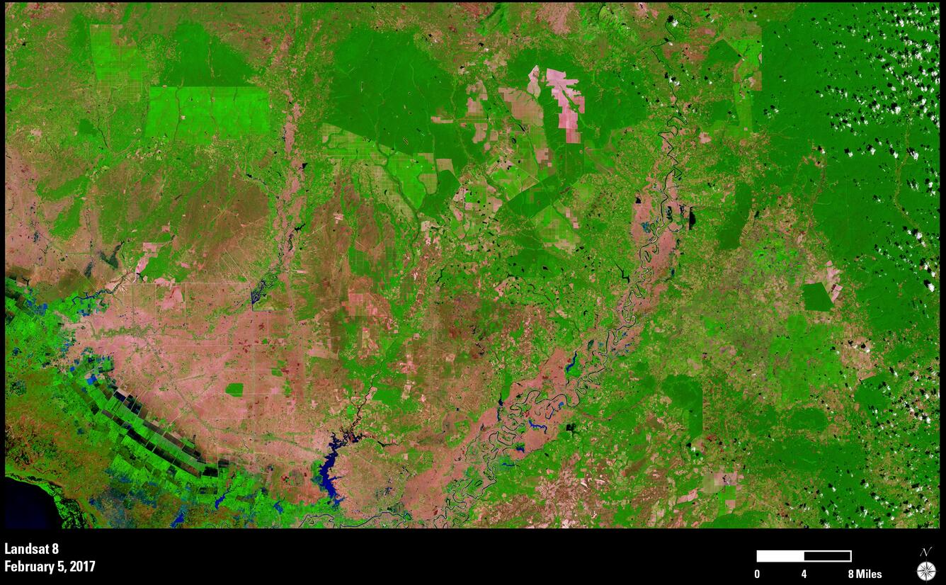
That loss is easily seen in these Landsat images. The Landsat 5 image captured in 1999 (left) shows vast dark green forest among a mountainous area of Cambodia. The 2017 image acquired by Landsat 8 (right) reveals areas where forest has been clear-cut. The bright green landscapes in the lower left interspersed with darker blocks are crops. The pinkish-tan areas are old, small-plot agricultural areas, and the bright green rectangles (top left) are agroforestry areas where rubber or oil palm plantations have emerged.
Working with Landsat data and other economic datasets, researchers at the University of Maryland have demonstrated that changes in global rubber prices and a surge in land-concession deals have helped accelerate Cambodia’s rate of deforestation. The Cambodian government leases concession lands to domestic and foreign investors for agriculture, timber production, and other uses.
Hungry for some science, but you don’t have time for a full-course research plate? Then check out USGS Science Snippets, our snack-sized science series that focuses on the fun, weird, and fascinating stories of USGS science.
Get Our News
These items are in the RSS feed format (Really Simple Syndication) based on categories such as topics, locations, and more. You can install and RSS reader browser extension, software, or use a third-party service to receive immediate news updates depending on the feed that you have added. If you click the feed links below, they may look strange because they are simply XML code. An RSS reader can easily read this code and push out a notification to you when something new is posted to our site.