Landsat Next Defined

Landsat Next Defined

Landsat Next is on the horizon—the new mission will not only ensure continuity of the longest space-based record of Earth’s land surface, it will fundamentally transform the breadth and depth of actionable information freely available to end users. Take a look at the new capabilities that will define the next Landsat mission.

Read More »

Expanding OpenET Across Amazon Basin

The research teams who help sustain the largest freshwater reserve in the world are developing a new tool to promote more resilient farming systems in Brazil. The goal is to help farmers better handle changes in the water cycle, deal with droughts, and adapt to a changing climate.

Read More »
Landsat Next Defined

Landsat Next Defined

Landsat Next is on the horizon—the new mission will not only ensure continuity of the longest space-based record of Earth’s land surface, it will fundamentally transform the breadth and depth of actionable information freely available to end users. Take a look at the new capabilities that will define the next Landsat mission.

Read More »

Expanding OpenET Across Amazon Basin

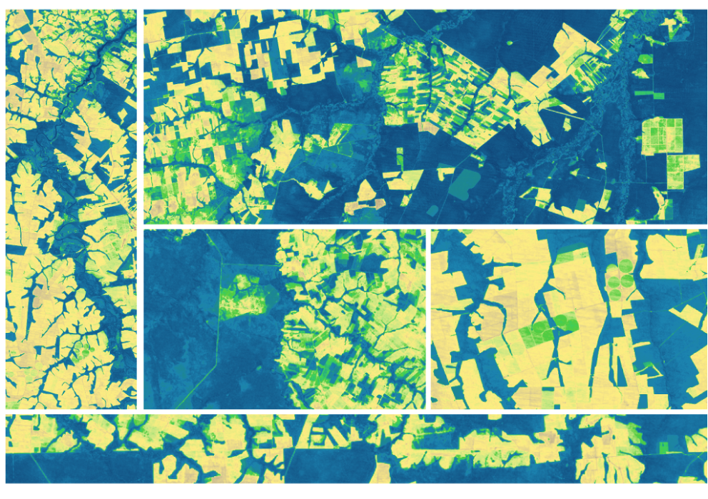
The research teams who help sustain the largest freshwater reserve in the world are developing a new tool to promote more resilient farming systems in Brazil. The goal is to help farmers better handle changes in the water cycle, deal with droughts, and adapt to a changing climate.

Read More »

“Within Australia, Earth Observation is so commonly used across all levels of government, industry and society that the minimum economic impact of Earth Observation from space-borne sensors alone is approximately $5.3 billion each year [Australian $; ~4.15B US$].”


“It is undeniable that having access to long-term satellite data has allowed ecologists and environmental managers to increase their understanding of the natural world, to make predictions about how this world might transform and to design efficient mitigation and adaptation strategies in the face of global environmental change.”


“LANDFIRE is the only complete, nationally consistent collection of spatial resource datasets with an ecological foundation.”


“Satellite imagery can help us get the biggest bang for our buck by targeting conservation initiatives in a specific window of time at key locations. Landsat is the longest running Earth observation satellite system we have, and free access to this data enables researchers to look at the effects of seasonality, climate cycles, and long-term trends in land-use change.”


“Landsat is the gold standard calibration reference because the Landsat Program has committed to world-class radiometric and geometric calibration standards.”


“This project would not have been possible without the consistent, long-term coverage provided by Landsat. The > 30-year archive of Landsat TM, ETM+, and OLI imagery enabled us to track changes in mangrove range limits on decadal scales.”


“Having Landsat 9 in progress, and a long-term commitment to sustainable land imaging, is great for natural resource science and for data-driven industries such as precision agriculture and insurance.”


“It’s really by stepping back and looking at the Earth, observing these changes in their context from space, can we really understand what’s happening.”


“I’d go to meetings and people were just jumping up and down because they had discovered another use for the data.”


“We cannot do this project if the Landsat program doesn’t deliver this open data to the scientific community… We are benefiting from these long-term investments now.”


“Our ability to analyze decades of history through the Landsat data record provided a strong backbone to this work.”


“The long, consistent view of Earth from space provided by Landsat sparks advances in science, enables more efficient natural resources management, and promotes profitable applications of the data in commerce and industry. In step with the National Research Council and other objective reviews, the non-federal Landsat Advisory Group has found that the broad benefits of Landsat far outweigh the cost.”


“Having a carefully calibrated multi-satellite record allows us to ensure that we are recording changes to the Earth, and not simply changes in the instrument response. The more detailed observations from Landsat 8 and Landsat 9 allow these subtle changes to be teased out of the long-term record unambiguously.”


“Because of Landsat’s global purview and long history, it has become a reference point for all Earth observation work and is considered the gold standard of natural resource satellite imagery.”


“…Landsat and Copernicus, the best two examples of government satellite programs that have positively impacted global development as result of their free and open data policy.”


“Landsat 9 replaces the older Landsat 7 and represents a step up in terms of image quality and data volume. Having two state-of-the-art platforms in orbit means more frequent data with excellent image quality.”


“I would summarize Landsat 8’s science impacts in three ways: More data, better data, and improved, expanded applications.”


“We are now beginning to see that the combination of high performance computing, data storage facilities, data preparation techniques, and advanced systems can materially accelerate the value of Landsat data.”


“In a world of scarce resources, there are distinct tradeoffs in costs and benefits of land use, and whether to conserve or convert forest to cropland. Map-based images are perhaps one of the most succinct means of helping policymakers digest complex ideas of social and economically driven environmental change.”


“We hope to accelerate innovation in climate research, humanitarian relief, and disaster preparedness efforts around the world by making Landsat data readily available near our flexible computing resources.”


“The Landsat series of satellites is a cornerstone of our Earth observing capability. The world relies on Landsat data to detect and measure land cover/land use change, the health of ecosystems, and water availability.”


“As a researcher with a limited budget, using the Landsat data for free made this project possible. The global geographic range together with free availability ensures that our study could potentially be repeated in other countries.”


“Landsat enabled us to collect a multi-decadal record of the [river] reaches at almost annual resolution. By extending our record into the past we were able to examine how the reaches changed through time providing us with a truly invaluable dataset.”


Landsat 9 bw
Landsat 9 bw
Landsat 9 bw

The NASA/USGS Landsat Program provides the longest continuous space-based record of Earth’s land in existence. Landsat data give us information essential for making informed decisions about Earth’s resources and environment.