
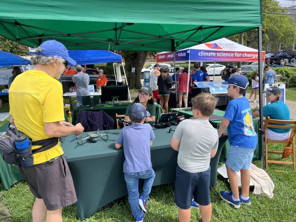
USGS Geographer and drone pilot Jen Cramer showing visitors USGS uncrewed aircraft system technology and talking about how drones are used to map short- and long-term changes in coastal environments.
Images
Woods Hole Coastal and Marine Science Center images
Filter Total Items: 1131

Woods Hole Science Stroll 2024
USGS Geographer and drone pilot Jen Cramer showing visitors USGS uncrewed aircraft system technology and talking about how drones are used to map short- and long-term changes in coastal environments.

Woods Hole Science Stroll 2024
USGS Geographer Jen Cramer showing off our uncrewed aircraft system technology at the Woods Hole Science Stroll.
USGS Geographer Jen Cramer showing off our uncrewed aircraft system technology at the Woods Hole Science Stroll.

Woods Hole Science Stroll 2024
USGS Geographer Jin-Si Over talking about drones and how they are used to map short- and long-term changes in coastal environments at the Woods Hole Science Stroll.
USGS Geographer Jin-Si Over talking about drones and how they are used to map short- and long-term changes in coastal environments at the Woods Hole Science Stroll.

Woods Hole Science Stroll 2024
USGS Oceanographer Zafer Defne discussing operational ocean and coastal dynamics forecasts at the Woods Hole Science Stroll.
USGS Oceanographer Zafer Defne discussing operational ocean and coastal dynamics forecasts at the Woods Hole Science Stroll.

Woods Hole Science Stroll 2024
USGS Geologist Marie Bartlett talking about foraminifera, tiny microfossils that live in marine environments, while a little girl looks at them through the microscope.
USGS Geologist Marie Bartlett talking about foraminifera, tiny microfossils that live in marine environments, while a little girl looks at them through the microscope.

Woods Hole Science Stroll 2024
A small drone on display at the USGS booth of the 2024 Woods Hole Science Stroll.
A small drone on display at the USGS booth of the 2024 Woods Hole Science Stroll.

Woods Hole Science Stroll 2024
USGS geographer Jin-Si Over at the 2024 Woods Hole Science Stroll, ready to discuss drones and how they are used to map short- and long-term changes in coastal environments.
USGS geographer Jin-Si Over at the 2024 Woods Hole Science Stroll, ready to discuss drones and how they are used to map short- and long-term changes in coastal environments.

Woods Hole Science Stroll 2024
USGS Geographer Jin-Si Over at the 2024 Woods Hole Science Stroll holding one of our drones.
USGS Geographer Jin-Si Over at the 2024 Woods Hole Science Stroll holding one of our drones.

Woods Hole Science Stroll 2024
USGS Geologist Marie Bartlett at the 2024 Woods Hole Science Stroll, ready for visitors to look at foraminifera, microfossils that live in marine environments, through our microscope.
USGS Geologist Marie Bartlett at the 2024 Woods Hole Science Stroll, ready for visitors to look at foraminifera, microfossils that live in marine environments, through our microscope.

Woods Hole Science Stroll 2024
Microscope station at the USGS booth of the Woods Hole Science Stroll, looking at foraminifera, microfossils that live in marine environments.
Microscope station at the USGS booth of the Woods Hole Science Stroll, looking at foraminifera, microfossils that live in marine environments.
Woods Hole Science Stroll 2024
USGS Geographer Jin-Si Over talking about drones and how they are used to map short- and long-term changes in coastal environments at the Woods Hole Science Stroll.
USGS Geographer Jin-Si Over talking about drones and how they are used to map short- and long-term changes in coastal environments at the Woods Hole Science Stroll.

Woods Hole Science Stroll 2024
USGS Oceanographer Zafer Defne discussing operational ocean and coastal dynamics forecasts at the Woods Hole Science Stroll.
USGS Oceanographer Zafer Defne discussing operational ocean and coastal dynamics forecasts at the Woods Hole Science Stroll.

Woods Hole Science Stroll 2024
The Woods Hole Diversity Advisory Committee booth at the 2024 Woods Hole Science Stroll.
The Woods Hole Diversity Advisory Committee booth at the 2024 Woods Hole Science Stroll.

Puerto Rico beach
Scenic photo of Domes Beach in Rincon, Puerto Rico. Photo credit: Emily Himmelstoss.
Scenic photo of Domes Beach in Rincon, Puerto Rico. Photo credit: Emily Himmelstoss.

U.S. Coastal Wetland Synthesis Applications Webpage Image
The USGS is assessing the physical condition of coastal wetlands and their response to external forces, using field observations and remote-sensing data. The U.S.
The USGS is assessing the physical condition of coastal wetlands and their response to external forces, using field observations and remote-sensing data. The U.S.

Distinguished Service Award - Carolyn Ruppel
Distinguished Service Award for USGS Research Geophysicist Carolyn Ruppel, presented on May 8, 2024.
Distinguished Service Award for USGS Research Geophysicist Carolyn Ruppel, presented on May 8, 2024.

Southeast Region Refuges
The Southeast Region Refuges tab of the U.S. Coastal Wetlands Synthesis Applications geonarrative. A FWS and USGS collaboration.
The Southeast Region Refuges tab of the U.S. Coastal Wetlands Synthesis Applications geonarrative. A FWS and USGS collaboration.

U.S. Coastal Wetland Synthesis Applications geonarrative
The U.S. Coastal Wetlands Synthesis Applications geonarrative. The U.S. Geological Survey (USGS) is assessing the physical condition of coastal wetlands and how they may change in response to storms, sea-level rise, and human activity.
The U.S. Coastal Wetlands Synthesis Applications geonarrative. The U.S. Geological Survey (USGS) is assessing the physical condition of coastal wetlands and how they may change in response to storms, sea-level rise, and human activity.

Ernest F. Hollings ACE Basin National Wildlife Refuge
Ernest F. Hollings ACE Basin National Wildlife Refuge in South Carolina shown in the pop-out of the U.S. Coastal Wetlands Synthesis Applications geonarrative.
Ernest F. Hollings ACE Basin National Wildlife Refuge in South Carolina shown in the pop-out of the U.S. Coastal Wetlands Synthesis Applications geonarrative.

Southeast Region Application
The Southeast Region Refuge tab of the U.S. Coastal Wetlands Synthesis Applications geonarrative, showing the application section. This is a FWS and USGS collaboration.
The Southeast Region Refuge tab of the U.S. Coastal Wetlands Synthesis Applications geonarrative, showing the application section. This is a FWS and USGS collaboration.