
Trainees in Remote Sensing class working to develop potential groundwater maps from multiple satellite data sources.
Images
Multimedia quality images
Filter Total Items: 60

Trainees in Remote Sensing class in Mombasa, Kenya
Trainees in Remote Sensing class working to develop potential groundwater maps from multiple satellite data sources.

Dry riverbed near Samburu in Kwale County, Kenya
Dry river beds like this one are common in arid and semi arid regions in Kenya in the dry seasons and highlight the need for access to groundwater.
Dry river beds like this one are common in arid and semi arid regions in Kenya in the dry seasons and highlight the need for access to groundwater.

Rural water distribution center in Kwale County, Kenya
Rural water distribution center near Maji Ya Chumvi in Kwale County, Kenya. Note water tank on roof.
Rural water distribution center near Maji Ya Chumvi in Kwale County, Kenya. Note water tank on roof.

USGS Director and the President of the Korea Institute of Geoscience and Mineral Resources (KIGAM)
linkDirector Applegate conversing with his Korean counterpart, President Kim from the Korea Institute of Geoscience and Mineral Resources (KIGAM).
USGS Director and the President of the Korea Institute of Geoscience and Mineral Resources (KIGAM)
linkDirector Applegate conversing with his Korean counterpart, President Kim from the Korea Institute of Geoscience and Mineral Resources (KIGAM).

The USGS Delegation visiting the APEC Climate Center in Busan, Korea
The USGS Delegation visiting the APEC Climate Center in Busan, Korea. Nine individuals from the USGS and APEC, including Dave Applegate and Bill Cunningham, stand in front of the modern APEC building.
The USGS Delegation visiting the APEC Climate Center in Busan, Korea. Nine individuals from the USGS and APEC, including Dave Applegate and Bill Cunningham, stand in front of the modern APEC building.

USGS booth at the International Geological Congress 2024
USGS scientist Christine DeVera at the USGS booth at the International Geological Congress 2024 held August 24-30 in Busan, Republic of Korea.
USGS scientist Christine DeVera at the USGS booth at the International Geological Congress 2024 held August 24-30 in Busan, Republic of Korea.
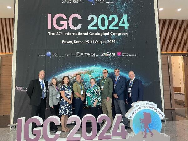
U.S. Delegates with the International Geological Congress 2024 banner and sign
Eight U.S. International Union of Geological Sciences (IUGS) Delegates (from the USGS, GSA, AGI, and academia) stand with the banner and sign at the International Geological Congress 2024 held August 24-30 in Busan, Republic of Korea.
Eight U.S. International Union of Geological Sciences (IUGS) Delegates (from the USGS, GSA, AGI, and academia) stand with the banner and sign at the International Geological Congress 2024 held August 24-30 in Busan, Republic of Korea.

The 2024 International Geologic Congress sign
The 2024 International Geologic Congress sign placed in front of a display skeleton of a long-necked dinosaur. The International Geological Congress 2024 was held August 24-30 in Busan, Republic of Korea.
The 2024 International Geologic Congress sign placed in front of a display skeleton of a long-necked dinosaur. The International Geological Congress 2024 was held August 24-30 in Busan, Republic of Korea.

Pacific Island Coral Reef and Fish
Coral reef fish assemblage in the Kealakekua Bay Marine Life Conservation District off the leeward side of Hawaiʻi Island, Hawaiʻi on 11 November 2016.
Coral reef fish assemblage in the Kealakekua Bay Marine Life Conservation District off the leeward side of Hawaiʻi Island, Hawaiʻi on 11 November 2016.

Matthew Andersen, USGS, and Sefanaia Nawadra, SPREP
Matthew Andersen, USGS, and the Director General of Secretariat for the Pacific Regional Environmental Programme (SPREP), Sefanaia Nawadra, at the 4th Pacific Ocean Pacific Climate Change Conference, sponsored by SPREP, the National University of Samoa, and Victoria University of Wellington, New Zealand, 20-24 May 2024.
Matthew Andersen, USGS, and the Director General of Secretariat for the Pacific Regional Environmental Programme (SPREP), Sefanaia Nawadra, at the 4th Pacific Ocean Pacific Climate Change Conference, sponsored by SPREP, the National University of Samoa, and Victoria University of Wellington, New Zealand, 20-24 May 2024.

USGS signs MOU with Dominican Republic Geological Survey
USGS and the National Geological Survey of the Dominican Republic signed a Memorandum of Understanding on March 12, 2024, in Reston, Virginia, for earth science cooperation.
USGS and the National Geological Survey of the Dominican Republic signed a Memorandum of Understanding on March 12, 2024, in Reston, Virginia, for earth science cooperation.

Caminos del Agua word cloud
A student chalkboard word cloud at the Caminos Del Agua Water Festival, Los Planes watershed, Baja California Sur, Mexico. (Víctor Sevilla Unda, Autonomous University of Baja California Sur)
A student chalkboard word cloud at the Caminos Del Agua Water Festival, Los Planes watershed, Baja California Sur, Mexico. (Víctor Sevilla Unda, Autonomous University of Baja California Sur)

Monitoring a shallow groundwater well in Los Planes watershed, Baja California Sur, Mexico
USGS and Alumbra Innovations scientists monitoring a shallow groundwater well in Los Planes watershed, Baja California Sur, Mexico. (Laura Norman, USGS)
USGS and Alumbra Innovations scientists monitoring a shallow groundwater well in Los Planes watershed, Baja California Sur, Mexico. (Laura Norman, USGS)

USGS scientists mapping vegetation and land use in Los Planes watershed, Baja California Sur, Mexico
linkUSGS scientists mapping vegetation and land use in Los Planes watershed, Baja California Sur, Mexico, as part of a joint project to understand the impacts of installing natural infrastructure in dryland streams (NIDS), structures made from rock, sandbags and wood, meant

Confluence of Rio Loco and Rio Coca near El Chaco, Ecuador Jan 2024
Erosion on the Rio Coca and its tributary, the Rio Loco (foreground), after a waterfall collapse, Ecuador. (Molly Wood, USGS)
Erosion on the Rio Coca and its tributary, the Rio Loco (foreground), after a waterfall collapse, Ecuador. (Molly Wood, USGS)

Rio Coca (Ecuador) near erosion front Jan 2024
Rio Coca, Ecuador, near current (January, 2024) location of the erosion front, which is migrating upstream toward the intake of the Coca Codo Sinclair hydropower facility. (Molly Wood, USGS)
Rio Coca, Ecuador, near current (January, 2024) location of the erosion front, which is migrating upstream toward the intake of the Coca Codo Sinclair hydropower facility. (Molly Wood, USGS)

Project group on bridge over the Río Coca near the Coca Codo Sinclair hydropower facility near Simón Bolivar, Ecuador Jan 2024
linkThe international, interagency team during a field site visit to the Río Coca, January 24, 2024. The team includes members from the Electric Corporation of Ecuador (CELEC), US Army Corps of Engineers, and USGS. (Pablo Espinoza, Electric Corp. Ecuador (CELEC))

Río Coca near El Chaco, Ecuador with new canyon since 2020 (Jan 2024)
Erosion on the Río Coca upstream of the former San Rafael waterfall site, Ecuador, showing a newly opened canyon that has formed since 2020. (Molly Wood, USGS)
Erosion on the Río Coca upstream of the former San Rafael waterfall site, Ecuador, showing a newly opened canyon that has formed since 2020. (Molly Wood, USGS)

Bridge over Río Marker near the confluence with Río Loco near El Chaco, Ecuador Jan 2024
Erosion in the Río Coca valley upstream of the former waterfall location, showing major damage to the roadway over the Río Marker, a tributary to the Río Loco, and temporary roadway access bridge. (Molly Wood, USGS)
Erosion in the Río Coca valley upstream of the former waterfall location, showing major damage to the roadway over the Río Marker, a tributary to the Río Loco, and temporary roadway access bridge. (Molly Wood, USGS)

Collapsed E45 road on western side of the Río Coca river corridor, Ecuador Jan 2024
Damage to the E45 road caused by valley-wall erosion following the 2020 failure of a lava dam, Rio Coca valley, Ecuador, January 2024. (Amy East, USGS)
Damage to the E45 road caused by valley-wall erosion following the 2020 failure of a lava dam, Rio Coca valley, Ecuador, January 2024. (Amy East, USGS)

Sediment deposits at the discharge outlet of a hydropower facility on the Rio Coca, Ecuador.
Sediment deposits at the discharge outlet of the Coca Codo Sinclair hydropower facility on the Rio Coca, Ecuador. (Molly Wood, USGS)
Sediment deposits at the discharge outlet of the Coca Codo Sinclair hydropower facility on the Rio Coca, Ecuador. (Molly Wood, USGS)