
Buttress Park
By Alaska Science Center
March 1964 (approx.)
Detailed Description
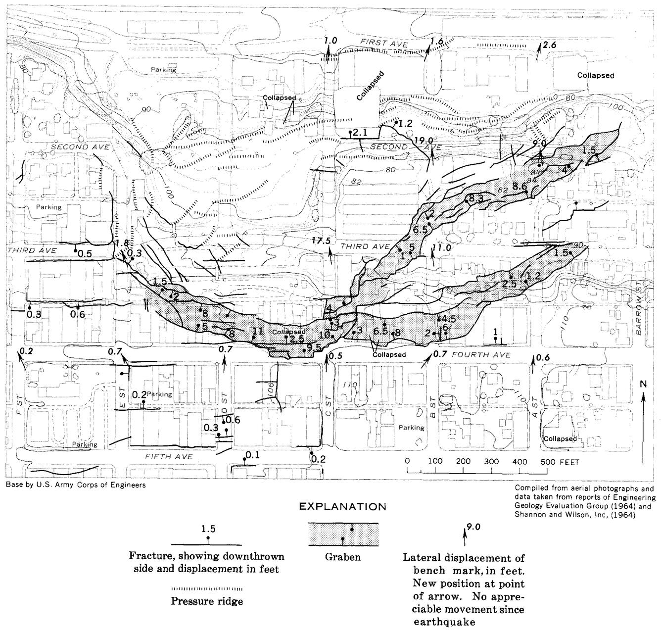
This map shows the extent of ground disrupted by the Fourth Avenue Slide and some of the measured displacements. Much of this area north of Third Avenue has since been re-graded and reinforced. The North-facing slope dropping into Ship Creek has been reinforced at its toe with a buried gravel buttress, giving the park its name.
Sources/Usage
Public Domain.
U.S. Geological Survey