
USGS Hydrologist Hilary Dozier (formerly Abraham) measuring stream discharge during sampling, to allow calculation of loads, in Fishing Creek, Logan Township, Clinton County, Pennsylvania, just below the Logan Mills Covered Bridge (John Clune, USGS).
Images
Explore our planet through photography and imagery, including climate change and water all the way back to the 1800s when the USGS was surveying the country by horse and buggy.
Filter Total Items: 21545

Hydrologist Hilary Dozier measuring flow in Fishing Creek, PA
USGS Hydrologist Hilary Dozier (formerly Abraham) measuring stream discharge during sampling, to allow calculation of loads, in Fishing Creek, Logan Township, Clinton County, Pennsylvania, just below the Logan Mills Covered Bridge (John Clune, USGS).

Mauna Loa caldera
HVO staff visited the summit of Mauna Loa on foot to repair the webcam on April 24. The weather was perfectly clear and views of the caldera floor showed nothing unusual.
HVO staff visited the summit of Mauna Loa on foot to repair the webcam on April 24. The weather was perfectly clear and views of the caldera floor showed nothing unusual.

Researchers deploying a corer in Lake Enriquillo.
Jessica Rodysill (Reston) and Hunter Wilcox (SPCMSC) deploying a corer in Lake Enriquillo. The scientists will use the cores to construct precipitation changes in Dominican Republic over the late Holocene (~5000 years ago to present) time period.
Jessica Rodysill (Reston) and Hunter Wilcox (SPCMSC) deploying a corer in Lake Enriquillo. The scientists will use the cores to construct precipitation changes in Dominican Republic over the late Holocene (~5000 years ago to present) time period.

USGS - GLSC Trawl net workshop
GLSC trawl net workshop held at the USGS vessel base in Cheboygan, Michigan, April 24-25, 2019. The USGS research vessel Sturgeon pictured in background.
GLSC trawl net workshop held at the USGS vessel base in Cheboygan, Michigan, April 24-25, 2019. The USGS research vessel Sturgeon pictured in background.

Adjusting a camera during an aerial photographic survey
Biological Technician, Laura (Laney) White adjusts the camera mount during a survey.
The Seabird Studies Team at the USGS Western Ecological Research Center is conducting aerial photographic surveys of the ocean off central and southern California to create comprehensive maps of seabird and marine mammal distributions.

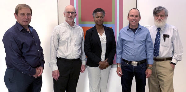
Astronaut Field Training in Flagstaff
USGS Field Test Support Unit (left to right) Dick Wiser, John Hendricks, Bill Tinnin and Putty Mills with the Explorer, a lunar rover vehicle simulator at Cinder Lake Crater Field east of Flagstaff, December 1968.
USGS Field Test Support Unit (left to right) Dick Wiser, John Hendricks, Bill Tinnin and Putty Mills with the Explorer, a lunar rover vehicle simulator at Cinder Lake Crater Field east of Flagstaff, December 1968.

Northern Right Whale Dolphins viewed from an airplane
Two Northern Right Whale Dolphins (Lissodelphis borealis), one below the water and another cresting the surface captured during a test flight in March 2019. This image was zoomed in to show the lack of a dorsal fin, a definitive trait in this species.
Two Northern Right Whale Dolphins (Lissodelphis borealis), one below the water and another cresting the surface captured during a test flight in March 2019. This image was zoomed in to show the lack of a dorsal fin, a definitive trait in this species.

Pod of dolphins captured during aerial photographic survey
Full size image of a pod of dolphins captured during an aerial photographic survey Fall 2018.
The Seabird Studies Team at the USGS Western Ecological Research Center is conducting aerial photographic surveys of the ocean off central and southern California to create comprehensive maps of seabird and marine mammal distributions.
Recipients of the 2019 Wings Across the Americas Conservation Award
Recipients of the Wings Across the Americas 2019 International Research Partnership Conservation Award representing the Migratory Dragonfly Partnership included Ralph Grundel, GLSC, second from left, and Leslie Weldon, Deputy Chief of the National Forest System, middle.
Recipients of the Wings Across the Americas 2019 International Research Partnership Conservation Award representing the Migratory Dragonfly Partnership included Ralph Grundel, GLSC, second from left, and Leslie Weldon, Deputy Chief of the National Forest System, middle.

Sea Walls of Japan
An earthquake and tsunami in March of 2011 leveled cities and left 18,000 people dead along the east coast of Japan.
The government responded with a plan to build hundreds of sea walls in hopes of protecting coastal communities from future disasters.
An earthquake and tsunami in March of 2011 leveled cities and left 18,000 people dead along the east coast of Japan.
The government responded with a plan to build hundreds of sea walls in hopes of protecting coastal communities from future disasters.

View of the ocean from above during an aerial photographic survey
Camera set-up and pyrometer collecting sea surface temperature measurements during a survey Fall 2018.
The Seabird Studies Team at the USGS Western Ecological Research Center is conducting aerial photographic surveys of the ocean off central and southern California to create comprehensive maps of seabird and marine mammal distributions.

Micronesian mangrove forest with high elevation and generalist species
Mangrove forest in Pohnpei, Micronesia, with Bruguiera gymnorrhiza (sohmw) and Xylocarpus gymnorrhiza (pwulok).
The USGS and partners are studying how mangrove forests in the Federated States of Micronesia may respond to sea-level rise over the coming century. Their projections will help Micronesian communities plan for the future.

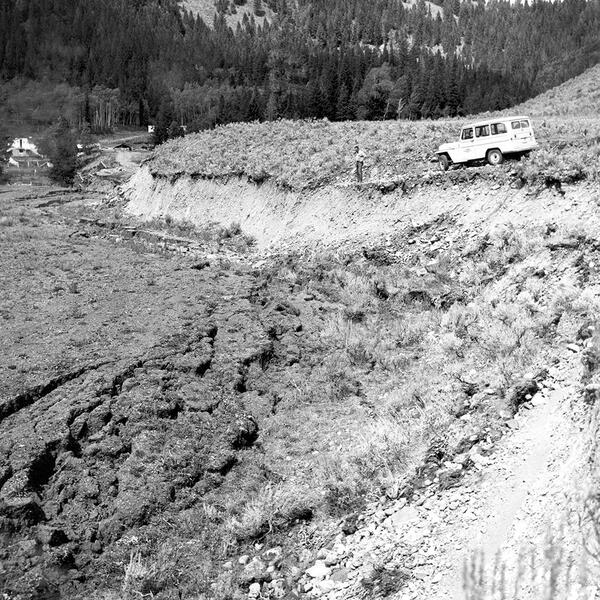
Rockslide damage to the Golden Gate area near Mammoth Hot Springs, Yellowstone N
Rockslide damage to the Golden Gate area near Mammoth Hot Springs, Yellowstone National Park, as a result of the 1959 Hebgen Lake earthquake.
Rockslide damage to the Golden Gate area near Mammoth Hot Springs, Yellowstone National Park, as a result of the 1959 Hebgen Lake earthquake.

Seismic geyser in eruption in 1970.
Seismic geyser in eruption in 1970. Photo by John Brandow.
Seismic geyser in eruption in 1970. Photo by John Brandow.
Hebgen Lake fault scarp in 1959
Hebgen Lake fault scarp in 1959. USGS photo by J. R. Stacy.
Hebgen Lake fault scarp in 1959. USGS photo by J. R. Stacy.

Angie Crain - OKI 2019 Cooperator Meeting
Angie Crain - OKI 2019 Cooperator Meeting. Angie gave a presentation on Super Gages/Mobile Super Gages: What's coming into Kentucky and what's leaving it - and new ways to answer that question.
Angie Crain - OKI 2019 Cooperator Meeting. Angie gave a presentation on Super Gages/Mobile Super Gages: What's coming into Kentucky and what's leaving it - and new ways to answer that question.

Angie Crain - OKI 2019 Cooperator Meeting
Angie Crain - OKI 2019 Cooperator Meeting
Angie Crain - OKI 2019 Cooperator Meeting

Angie Crain - Super Gages/Mobile Super Gages
Angie Crain - Super Gages/Mobile Super Gages. Angie gave a presentation on super gages at the OKI 2109 Cooperator meeting. She also gave a hnads-on demonstration regarding how to measure/sample water quality using the "clean hands/dirty hands" technique.
Angie Crain - Super Gages/Mobile Super Gages. Angie gave a presentation on super gages at the OKI 2109 Cooperator meeting. She also gave a hnads-on demonstration regarding how to measure/sample water quality using the "clean hands/dirty hands" technique.

Chris Kephart - OKI 2019 Cooperator Meeting
Chris Kephart - OKI 2019 Cooperator Meeting. Chris gave a
Chris Kephart - OKI 2019 Cooperator Meeting. Chris gave a

Chris Kephart - OKI 2019 Cooperator Meeting
Chris Kephart - OKI 2019 Cooperator Meeting. Chris gave a presentation titled "OKI Water Microbiology Laboratory: Capabilities and Current Studies".
Chris Kephart - OKI 2019 Cooperator Meeting. Chris gave a presentation titled "OKI Water Microbiology Laboratory: Capabilities and Current Studies".

Chris Kephart - OKI 2019 Cooperator Meeting
Chris Kephart - OKI 2019 Cooperator Meeting.
Chris Kephart - OKI 2019 Cooperator Meeting.