
USGS scientist Sarah Fitzgerald holds a surf scoter that has been fitted with a satellite tag that works by transmitting the location of the birds to satellites that are orbiting the Earth. (Jonathan Fiely, USGS)
Images
Explore our planet through photography and imagery, including climate change and water all the way back to the 1800s when the USGS was surveying the country by horse and buggy.
Filter Total Items: 21545
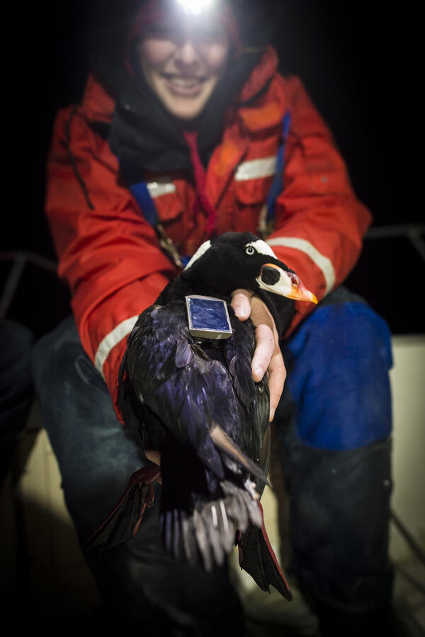
USGS scientist holds a surf scoter that has been tagged.
USGS scientist Sarah Fitzgerald holds a surf scoter that has been fitted with a satellite tag that works by transmitting the location of the birds to satellites that are orbiting the Earth. (Jonathan Fiely, USGS)

USGS scientist measures water, sediment movement in coastal salt marsh
USGS scientist Zafer Defne measures water and sediment movement at Forsythe National Wildlife Refuge, New Jersey. Defne is co-author with Neil Ganju of a 2017 study on how to estimate coastal salt marshes’ potential longevity, based on their sediment budgets and the ratio of open water to vegetation.
USGS scientist Zafer Defne measures water and sediment movement at Forsythe National Wildlife Refuge, New Jersey. Defne is co-author with Neil Ganju of a 2017 study on how to estimate coastal salt marshes’ potential longevity, based on their sediment budgets and the ratio of open water to vegetation.

USGS Streamgaging on the Pit River operates year round.
USGS Streamgaging equipment and cableway on the Pit River near Canby, California operates year round.
USGS Streamgaging equipment and cableway on the Pit River near Canby, California operates year round.

USGS Streamgaging Station in northern Nevada.
USGS Streamgaging Station in northern Nevada.
USGS Streamgaging Station in northern Nevada.

USGS StreamStats: Hydrologic and Geospatial Data
USGS StreamStats: Hydrologic and Geospatial Data Integrated to Support Water Science and Management
USGS StreamStats: Hydrologic and Geospatial Data Integrated to Support Water Science and Management

Video camera atop a hotel in Madeira Beach, Florida
Video camera atop a hotel in Madeira Beach, Florida.
Video camera atop a hotel in Madeira Beach, Florida.

video-camera station
Gerry Hatcher (left) and Shawn Harrison work on their video-camera station atop a hotel in Santa Cruz, California.
Gerry Hatcher (left) and Shawn Harrison work on their video-camera station atop a hotel in Santa Cruz, California.

Views of Cowells Beach in Santa Cruz, California, from a video
Views of Cowells Beach in Santa Cruz, California, from a 10-minute video shot on May 6, 2017. Snapshot (first frame in video) on left; time-averaged image on right.
Views of Cowells Beach in Santa Cruz, California, from a 10-minute video shot on May 6, 2017. Snapshot (first frame in video) on left; time-averaged image on right.

Virginia Multi Parameter Sonde Relay Station
Virginia Multi Parameter Sonde Relay Station
Virginia Multi Parameter Sonde Relay Station

WARC staff member displays a baby alligator at World Wetlands Day
A special guest made an appearance at the 20th annual Louisiana Environmental Education Symposium where staff from the USGS Wetland and Aquatic Research Center's Coastal Wetlands Planning, Protection and Restoration Act (CWPPRA) outreach office shared materials and information with teachers.
A special guest made an appearance at the 20th annual Louisiana Environmental Education Symposium where staff from the USGS Wetland and Aquatic Research Center's Coastal Wetlands Planning, Protection and Restoration Act (CWPPRA) outreach office shared materials and information with teachers.

WERC Song Meter for Ashy Storm-petrel Surveys
Photo of a passive acoustic monitor or "song meter." Scientists use these tools to study the distribution of seabirds without causing damage to sensitive habitat or disturbing the animals.
Photo of a passive acoustic monitor or "song meter." Scientists use these tools to study the distribution of seabirds without causing damage to sensitive habitat or disturbing the animals.

Wolf Creek site map modified from Figure 1
Wolf Creek site map modified from Figure 1 of 'Organic geochemistry and toxicology of a stream impacted by unconventional oil and gas wastewater disposal operations, Orem and Others, 2017'.
Wolf Creek site map modified from Figure 1 of 'Organic geochemistry and toxicology of a stream impacted by unconventional oil and gas wastewater disposal operations, Orem and Others, 2017'.

Woods Hole Science Center hosts Woods Hole Science School students
Michael Casso, Woods Hole Coastal and Marine Science Center physical scientist, seeks volunteers from Children’s School of Science students to have their breath measured for carbon dioxide and methane, greenhouse gases USGS scientists measure in the oceans
Michael Casso, Woods Hole Coastal and Marine Science Center physical scientist, seeks volunteers from Children’s School of Science students to have their breath measured for carbon dioxide and methane, greenhouse gases USGS scientists measure in the oceans

Black River at Elyria, OH - bridge view
Black River at Elyria, OH - bridge view
Black River at Elyria, OH - bridge view

Black River at Elyria, OH - control on the river
Black River at Elyria, OH - adcp measurement on snow covered river
Black River at Elyria, OH - adcp measurement on snow covered river

Black River at Elyria, OH - wading measurement
Black River at Elyria, OH - wading measurement
Black River at Elyria, OH - wading measurement

Black River at Elyria, OH - wading measurement
Black River at Elyria, OH - wading measurement
Black River at Elyria, OH - wading measurement

Scenic View from Vermilion River, Vermilion, Ohio
Scenic view from Vermilion River, near Vermilion, OH
Scenic view from Vermilion River, near Vermilion, OH

Vermillion River near Vermillion OH - frozen waterfall
Vermillion River near Vermillion OH - frozen waterfall
Vermillion River near Vermillion OH - frozen waterfall

Vermillion River near Vermillion OH - left bank view
Vermillion River near Vermillion OH - left bank view
Vermillion River near Vermillion OH - left bank view

Vermillion River near Vermillion OH - right bank view
Vermillion River near Vermillion OH - right bank view
Vermillion River near Vermillion OH - right bank view