
USGS Scientist sampling soil gasses from a grassy hilltop soil on Santa Rosa Island, Channel Islands National Park, California. The composition of soil gasses is indicative of the number and variety of microorganisms in the soil and what type of material they are digesting.
Images
Explore our planet through photography and imagery, including climate change and water all the way back to the 1800s when the USGS was surveying the country by horse and buggy.
Filter Total Items: 21545

Sampling soil carbon dioxide on Santa Rosa Island
USGS Scientist sampling soil gasses from a grassy hilltop soil on Santa Rosa Island, Channel Islands National Park, California. The composition of soil gasses is indicative of the number and variety of microorganisms in the soil and what type of material they are digesting.

Shannon Waters Lifting Chinook Salmon
USGS biological science technician Shannon Waters lifts a Chinook salmon out of a fish wheel in the Yukon River, AK.
USGS biological science technician Shannon Waters lifts a Chinook salmon out of a fish wheel in the Yukon River, AK.

Shoreline trap in Lookout Point Reservoir, OR
Shoreline traps in Lookout Point Reservoir, Oregon.
Shoreline traps in Lookout Point Reservoir, Oregon.

Upright petrified tree in Yellowstone National Park
Upright petrified tree in Yellowstone National Park.
Upright petrified tree in Yellowstone National Park.
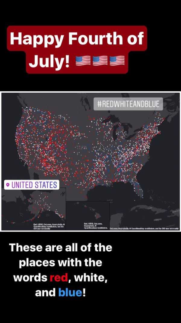
USGS Instagram Story: Happy Fourth of July
The image from the USGS Instagram Story (@USGS) showing places within the U.S. that contain the words red, white, and blue.
The image from the USGS Instagram Story (@USGS) showing places within the U.S. that contain the words red, white, and blue.

A Common Murre holding a juvenile Pacific Herring at its colony
A Common Murre holding a juvenile Pacific Herring at its colony on Gull Island, Cook Inlet on July 3, 2017.
A Common Murre holding a juvenile Pacific Herring at its colony on Gull Island, Cook Inlet on July 3, 2017.

Juvenile Chinook salmon
Juvenile Chinook salmon on the Middle Fork Willamette River, Oregon.
Juvenile Chinook salmon on the Middle Fork Willamette River, Oregon.

Male Wilson's Warbler in a shrub on the Seward Peninsula, Alaska
Male Wilson's Warbler. This photo was taken on the Seward Peninsula as part of the Changing Arctic Ecosystem Boreal-Arctic Transition Zone program.
Male Wilson's Warbler. This photo was taken on the Seward Peninsula as part of the Changing Arctic Ecosystem Boreal-Arctic Transition Zone program.

Streamer depth control device, or bird
The Geospace Navigator bird is a streamer depth control device, used with a high-resolution seismic system to regulate and record the depth of the streamer.
The Geospace Navigator bird is a streamer depth control device, used with a high-resolution seismic system to regulate and record the depth of the streamer.

Eagle Nest Dam overlooking the Cimarron River
Hydrologic technician Chris Peskuski snapped this picture from Eagle Nest Dam overlooking the Cimarron River where streamflow measurements are made to measure outflow from the dam. Eagle Nest Dam sits at 8,300 feet elevation and is surrounded by two of the highest peaks in New Mexico; Wheeler Peak and Baldy Mountain.
Hydrologic technician Chris Peskuski snapped this picture from Eagle Nest Dam overlooking the Cimarron River where streamflow measurements are made to measure outflow from the dam. Eagle Nest Dam sits at 8,300 feet elevation and is surrounded by two of the highest peaks in New Mexico; Wheeler Peak and Baldy Mountain.

A compass on the peak of Hawksbill Mountain, Shenandoah National Park
A compass on the peak of Hawksbill Mountain, Shenandoah National Park, Virginia.
A compass on the peak of Hawksbill Mountain, Shenandoah National Park, Virginia.

Batagaika Crater and the Megaslump
An increasingly large gash has opened up in northern Russia's Siberian tundra. During the past few decades, warmer summers and shorter winters have caused permafrost in this region to thaw, which then allows the warmed soils on slopes to slump and erode.
An increasingly large gash has opened up in northern Russia's Siberian tundra. During the past few decades, warmer summers and shorter winters have caused permafrost in this region to thaw, which then allows the warmed soils on slopes to slump and erode.

Changing vegetation in the Delta 2016-2017
Chart showing changes in vegetation density in the Mississippi River delta in Louisiana, May 2015-May 2016. From a USGS Open File Report published in July 2017 by co-authors Elijah Ramsey III and Amina Rangoonwala,
Chart showing changes in vegetation density in the Mississippi River delta in Louisiana, May 2015-May 2016. From a USGS Open File Report published in July 2017 by co-authors Elijah Ramsey III and Amina Rangoonwala,

Reseach vessel Ocean Starr
Research vessel Ocean Starr in Alaska.
Research vessel Ocean Starr in Alaska.

Seismic survey of the Queen Charlotte Fault
USGS scientists deploy a seismic streamer aboard the R/V David Starr offshore of southeast Alaska to study the Queen Charlotte Fault.
USGS scientists deploy a seismic streamer aboard the R/V David Starr offshore of southeast Alaska to study the Queen Charlotte Fault.

Setting up experimental restoration plots.
Field crew install a Restoration Field Trial Network garden in the rangelands of Northern Arizona.
Field crew install a Restoration Field Trial Network garden in the rangelands of Northern Arizona.

Shannon Waters Releases Chinook Salmon, Alaska
USGS biological science technician Shannon Waters releases a Chinook Salmon into an Alaskan river.
USGS biological science technician Shannon Waters releases a Chinook Salmon into an Alaskan river.

Shawn Meyer flying a Unmanned Aircraft System
Photograph of USGS Hydrologic technician, Shawn Meyer, preparing the UAS for a flight,
Photograph of USGS Hydrologic technician, Shawn Meyer, preparing the UAS for a flight,

WERC Coastal Ecosystem Studies
Coastal ecosystem studies at Trinidad coast, California.
Coastal ecosystem studies at Trinidad coast, California.