
A USGS grizzly bear researcher snapped this picture of a mother grizzly bear and her cub in Yellowstone National Park. Recent research shows that fffspring of grizzly bear mothers with a history of human-bear conflicts are more likely to be involved in human-bear conflicts than offspring of mothers without a history of human-bear conflicts.
Images
Explore our planet through photography and imagery, including climate change and water all the way back to the 1800s when the USGS was surveying the country by horse and buggy.
Filter Total Items: 21545

A mother grizzly bear and her cub in Yellowstone National Park.
A USGS grizzly bear researcher snapped this picture of a mother grizzly bear and her cub in Yellowstone National Park. Recent research shows that fffspring of grizzly bear mothers with a history of human-bear conflicts are more likely to be involved in human-bear conflicts than offspring of mothers without a history of human-bear conflicts.

A scientist hikes up to a glacier in Glacier National Park.
A scientist hikes up to a glacier in Glacier National Park.
A scientist hikes up to a glacier in Glacier National Park.

A Scientist Working in a Laboratory Measuring Pharmaceuticals in Water
A PhD fellow from the University of York measuring pharmaceutical concentrations in samples collected from the Rivers Foss and Ouse, United Kingdom, during her work at the U.S. Geological Survey (USGS) National Water Quality Laboratory.
A PhD fellow from the University of York measuring pharmaceutical concentrations in samples collected from the Rivers Foss and Ouse, United Kingdom, during her work at the U.S. Geological Survey (USGS) National Water Quality Laboratory.

A time-averaged image from Duck, North Carolina, on September 1, 2015
The relatively new camera stations at Santa Cruz and Madeira Beach have not yet imaged many rip channels, so this is an example from the U.S. Army Corps of Engineers Field Research Facility in Duck, North Carolina. In this time-averaged image from video taken September 1, 2015, the dark horizontal bands perpendicular to the beach indicate rip channels.
The relatively new camera stations at Santa Cruz and Madeira Beach have not yet imaged many rip channels, so this is an example from the U.S. Army Corps of Engineers Field Research Facility in Duck, North Carolina. In this time-averaged image from video taken September 1, 2015, the dark horizontal bands perpendicular to the beach indicate rip channels.

Aerial images of the wilderness breach
Aerial images of the wilderness breach: a) Aerial photograph taken several days after Hurricane Sandy (photo credit: NOAA); b) Aerial mosaic of the breach in June 2015 showing the location of erosion on the ocean side of the breach and deposition that results in the seasonal formation of a spit (photo credit: Stonybrook University).
Aerial images of the wilderness breach: a) Aerial photograph taken several days after Hurricane Sandy (photo credit: NOAA); b) Aerial mosaic of the breach in June 2015 showing the location of erosion on the ocean side of the breach and deposition that results in the seasonal formation of a spit (photo credit: Stonybrook University).

Aerial photographs of Bear Inlet, North Carolina
Near vertical (top, middle) and low angle oblique (bottom) aerial photographs of Bear Inlet, North Carolina. View looking northwest along the North Carolina shore. High waves and storm surge from Hurricane Joaquin eroded the beaches, moving sand inland (green arrow) and reshaping the flood-tidal shoals.
Near vertical (top, middle) and low angle oblique (bottom) aerial photographs of Bear Inlet, North Carolina. View looking northwest along the North Carolina shore. High waves and storm surge from Hurricane Joaquin eroded the beaches, moving sand inland (green arrow) and reshaping the flood-tidal shoals.

Aerial photographs of Camp Lejeune, North Carolina
Near vertical (top, middle) and low angle oblique (bottom) aerial photographs of Camp Lejeune, North Carolina. View looking northwest along the North Carolina shore. Waves and surge from Hurricane Joaquin eroded the beach, causing significant shoreline retreat and a narrower beach.
Near vertical (top, middle) and low angle oblique (bottom) aerial photographs of Camp Lejeune, North Carolina. View looking northwest along the North Carolina shore. Waves and surge from Hurricane Joaquin eroded the beach, causing significant shoreline retreat and a narrower beach.

Aerial photographs of Hatteras, North Carolina
Near vertical (top, middle) and low angle oblique (bottom) aerial photographs of Hatteras, North Carolina. View looking north along the North Carolina shore. Waves and surge from Hurricane Joaquin eroded the beach, causing significant shoreline retreat and a narrower beach at the location of the Hurricane Isabel breach in 2003 (green arrow).
Near vertical (top, middle) and low angle oblique (bottom) aerial photographs of Hatteras, North Carolina. View looking north along the North Carolina shore. Waves and surge from Hurricane Joaquin eroded the beach, causing significant shoreline retreat and a narrower beach at the location of the Hurricane Isabel breach in 2003 (green arrow).

Aerial photographs of New Drum Inlet, Core Banks, North Carolina
Near vertical (top, middle) and low angle oblique (bottom) aerial photographs of New Drum Inlet, Core Banks, North Carolina. View looking northwest along the North Carolina shore.
Near vertical (top, middle) and low angle oblique (bottom) aerial photographs of New Drum Inlet, Core Banks, North Carolina. View looking northwest along the North Carolina shore.

Aerial photographs of Oregon Inlet, North Carolina
Near vertical (top, middle) and low angle oblique (bottom) aerial photographs of Oregon Inlet, North Carolina. View looking west along the North Carolina shore. High waves and storm surge from Hurricane Joaquin eroded the beach and inundated the low area in the backshore at Oregon Inlet (A, green box, blue arrows).
Near vertical (top, middle) and low angle oblique (bottom) aerial photographs of Oregon Inlet, North Carolina. View looking west along the North Carolina shore. High waves and storm surge from Hurricane Joaquin eroded the beach and inundated the low area in the backshore at Oregon Inlet (A, green box, blue arrows).

Aerial photographs of Rodanthe, North Carolina
Near vertical (top, middle) and low angle oblique (bottom) aerial photographs of Rodanthe, North Carolina. View looking west along the North Carolina shore. High waves and storm surge from Hurricane Joaquin eroded the beach, exposing the pilings of the homes to wave attack (green and orange arrows).
Near vertical (top, middle) and low angle oblique (bottom) aerial photographs of Rodanthe, North Carolina. View looking west along the North Carolina shore. High waves and storm surge from Hurricane Joaquin eroded the beach, exposing the pilings of the homes to wave attack (green and orange arrows).

Aerial photographs of Salvo, North Carolina
Near vertical (top, middle) and low angle oblique (bottom) aerial photographs of Salvo, North Carolina. View looking west along the North Carolina shore. Waves and surge from Hurricane Joaquin eroded the beach, causing significant shoreline retreat and a narrower beach, leaving deposits of darker sand at the base of the dune (green arrow).
Near vertical (top, middle) and low angle oblique (bottom) aerial photographs of Salvo, North Carolina. View looking west along the North Carolina shore. Waves and surge from Hurricane Joaquin eroded the beach, causing significant shoreline retreat and a narrower beach, leaving deposits of darker sand at the base of the dune (green arrow).

Aerial photographs of Topsail, North Carolina
Near vertical (top, middle) and low angle oblique (bottom) aerial photographs of Topsail, North Carolina. View looking northwest along the North Carolina shore. Elevated storm-induced water levels overtopped the low dunes here causing the dune to overwash. Sand was transported landward, burying the marsh (green arrow).
Near vertical (top, middle) and low angle oblique (bottom) aerial photographs of Topsail, North Carolina. View looking northwest along the North Carolina shore. Elevated storm-induced water levels overtopped the low dunes here causing the dune to overwash. Sand was transported landward, burying the marsh (green arrow).
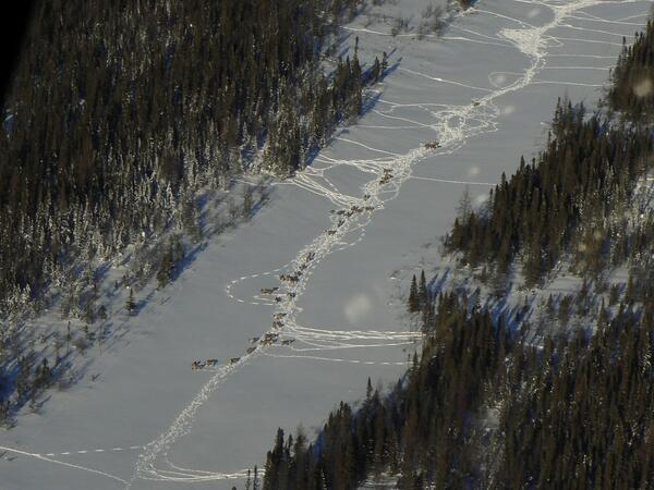
Aerial view of caribou in northern Ontario, Canada
Aerial view of caribou in northern Ontario, Canada.
Aerial view of caribou in northern Ontario, Canada.

Aerial view of the Williston Basin
Aerial view of the Williston Basin
Aerial view of the Williston Basin

Airborne Electromagnetic Data Collection Over an Agricultural Field
Airborne electromagnetic data collection over an agricultural field near Sioux Falls, SD. The bird is suspended from a helicopter as it transmits and receives electromagnetic signals to the ground, which are used to interpret characteristics of the aquifer.
Airborne electromagnetic data collection over an agricultural field near Sioux Falls, SD. The bird is suspended from a helicopter as it transmits and receives electromagnetic signals to the ground, which are used to interpret characteristics of the aquifer.

Barred Owl
Barred owls like this one were most strongly associated with patches of large hardwood and conifer trees in relatively flat areas along streams.
Barred owls like this one were most strongly associated with patches of large hardwood and conifer trees in relatively flat areas along streams.

Black bear cub in Great Smoky Mountains National Park, Tennessee, USA
Thompson holding a back bear cub in Great Smoky Mountains National Park, Tennessee, USA.
Thompson holding a back bear cub in Great Smoky Mountains National Park, Tennessee, USA.

Calcrete near Sulfur Springs Draw
A calcrete outcropping near Sulfur Springs Draw in Texas. This deposit dates to the Pliocene and Pleistocene, and hosts uranium-vanadate minerals.
A calcrete outcropping near Sulfur Springs Draw in Texas. This deposit dates to the Pliocene and Pleistocene, and hosts uranium-vanadate minerals.

Calyptogena spp. in Alaska
These clams (Calyptogena spp.) were discovered in about 1000 meter-deep waters off the southern tip of Alaska near a 250-meter-high cone rising from the seafloor and 10 kilometers from the Queen Charlotte-Fairweather fault.
These clams (Calyptogena spp.) were discovered in about 1000 meter-deep waters off the southern tip of Alaska near a 250-meter-high cone rising from the seafloor and 10 kilometers from the Queen Charlotte-Fairweather fault.

Caribou in northern Ontario, Canada
Caribou in northern Ontario, Canada.
Caribou in northern Ontario, Canada.