Massachusetts student intern Michael Upton placing a new survey reference marker at a live recording groundwater well station.
Videos
The USGS is a science organization that provides impartial information on the health of our ecosystems and environment, the natural hazards that threaten us, the natural resources we rely on, the impacts of climate and land-use change, and the core science systems that help us provide timely, relevant, and useable information.
Massachusetts student intern Michael Upton placing a new survey reference marker at a live recording groundwater well station.
 Time-lapse video of bluff erosion on Barter Island, Alaska
Recorded June 1, 2019 - August 18, 2019: Video shows a series of photos taken every hour during daylight hours in the summer of 2019. The camera looks westward along the coastal bluffs of Barter Island, located on Alaska’s North Slope.
Recorded June 1, 2019 - August 18, 2019: Video shows a series of photos taken every hour during daylight hours in the summer of 2019. The camera looks westward along the coastal bluffs of Barter Island, located on Alaska’s North Slope.
This video shows a close-up of the water pond at the bottom of Halema‘uma‘u on August 13, 2019. Steaming from the water surface shows the shifting winds over the pond.
This video shows a close-up of the water pond at the bottom of Halema‘uma‘u on August 13, 2019. Steaming from the water surface shows the shifting winds over the pond.
 Surveying Contracted-Opening Indirect Measurements
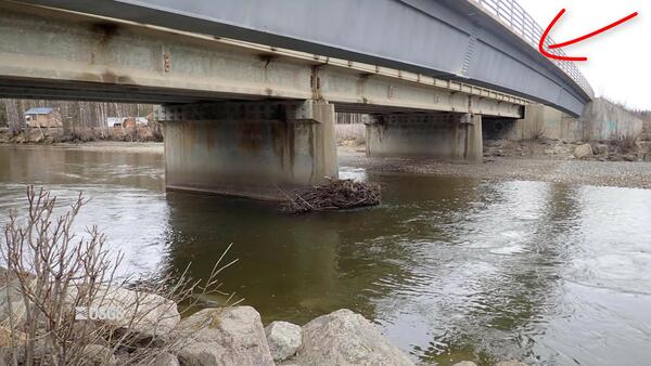
This video goes into detail about surveying high-water marks, various aspects of bridges, and cross sections for the contracted-opening method.
This video goes into detail about surveying high-water marks, various aspects of bridges, and cross sections for the contracted-opening method.
This video shows a close-up of the ponded water at the bottom of Halema'uma'u. Yesterday, the separate ponds joined into a single elongate pond. The water level has continued to slowly rise.
This video shows a close-up of the ponded water at the bottom of Halema'uma'u. Yesterday, the separate ponds joined into a single elongate pond. The water level has continued to slowly rise.
Iceland had 269 named glaciers as of the year 2000 but ice has retreated in the face of warming temperatures. By 2014, OK Glacier in western Iceland had lost so much mass that it was no longer considered one at all. Icelanders now refer to it simply as OK, the name of the volcano upon which it rests.
Iceland had 269 named glaciers as of the year 2000 but ice has retreated in the face of warming temperatures. By 2014, OK Glacier in western Iceland had lost so much mass that it was no longer considered one at all. Icelanders now refer to it simply as OK, the name of the volcano upon which it rests.
This video shows a close-up of the ponded water at the bottom of Halema‘uma‘u. USGS video by M. Patrick, 08-09-2019.
This video shows a close-up of the ponded water at the bottom of Halema‘uma‘u. USGS video by M. Patrick, 08-09-2019.
 More imagery from August 4 field observations of Halema‘uma‘u
This video shows steaming from the main pond of water at the bottom of Halema‘uma‘u as captured on Sunday, August 4. Two smaller areas of ponded water were present a short distance east of this spot. Thermal images indicate that the water surface is roughly 70 degrees Celsius (158 degrees Fahrenheit). USGS video by M. Patrick, 08-04-2019.
This video shows steaming from the main pond of water at the bottom of Halema‘uma‘u as captured on Sunday, August 4. Two smaller areas of ponded water were present a short distance east of this spot. Thermal images indicate that the water surface is roughly 70 degrees Celsius (158 degrees Fahrenheit). USGS video by M. Patrick, 08-04-2019.
Mule deer are an important part of the Western landscape and are coveted among big-game hunters throughout the country. These animals draw outdoor enthusiasts to states, such as Wyoming, where nearly 800,000 people hunted, fished, and viewed wildlife, and contributed $1.1 billion to the state’s economy.
Mule deer are an important part of the Western landscape and are coveted among big-game hunters throughout the country. These animals draw outdoor enthusiasts to states, such as Wyoming, where nearly 800,000 people hunted, fished, and viewed wildlife, and contributed $1.1 billion to the state’s economy.
This video shows steaming from the main pond of water at the bottom of Halema‘uma‘u as captured on Sunday, August 4. Two smaller areas of ponded water were present a short distance east of this spot. Thermal images indicate that the water surface is roughly 70 degrees Celsius (158 degrees Fahrenheit). USGS video by M. Patrick, 08-04-2019.
This video shows steaming from the main pond of water at the bottom of Halema‘uma‘u as captured on Sunday, August 4. Two smaller areas of ponded water were present a short distance east of this spot. Thermal images indicate that the water surface is roughly 70 degrees Celsius (158 degrees Fahrenheit). USGS video by M. Patrick, 08-04-2019.
This video discusses the general requirements that will be needed to accomplish a contracted-opening indirect discharge measurement. Approach section, contracted section, and necessary high-water mark locations are described along with scenarios where the method will not be successful.
This video discusses the general requirements that will be needed to accomplish a contracted-opening indirect discharge measurement. Approach section, contracted section, and necessary high-water mark locations are described along with scenarios where the method will not be successful.
Satellite imagery shows the rupture and shifting of land near Ridgecrest, CA from the July 2019 earthquakes.
Satellite imagery shows the rupture and shifting of land near Ridgecrest, CA from the July 2019 earthquakes.
 Yellowstone Volcano Observatory Monthly Update: August 1, 2019
Mike Poland, Scientist-in-Charge of the Yellowstone Volcano Observatory, describes activity at Yellowstone during the month of July 2019.
Mike Poland, Scientist-in-Charge of the Yellowstone Volcano Observatory, describes activity at Yellowstone during the month of July 2019.
 Plotting High-Water Marks in the Field Using SAC-GUI
This video describes how to use SAC-GUI in the field to plot high-water mark profiles. Plotting high-water marks in the field is required for most indirect measurement techniques
This video describes how to use SAC-GUI in the field to plot high-water mark profiles. Plotting high-water marks in the field is required for most indirect measurement techniques
This video describes the field selection of roughness coefficients, or Manning's "n" values. Both the comparative (photos) and analytical (Cowan's) methods are discussed.
This video describes the field selection of roughness coefficients, or Manning's "n" values. Both the comparative (photos) and analytical (Cowan's) methods are discussed.
 Surveying High-Water Marks and Cross-Sections for Indirects
This video describes how to survey high-water marks and cross-sections for indirect measurements. Included are tips and tricks for getting across non-wadeable sections of the stream.
This video describes how to survey high-water marks and cross-sections for indirect measurements. Included are tips and tricks for getting across non-wadeable sections of the stream.
This video goes into detail about where to flag high-water marks and how to survey a slope-area measurement. A simple one-setup Total Station survey is demonstrated.
This video goes into detail about where to flag high-water marks and how to survey a slope-area measurement. A simple one-setup Total Station survey is demonstrated.
This video covers the theory behind a slope-area indirect measurement, the most common type of indirect measurement used in the USGS.
This video covers the theory behind a slope-area indirect measurement, the most common type of indirect measurement used in the USGS.
 Climate Projections as a Way to Illustrate Future Possibilities
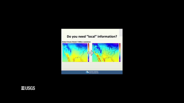
This video is a recording of the webinar “Climate Projections as a Way to Illustrate Future Possibilities" that is part of the USGS National Climate Adaptation Science Center (NCASC), in partnership with the National Conservation Training Center (NCTC), 2019 webinar series.
This video is a recording of the webinar “Climate Projections as a Way to Illustrate Future Possibilities" that is part of the USGS National Climate Adaptation Science Center (NCASC), in partnership with the National Conservation Training Center (NCTC), 2019 webinar series.
Title: Taking the Pulse of our Planet: A 10-year status report from the USA National Phenology Network
Title: Taking the Pulse of our Planet: A 10-year status report from the USA National Phenology Network
 Navy Base Commander Commends USGS Work Following Earthquake Sequence
US Navy Captain Paul Dale discusses the collaborative efforts between the USGS and Naval Air Weapons Station, China Lake after the Ridgecrest earthquake sequence.
US Navy Captain Paul Dale discusses the collaborative efforts between the USGS and Naval Air Weapons Station, China Lake after the Ridgecrest earthquake sequence.


