
Flower in Big Meadows, Virginia.
Images
Images intro.
Filter Total Items: 385

Flower in Big Meadows, Virginia.
Flower in Big Meadows, Virginia.

USGS scientist collecting a water sample from Boulder Creek, Colorado.
A USGS scientist collecting a water-quality sample from Boulder Creek, Colorado.
A USGS scientist collecting a water-quality sample from Boulder Creek, Colorado.

USGS Analyst Performs DNA Extractions in a Laboratory
A U.S. Geological Survey analyst performs DNA extractions on enriched cultures of water from the study area. Once the DNA was extracted it was used to detect pathogen gene markers using polymerase chain reaction (PCR).
A U.S. Geological Survey analyst performs DNA extractions on enriched cultures of water from the study area. Once the DNA was extracted it was used to detect pathogen gene markers using polymerase chain reaction (PCR).

Scientist Collecting a Water-Quality sample from the Zumbro River
USGS Scientist collecting a water-quality sample from the South Fork Zumbro River, MN
USGS Scientist collecting a water-quality sample from the South Fork Zumbro River, MN

USGS scientists recording information on water-quality samples
USGS scientists recording information on water-quality samples and field water-quality parameters
USGS scientists recording information on water-quality samples and field water-quality parameters

Bacteria contained in filter chambers
Microbial-Contaminant Interactions Laboratory — Boulder, Colorado. Bacteria contained in filter chambers placed in downgradient observation wells were exposed to sulfamethoxazole for 30 days as it traveled past the wells.
Microbial-Contaminant Interactions Laboratory — Boulder, Colorado. Bacteria contained in filter chambers placed in downgradient observation wells were exposed to sulfamethoxazole for 30 days as it traveled past the wells.

Bacteria contained in filter chambers
Bacteria contained in filter chambers placed in downgradient observation wells were exposed to sulfamethoxazole for 30 days as it traveled past the wells
Bacteria contained in filter chambers placed in downgradient observation wells were exposed to sulfamethoxazole for 30 days as it traveled past the wells

Field work in a stream impacted by acid mine drainage
USGS scientist pauses during field work in a stream impacted by acidic runoff and metal contamination. Iron precipitates are visible on the stream's rocks. The mesh pyramid is an insect emergence trap.
USGS scientist pauses during field work in a stream impacted by acidic runoff and metal contamination. Iron precipitates are visible on the stream's rocks. The mesh pyramid is an insect emergence trap.

USGS scientists samples the East Fork of the Upper Arkansas River
USGS Scientists study the effects of trace metal contamination on diets of stream fish. Vegetation surrounding this relatively pristine stream is dominated by deciduous willow, which are inhabited by riparian spiders that consume adult aquatic insects emerging from the stream. Regionally, streams are impacted by acid mine drainage and natural mineralization.
USGS Scientists study the effects of trace metal contamination on diets of stream fish. Vegetation surrounding this relatively pristine stream is dominated by deciduous willow, which are inhabited by riparian spiders that consume adult aquatic insects emerging from the stream. Regionally, streams are impacted by acid mine drainage and natural mineralization.

USGS Scientist Standing in a Metal Contaminated Stream
U.S. Geological Survey (USGS) scientist pauses during field work in a stream impacted by acidic runoff and metal contamination. Iron precipitates are visible on the stream's rocks. The mesh pyramid is an insect emergence trap. A riparian zone rich in terrestrial insects can provide an alternate food source for fish in metal-impacted watersheds.
U.S. Geological Survey (USGS) scientist pauses during field work in a stream impacted by acidic runoff and metal contamination. Iron precipitates are visible on the stream's rocks. The mesh pyramid is an insect emergence trap. A riparian zone rich in terrestrial insects can provide an alternate food source for fish in metal-impacted watersheds.

Game camera image of an osprey taken on Poplar Island, Maryland
Game camera image of an osprey taken on Poplar Island, Maryland. Game cameras were used to identify species of fish fed to osprey nestlings. The image was taken during a U.S.
Game camera image of an osprey taken on Poplar Island, Maryland. Game cameras were used to identify species of fish fed to osprey nestlings. The image was taken during a U.S.

The USGS Environmental Health Science Strategy Addresses Relationships
The USGS Environmental Health Science Strategy addresses the relationship among environmental drivers, exposure to disease agents (contaminants and pathogens), and the complex responses to contaminant and pathogen exposure that result in environmental disease in wildlife, domesticated animals, and people.
The USGS Environmental Health Science Strategy addresses the relationship among environmental drivers, exposure to disease agents (contaminants and pathogens), and the complex responses to contaminant and pathogen exposure that result in environmental disease in wildlife, domesticated animals, and people.

A scientist collects a groundwater sample with a syringe
A scientist collects a groundwater sample to analyze for arsenic and other chemicals from a well installed in a wetland at the National Crude Oil Spill Fate and Natural Attenuation Research Site, near Bemidji, Minnesota.
A scientist collects a groundwater sample to analyze for arsenic and other chemicals from a well installed in a wetland at the National Crude Oil Spill Fate and Natural Attenuation Research Site, near Bemidji, Minnesota.
Video recording setup from a swimming behavior assay system
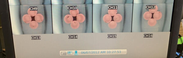
Behavioral Toxicology Laboratory — Columbia, Missouri. Screen shot of a computer monitor from a video recording setup from a swimming behavior experimental swimming behavior assay system. U.S. Geological Survey (USGS) scientists can record swimming activity of multiple treatments simultaneously in the swimming behavior assay.
Behavioral Toxicology Laboratory — Columbia, Missouri. Screen shot of a computer monitor from a video recording setup from a swimming behavior experimental swimming behavior assay system. U.S. Geological Survey (USGS) scientists can record swimming activity of multiple treatments simultaneously in the swimming behavior assay.

U.S. Geological Survey scientists prepare a tracer solution
U.S. Geological Survey (USGS) scientists prepare a tracer solution to conduct a natural gradient tracer test to measure anammox activity in groundwater. The tracer solution is prepared by pumping groundwater into a gas impermeable bladder to maintain the in situ dissolved oxygen concentration and then mixing in the tracer chemicals.
U.S. Geological Survey (USGS) scientists prepare a tracer solution to conduct a natural gradient tracer test to measure anammox activity in groundwater. The tracer solution is prepared by pumping groundwater into a gas impermeable bladder to maintain the in situ dissolved oxygen concentration and then mixing in the tracer chemicals.

Dead Bat Shows Points of Fluorescence When Exposed to UV Light
Wing from dead eastern pipestrelle (Pipistrellus subflavus) bat shows points of orange-yellow fluorescence when exposed to UVlight. From Turner and others, 2014, Figure 1E, page 569.
Wing from dead eastern pipestrelle (Pipistrellus subflavus) bat shows points of orange-yellow fluorescence when exposed to UVlight. From Turner and others, 2014, Figure 1E, page 569.

Dr. Carol U. Meteyer examining a bat
Dr. Carol U. Meteyer examining a bat. Dr. Carol U. Meteyer and Dr. David S.
Dr. Carol U. Meteyer examining a bat. Dr. Carol U. Meteyer and Dr. David S.

USGS Scientists Conducting Chemical Analyses in an On-site Mobile Lab
USGS scientists conducting chemical analyses on site and in an on-site mobile laboratory in order to identify important degradation products from the natural attenuation of landfill leachate in the aquifer.
USGS scientists conducting chemical analyses on site and in an on-site mobile laboratory in order to identify important degradation products from the natural attenuation of landfill leachate in the aquifer.

Aerial Spraying of Fungicides on Row Crops in Iowa
Aerial spraying of fungicides on row crops in Iowa. A soybean field is in the foreground, and a cornfield is in the background. The soybean crop is the target of the aerial application. Fungicides are used to combat soybean rust, a fungal disease.
Aerial spraying of fungicides on row crops in Iowa. A soybean field is in the foreground, and a cornfield is in the background. The soybean crop is the target of the aerial application. Fungicides are used to combat soybean rust, a fungal disease.

Diagram of the Nitrogen Cycle
This diagram of the nitrogen cycle shows were in the cycle antibiotics could impact the ability of denitrifying bacteria to process nitrates and nitrites in groundwater. The diagram is a modified version of figure 9 from USGS SIR 2004-5144, page 16.
This diagram of the nitrogen cycle shows were in the cycle antibiotics could impact the ability of denitrifying bacteria to process nitrates and nitrites in groundwater. The diagram is a modified version of figure 9 from USGS SIR 2004-5144, page 16.

USGS Scientists Sampling Groundwater Downgradient of Septic Systems
USGS Hydrologists Tristen Tagliaferri and Irene Fisher sampling shallow groundwater downgradient of septic systems in Kismet, NY (Fire Island), December 2011.
USGS Hydrologists Tristen Tagliaferri and Irene Fisher sampling shallow groundwater downgradient of septic systems in Kismet, NY (Fire Island), December 2011.