
Marine Geology
Exploring
Research
Analysis
Mapping
A well-developed understanding of the geological framework within the marine environment is foundational for expanding our knowledge about hazards, minerals and living resources in the ocean. Because the ocean covers the majority of the Earth’s surface, improved marine geologic knowledge broadens our understanding of geologic features and characteristics on land.
Geology is the study of the Earth. This includes how the Earth was formed, how the Earth has changed since it was formed, the materials that make up the Earth, and the processes that act on it. While marine geology focuses on areas affected by our oceans including the deep ocean floor, the shallower slopes and shelves that surround the continents, and coastal areas like beaches and estuaries, geology is a continuum that links these processes to those seen on land. USGS studies and links land-based geologic knowledge to marine geology, which includes studying the geology in coastal, riverine and lake areas.
Coastal and marine geology expertise contributes to the greater USGS mission of providing impartial information on the health of our ecosystems and environment, the natural hazards that threaten us, the natural resources we rely on, the impacts of climate and land-use change, and the core science systems that help us provide timely, relevant, and usable information.
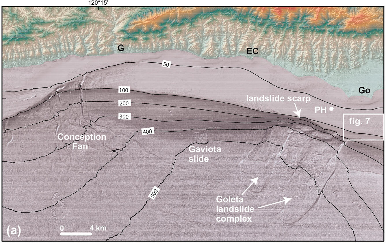
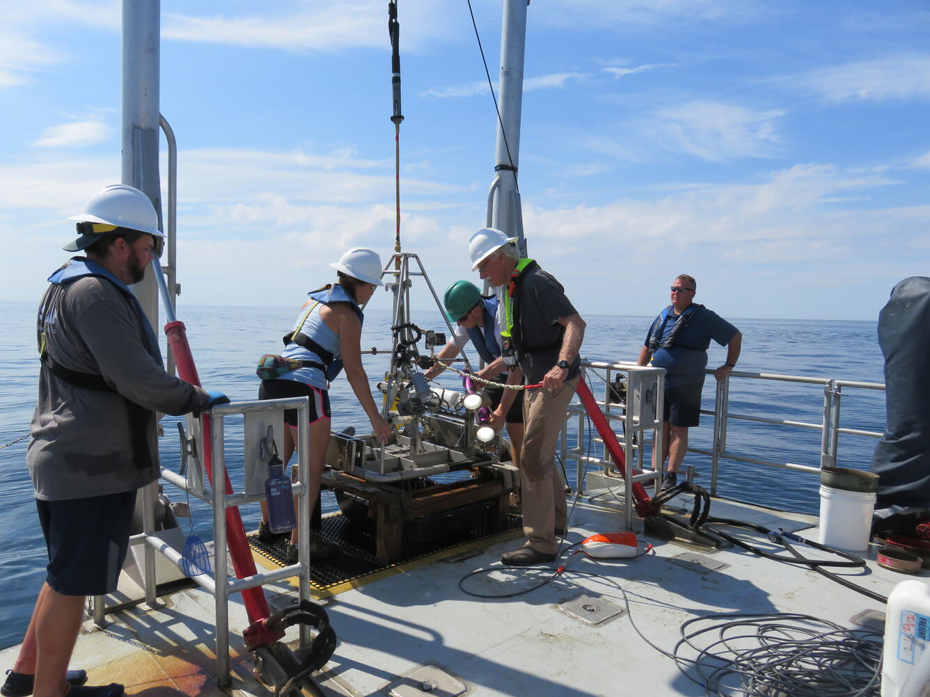
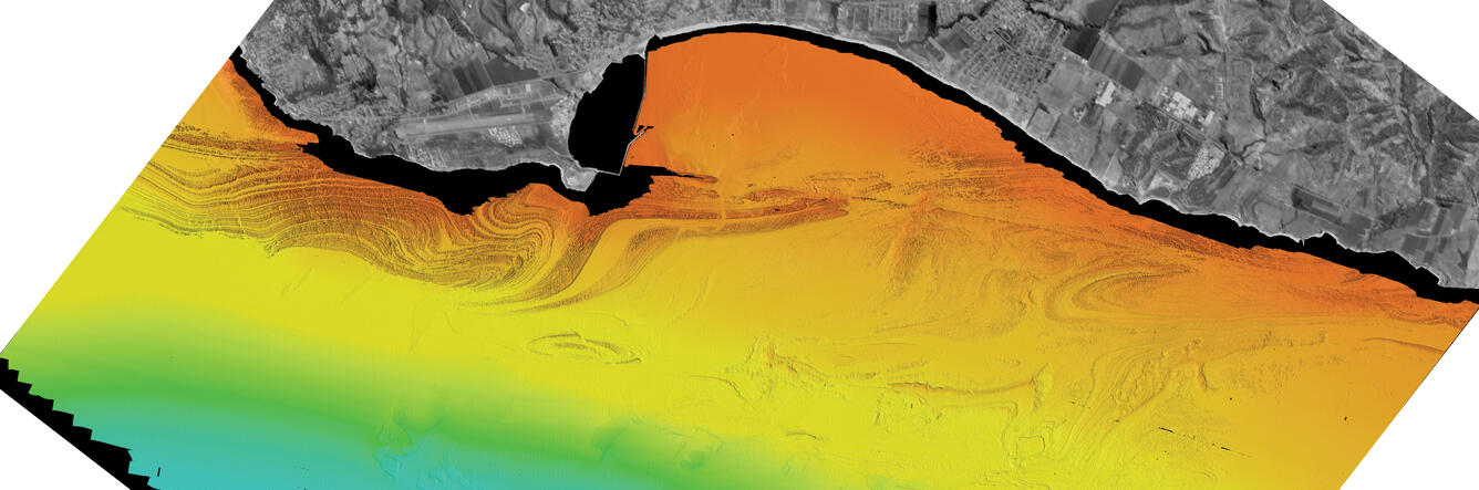
The USGS marine geology and geophysics team maps seafloor morphology and images the shallow sub-seafloor structure of the canyons, plateaus, and other components of the deep-sea landscape to better understand the processes that form and shape these features. Sampling sediment and rocks allows scientists to ground truth geophysical and visual observations, while providing valuable information about the composition and age of these underwater geologic environments.


Science

USGS Law of the Sea

Cascadia Subduction Zone Marine Geohazards

Marine Geomorphology, Evolution, and Habitats

California Seafloor Mapping Program

Seafloor Faults off Southern California
Sediment transport in submarine canyons

EXPRESS: Expanding Pacific Research and Exploration of Submerged Systems

Stellwagen Bank National Marine Sanctuary Geologic Mapping

Geologic Mapping of the Massachusetts Seafloor

Hurricane Sandy Response- Linking the Delmarva Peninsula's Geologic Framework to Coastal Vulnerability

Geological Investigations of the Neogene

What are tsunamis?

What is the difference between a tsunami and a tidal wave?

Where can I get current sea-surface temperature data?

How is the Landsat 8 and Landsat 9 Coastal/Aerosol Band 1 used?

Why is the ocean salty?

Why are coral reefs in peril and what is being done to protect them?
A well-developed understanding of the geological framework within the marine environment is foundational for expanding our knowledge about hazards, minerals and living resources in the ocean. Because the ocean covers the majority of the Earth’s surface, improved marine geologic knowledge broadens our understanding of geologic features and characteristics on land.
Geology is the study of the Earth. This includes how the Earth was formed, how the Earth has changed since it was formed, the materials that make up the Earth, and the processes that act on it. While marine geology focuses on areas affected by our oceans including the deep ocean floor, the shallower slopes and shelves that surround the continents, and coastal areas like beaches and estuaries, geology is a continuum that links these processes to those seen on land. USGS studies and links land-based geologic knowledge to marine geology, which includes studying the geology in coastal, riverine and lake areas.
Coastal and marine geology expertise contributes to the greater USGS mission of providing impartial information on the health of our ecosystems and environment, the natural hazards that threaten us, the natural resources we rely on, the impacts of climate and land-use change, and the core science systems that help us provide timely, relevant, and usable information.
The USGS marine geology and geophysics team maps seafloor morphology and images the shallow sub-seafloor structure of the canyons, plateaus, and other components of the deep-sea landscape to better understand the processes that form and shape these features. Sampling sediment and rocks allows scientists to ground truth geophysical and visual observations, while providing valuable information about the composition and age of these underwater geologic environments.