
A close up of the cone that formed in the June 2023 eruption, at the southwest end of Halema‘uma‘u crater, at the summit of Kīlauea. Lava from the vent poured into a ponded region, which later drained as the eruption waned. USGS photo by M. Patrick.
Multimedia
Images

May 10, 2024 — Features from the June 2023 eruption at the summit of Kīlauea
A close up of the cone that formed in the June 2023 eruption, at the southwest end of Halema‘uma‘u crater, at the summit of Kīlauea. Lava from the vent poured into a ponded region, which later drained as the eruption waned. USGS photo by M. Patrick.

May 8, 2024 — Kīlauea gravity survey
An HVO scientist takes gravity measurements at a benchmark near a crater in Hawaiʻi Volcanoes National Park. The gravimeter is the small, shoebox-sized instrument, which can measure a change in the force of gravity to one-in-one billionth of the force you feel every day. USGS photo by A. Ellis.
An HVO scientist takes gravity measurements at a benchmark near a crater in Hawaiʻi Volcanoes National Park. The gravimeter is the small, shoebox-sized instrument, which can measure a change in the force of gravity to one-in-one billionth of the force you feel every day. USGS photo by A. Ellis.

May 5, 2024—InSAR image of deformation during Kīlauea upper East Rift Zone swarm
This map shows recent deformation at Kīlauea from April 19 to May 5, 2024, as recorded by the Italian Space Agency's (AGI) Cosmo-SkyMED satellite. Colored fringes denote areas of ground deformation, with more fringes indicating more deformation. Each color cycle represents 1.5 cm (0.6 in) of ground motion indicative of inflation as the magma reservoi
This map shows recent deformation at Kīlauea from April 19 to May 5, 2024, as recorded by the Italian Space Agency's (AGI) Cosmo-SkyMED satellite. Colored fringes denote areas of ground deformation, with more fringes indicating more deformation. Each color cycle represents 1.5 cm (0.6 in) of ground motion indicative of inflation as the magma reservoi

May 2, 2024—Summary map of recent unrest at Kīlauea volcano
This map depicts recent unrest at Kīlauea. Yellow circles mark the locations of approximately 1,600 earthquakes that have occurred between April 27 and May 2, 2024. Most earthquakes have been smaller than magnitude-2, with locations clustering in an area known as the upper East Rift Zone or East Rift connector.
This map depicts recent unrest at Kīlauea. Yellow circles mark the locations of approximately 1,600 earthquakes that have occurred between April 27 and May 2, 2024. Most earthquakes have been smaller than magnitude-2, with locations clustering in an area known as the upper East Rift Zone or East Rift connector.

May 1, 2024 — Maintenance on Kīlauea summit livestream camera
Despite a significant increase in small earthquakes at the summit and upper East Rift Zone in recent days, activity at the surface was quiet On May 1, 2024. This photo shows the floor of Halema‘uma‘u, at the summit of Kīlauea, which last erupted in September 2023.
Despite a significant increase in small earthquakes at the summit and upper East Rift Zone in recent days, activity at the surface was quiet On May 1, 2024. This photo shows the floor of Halema‘uma‘u, at the summit of Kīlauea, which last erupted in September 2023.

May 1, 2024 — Maintenance on Kīlauea summit livestream camera
This photo shows the southwest portion of Kaluapele (Kīlauea's summit caldera). In the lower right corner of the image is the cone formed during the June 2023 eruption. This cone hosted impressive lava fountaining that supplied lava through a narrow channel into the lava pond in the lower left portion of the image. USGS photo by M. Patrick.
This photo shows the southwest portion of Kaluapele (Kīlauea's summit caldera). In the lower right corner of the image is the cone formed during the June 2023 eruption. This cone hosted impressive lava fountaining that supplied lava through a narrow channel into the lava pond in the lower left portion of the image. USGS photo by M. Patrick.
Videos

100 years ago at Kīlauea: The 1924 explosive eruption described by Thomas Jaggar
This two-minute video summarizes the 1924 explosive eruption at the summit of Kīlauea, which occurred 100 years ago this year. The video is narrated by Thomas Jaggar, who founded the Hawaiian Volcano Observatory in 1912. His description of the 1924 eruption was recorded in 1951 by Hawaiʻi Volcanoes National Park.
This two-minute video summarizes the 1924 explosive eruption at the summit of Kīlauea, which occurred 100 years ago this year. The video is narrated by Thomas Jaggar, who founded the Hawaiian Volcano Observatory in 1912. His description of the 1924 eruption was recorded in 1951 by Hawaiʻi Volcanoes National Park.

Kīlauea Collapse and Refilling – Changes Since 2018
This video summarizes changes to the summit Kīlauea volcano since the 2018 caldera collapse. In the year after the 2018 collapse, a water lake began to rise from the bottom. It evaporated during about 90 minutes when an eruption started in Halemaʻumaʻu crater on the night of December 20, 2020.
This video summarizes changes to the summit Kīlauea volcano since the 2018 caldera collapse. In the year after the 2018 collapse, a water lake began to rise from the bottom. It evaporated during about 90 minutes when an eruption started in Halemaʻumaʻu crater on the night of December 20, 2020.
")
Kīlauea earthquake activity (January 26-February 2, 2024)
This video shows earthquake activity recorded by the Hawaiian Volcano Observatory at Kīlauea summit, extending southwest, from January 26-February 2, 2024, in 12-hour snapshots.
This video shows earthquake activity recorded by the Hawaiian Volcano Observatory at Kīlauea summit, extending southwest, from January 26-February 2, 2024, in 12-hour snapshots.

PubTalk-11/2023: Six Eruptions at Two Volcanoes Over the Past Three Years
Six Eruptions at Two Volcanoes Over the Past Three Years
How the Hawaiian Volcano Observatory monitors some of Earth’s most active volcanoes
by Katie Mulliken, Geologist, Research Corporation of the University of Hawai‘i and USGS Hawaiian Volcano Observatory
Six Eruptions at Two Volcanoes Over the Past Three Years
How the Hawaiian Volcano Observatory monitors some of Earth’s most active volcanoes
by Katie Mulliken, Geologist, Research Corporation of the University of Hawai‘i and USGS Hawaiian Volcano Observatory

Kīlauea volcano - views of the September 2023 summit eruption
This is a video compilation of Kīlauea volcano's summit eruption in September 2023. The video shows clips of the eruptive vents and lava fountains as the eruption progressed from September 10-16, 2023.
This is a video compilation of Kīlauea volcano's summit eruption in September 2023. The video shows clips of the eruptive vents and lava fountains as the eruption progressed from September 10-16, 2023.

Kīlauea summit eruptive activity decreases — September 16, 2023
Eruptive activity was shutting down at Kīlauea summit on Saturday, September 16, with only weak spattering at one vent in the morning. By midday, the eruptive activity had effectively ended.
Eruptive activity was shutting down at Kīlauea summit on Saturday, September 16, with only weak spattering at one vent in the morning. By midday, the eruptive activity had effectively ended.
Audio

Lava lake activity from inside Halema`uma`u Crater
Sounds of lava lake activity within Kilauea Volcano's summit vent inside Halema`uma`u Crater on the afternoon of February 14, 2011. The continuous "crashing wave" noise is the sound of churning lava as gases are released from the lake surface, which is in nearly constant motion.
Sounds of lava lake activity within Kilauea Volcano's summit vent inside Halema`uma`u Crater on the afternoon of February 14, 2011. The continuous "crashing wave" noise is the sound of churning lava as gases are released from the lake surface, which is in nearly constant motion.

Dramatic Developments at Kilauea Volcano
Kilauea Volcano in Hawaii has experienced its first explosive eruption in more than 80 years and is now spewing noxious gas at 10 times the normal rate. John Eichelberger, head of the USGS Volcano Hazards Program, fills us in on the situation.
Kilauea Volcano in Hawaii has experienced its first explosive eruption in more than 80 years and is now spewing noxious gas at 10 times the normal rate. John Eichelberger, head of the USGS Volcano Hazards Program, fills us in on the situation.
Webcams

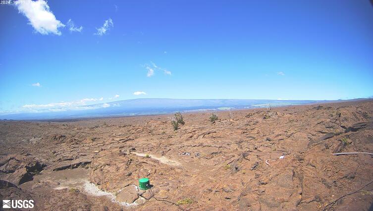
[KOcam] Live Image of upper East Rift Zone from Maunaulu
This image is from a temporary research camera positioned near Maunaulu, looking northwest toward the upper East Rift Zone of Kīlauea.
Disclaimer
This image is from a temporary research camera positioned near Maunaulu, looking northwest toward the upper East Rift Zone of Kīlauea.
Disclaimer
[MITDcam] Kīlauea upper Southwest Rift Zone
[MITDcam] Live view of Kīlauea's upper Southwest Rift Zone, looking northwest from a seismic station in the Kaʻū Desert.
[MITDcam] Live view of Kīlauea's upper Southwest Rift Zone, looking northwest from a seismic station in the Kaʻū Desert.

[B2cam] Halemaʻumaʻu crater from the east rim and down-dropped block
[B2cam] This image is from a research camera located on the down-dropped block in Kīlauea caldera and east rim of Halemaʻumaʻu crater within Hawaiʻi Volcanoes National Park. The camera is looking west towards Halemaʻumaʻu crater.
Disclaimer
[B2cam] This image is from a research camera located on the down-dropped block in Kīlauea caldera and east rim of Halemaʻumaʻu crater within Hawaiʻi Volcanoes National Park. The camera is looking west towards Halemaʻumaʻu crater.
Disclaimer
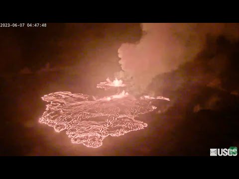
Kīlauea Volcano Live Stream - Halemaʻumaʻu crater
Live view of the eruption in Halemaʻumaʻu, from the northwest rim of the caldera, looking east [V1cam] on the USGS YouTube Channel.
- USGS Kīlauea Volcano
- USGS Hawaiian Volcano Observatory
- Kilauea webcams
Live view of the eruption in Halemaʻumaʻu, from the northwest rim of the caldera, looking east [V1cam] on the USGS YouTube Channel.
- USGS Kīlauea Volcano
- USGS Hawaiian Volcano Observatory
- Kilauea webcams

[V1] Kīlauea caldera views
Live view of Kīlauea caldera, from the northwest rim of the caldera [V1cam]. This camera is a pan-tilt-zoom model and the view may change depending on activity.
Disclaimer
Live view of Kīlauea caldera, from the northwest rim of the caldera [V1cam]. This camera is a pan-tilt-zoom model and the view may change depending on activity.
Disclaimer
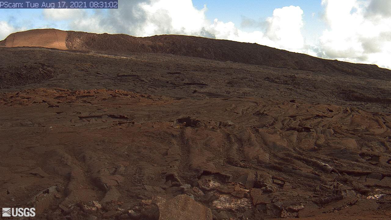
[PScam] Puʻu ʻŌʻō South Flank from the South Rim
This image is from a temporary research camera positioned just south of Puʻu ʻŌʻō, looking north at the southern flank of Puʻu ʻŌʻō's cone.
Disclaimer
This image is from a temporary research camera positioned just south of Puʻu ʻŌʻō, looking north at the southern flank of Puʻu ʻŌʻō's cone.
Disclaimer