
The two distinct clusters of earthquakes at Kīlauea during the four recent time periods of swarm activity. The event counts at the south caldera cluster increase while the counts at the upper East Rift Zone cluster diminish from the first to the fourth time periods.
Multimedia
Webcams—Near-real-time images from webcams.
Videos—Collection of videos recorded during field excursions or caught on our webcams.
Image Galleries—Galleries of images and events with expanded descriptions.
The Kīlauea Photo and Video Chronology and Mauna Loa Photo and Video Chronology webpages also feature photos.
Images

Clusters of earthquakes at Kīlauea during April, May, and June 2024
The two distinct clusters of earthquakes at Kīlauea during the four recent time periods of swarm activity. The event counts at the south caldera cluster increase while the counts at the upper East Rift Zone cluster diminish from the first to the fourth time periods.

June 6, 2024 — Kīlauea Southwest Rift Zone eruption
This reference map depicts the June 3, 2024, eruption along Kīlauea's Southwest Rift Zone. The lava flows are shown in pink, covering about 99 acres (40 hectares); this number represents a slight increase from that reported Monday, June 3, due to minor flow expansion in the hours following that morning's helicopter overflight.
This reference map depicts the June 3, 2024, eruption along Kīlauea's Southwest Rift Zone. The lava flows are shown in pink, covering about 99 acres (40 hectares); this number represents a slight increase from that reported Monday, June 3, due to minor flow expansion in the hours following that morning's helicopter overflight.

June 6, 2024 — Lava flows that formed during the recent Kīlauea Southwest Rift Zone eruption
During the Kīlauea Southwest Rift Zone eruption on June 3, fissures 3 and 4—located farther to the southwest than fissures 1 and 1— erupted the larger volumes of lava and continue to exhibit elevated gas emissions.
During the Kīlauea Southwest Rift Zone eruption on June 3, fissures 3 and 4—located farther to the southwest than fissures 1 and 1— erupted the larger volumes of lava and continue to exhibit elevated gas emissions.

June 6, 2024—InSAR image of deformation during Kīlauea Southwest Rift Zone eruption
This map shows recent deformation spanning the recent eruption at Kīlauea. It covers from May 28 to June 6, 2024, and is recorded by the Italian Space Agency's (ASI) Cosmo-SkyMED satellite. Colored fringes denote areas of ground deformation, with more fringes indicating more deformation. Each color cycle represents 1.5 cm (0.6 in) of ground mot
This map shows recent deformation spanning the recent eruption at Kīlauea. It covers from May 28 to June 6, 2024, and is recorded by the Italian Space Agency's (ASI) Cosmo-SkyMED satellite. Colored fringes denote areas of ground deformation, with more fringes indicating more deformation. Each color cycle represents 1.5 cm (0.6 in) of ground mot

June 6, 2024 — Cracks formed around recent Kīlauea eruption site
In addition to elevated volcanic gas emissions, other significant hazards also remain around the recent eruption site on the upper Southwest Rift Zone of Kīlauea.
In addition to elevated volcanic gas emissions, other significant hazards also remain around the recent eruption site on the upper Southwest Rift Zone of Kīlauea.

June 6, 2024 — Cracks formed around recent Kīlauea Southwest Rift Zone eruption fissures
During an overflight at approximately 8:15 a.m. HST on June 6, 2024, USGS Hawaiian Volcano Observatory scientists observed the extensive crack features on either side of the now inactive fissures from the June 3 Kīlauea Southwest Rift Zone eruption. Cracks range in length and are parallel to the fissure system. USGS photo by A.R. Nalesnik.
During an overflight at approximately 8:15 a.m. HST on June 6, 2024, USGS Hawaiian Volcano Observatory scientists observed the extensive crack features on either side of the now inactive fissures from the June 3 Kīlauea Southwest Rift Zone eruption. Cracks range in length and are parallel to the fissure system. USGS photo by A.R. Nalesnik.
Videos

Aerial video of the Southwest Rift Zone eruption of Kīlauea
Aerial video of the Southwest Rift Zone eruption of Kīlauea, viewed during an overflight at approximately 6 a.m. on June 3, 2024. USGS video.
Aerial video of the Southwest Rift Zone eruption of Kīlauea, viewed during an overflight at approximately 6 a.m. on June 3, 2024. USGS video.
")
Flyover of Southwest Rift Zone (June 3, 2024)
During an overflight at approximately 6 a.m., USGS Hawaiian Volcano Observatory geologists observed the fissures system that opened on the upper portion of the Southwest Rift Zone early this morning. Approximately half a mile (about 1 km) in length, only the southwest portion of the system was active by daylight.
During an overflight at approximately 6 a.m., USGS Hawaiian Volcano Observatory geologists observed the fissures system that opened on the upper portion of the Southwest Rift Zone early this morning. Approximately half a mile (about 1 km) in length, only the southwest portion of the system was active by daylight.

HVO geologists observe new fissure system
USGS Hawaiian Volcano Observatory geologists visited the fissure that formed on the upper Southwest Rift Zone of Kīlauea volcano early this morning, June 3, 2024. Elevated gas emissions are being carried downwind, in a southwest direction. USGS video.
USGS Hawaiian Volcano Observatory geologists visited the fissure that formed on the upper Southwest Rift Zone of Kīlauea volcano early this morning, June 3, 2024. Elevated gas emissions are being carried downwind, in a southwest direction. USGS video.

100 years ago at Kīlauea: The 1924 explosive eruption described by Thomas Jaggar
This two-minute video summarizes the 1924 explosive eruption at the summit of Kīlauea, which occurred 100 years ago this year. The video is narrated by Thomas Jaggar, who founded the Hawaiian Volcano Observatory in 1912. His description of the 1924 eruption was recorded in 1951 by Hawaiʻi Volcanoes National Park.
This two-minute video summarizes the 1924 explosive eruption at the summit of Kīlauea, which occurred 100 years ago this year. The video is narrated by Thomas Jaggar, who founded the Hawaiian Volcano Observatory in 1912. His description of the 1924 eruption was recorded in 1951 by Hawaiʻi Volcanoes National Park.

Kīlauea Collapse and Refilling – Changes Since 2018
This video summarizes changes to the summit Kīlauea volcano since the 2018 caldera collapse. In the year after the 2018 collapse, a water lake began to rise from the bottom. It evaporated during about 90 minutes when an eruption started in Halemaʻumaʻu crater on the night of December 20, 2020.
This video summarizes changes to the summit Kīlauea volcano since the 2018 caldera collapse. In the year after the 2018 collapse, a water lake began to rise from the bottom. It evaporated during about 90 minutes when an eruption started in Halemaʻumaʻu crater on the night of December 20, 2020.
")
Kīlauea earthquake activity (January 26-February 2, 2024)
This video shows earthquake activity recorded by the Hawaiian Volcano Observatory at Kīlauea summit, extending southwest, from January 26-February 2, 2024, in 12-hour snapshots.
This video shows earthquake activity recorded by the Hawaiian Volcano Observatory at Kīlauea summit, extending southwest, from January 26-February 2, 2024, in 12-hour snapshots.
Audio

Lava lake activity from inside Halema`uma`u Crater
Sounds of lava lake activity within Kilauea Volcano's summit vent inside Halema`uma`u Crater on the afternoon of February 14, 2011. The continuous "crashing wave" noise is the sound of churning lava as gases are released from the lake surface, which is in nearly constant motion.
Sounds of lava lake activity within Kilauea Volcano's summit vent inside Halema`uma`u Crater on the afternoon of February 14, 2011. The continuous "crashing wave" noise is the sound of churning lava as gases are released from the lake surface, which is in nearly constant motion.

Dramatic Developments at Kilauea Volcano
Kilauea Volcano in Hawaii has experienced its first explosive eruption in more than 80 years and is now spewing noxious gas at 10 times the normal rate. John Eichelberger, head of the USGS Volcano Hazards Program, fills us in on the situation.
Kilauea Volcano in Hawaii has experienced its first explosive eruption in more than 80 years and is now spewing noxious gas at 10 times the normal rate. John Eichelberger, head of the USGS Volcano Hazards Program, fills us in on the situation.
Webcams
[S2cam] - View of the upper Southwest Rift Zone of Kīlauea, view is to the south
Live view of the upper Southwest Rift Zone of Kīlauea, view is to the south [S2cam].
Disclaimer
Live view of the upper Southwest Rift Zone of Kīlauea, view is to the south [S2cam].
Disclaimer

[KOcam] Live Image of upper East Rift Zone from Maunaulu
This image is from a temporary research camera positioned near Maunaulu, looking northwest toward the upper East Rift Zone of Kīlauea.
Disclaimer
This image is from a temporary research camera positioned near Maunaulu, looking northwest toward the upper East Rift Zone of Kīlauea.
Disclaimer

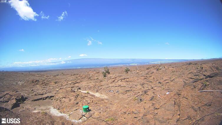
[MDLcam] The Upper and Middle Parts of Mauna Loa's Southwest Rift Zone
Live image of Mauna Loa's upper and middle Southwest Rift Zone from Dandelion Cone along the middle part of the rift zone [MDLcam]. This camera is a pan-tilt-zoom model and the view may change depending on activity.
Disclaimer
Live image of Mauna Loa's upper and middle Southwest Rift Zone from Dandelion Cone along the middle part of the rift zone [MDLcam]. This camera is a pan-tilt-zoom model and the view may change depending on activity.
Disclaimer

[MSPcam] Mauna Loa's Southwest Rift Zone from the South Point area
Live image of Mauna Loa's Southwest Rift Zone from the South Point area [MSPcam]. This camera is a pan-tilt-zoom model and the view may change depending on activity.
Disclaimer
Live image of Mauna Loa's Southwest Rift Zone from the South Point area [MSPcam]. This camera is a pan-tilt-zoom model and the view may change depending on activity.
Disclaimer
[MITDcam] Kīlauea upper Southwest Rift Zone
[MITDcam] Live view of Kīlauea's upper Southwest Rift Zone, looking northwest from a seismic station in the Kaʻū Desert.
[MITDcam] Live view of Kīlauea's upper Southwest Rift Zone, looking northwest from a seismic station in the Kaʻū Desert.

[B2cam] Halemaʻumaʻu crater from the east rim and down-dropped block
[B2cam] This image is from a research camera located on the down-dropped block in Kīlauea caldera and east rim of Halemaʻumaʻu crater within Hawaiʻi Volcanoes National Park. The camera is looking west towards Halemaʻumaʻu crater.
Disclaimer
[B2cam] This image is from a research camera located on the down-dropped block in Kīlauea caldera and east rim of Halemaʻumaʻu crater within Hawaiʻi Volcanoes National Park. The camera is looking west towards Halemaʻumaʻu crater.
Disclaimer