
The latest Landsat Update is available for the public. Text on image reads: "Landsat Update: March 2022. Learn the latest Landsat information and news. What's inside? Pecora 22 upcoming meeting, Landsat 9 mission status, Landsat 9 data available, Collection 2 Level 3 products available, Archive reaches 10 million scenes, Landsat Science Team meeting.
Pecora 22
The 22nd William T. Pecora Memorial Remote Sensing Symposium (Pecora 22) convened in Denver, Colorado, USA from October 23 – 27, 2022.
The conference was hosted by the USGS and NASA, with an overarching theme of Opening the Aperture to Innovation: Expanding Our Collective Understanding of a Changing Earth, which embraces both the innovations and discoveries that resulted from 50 years of Landsat Earth observations, and also current and future innovations in science and technology that are contributing to our ability to improve our understanding and better manage the Earth’s environment.
For more information on this conference, check out the Pecora 22 website.
Plenary Sessions
PS_Advanced EO Decadel Surveys WBGail
PS_Advancing State of Art Pecora22 Geoscience Australia-Alison Rose
PS_Kass Green_The Market for Remotely Sensed Data Pecora 22
PS_Levy.Pecora22.25Oct2022 - Marc Levy_PPT
PS_Pecora Past Winners Panel - Darrel Williams
PS_TanyaTrujillo-Keynote-Slides
PS_Vincent_Pecora 2022 50years of Landsat
PS-20221027-50-years-Sinergise Grega Milcinski
Technical Sessions
TS_1-1_Calculated Risk-Leveraging Multi-Mission Compositing_KFickas
TS_1-1_Long-Term Monitoring of Water Clarity in Amazon Basin Using Landsat Data_DMaciel
TS_1-1_Sentinel-2 Chlorophyll_WSalls
TS_1-1_Towards Macroscale Application of Water Remote Sensing_STopp
TS_1-2_CEOS ARD Specifications for SAR_BKillough
TS_1-2_CEOS Strategy for ARD_SLabahn
TS_1-2_Leveraging ARD with DE Africa_ALewis
TS_1-2_Planet Fusion Applications of a Next-Generation ARD_RHouborg
TS_1-2_Quantitative-Metrics-for-Interoperability-Emily Maddox
TS_1-2_Sentinel Hub-On Demand Sentinel-1 CARD4L_GMilinski
TS_1-2_What's Next for ARD_ALewis
TS_1-3_Analysis of Underfly Data_SDSU_GGross
TS_1-3_Claibrating the 50-Year Landsat Archive_EMicijevic
TS_1-3_L8 Per-Pixel Raiometric Uncertainty Algorithm_MPagnutti
TS_1-3_Landsat 9 Calibration Move to Operations_CAnderson
TS_1-3_OLI2_Development and Characterization Lessons Learned_EKnight
TS_1-4_Modeling Forest Phenology_SMartinuzzi
TS_1-4_Monitoring Mangroves_LFatayinbo
TS_1-5_2016 NLCD TCC Validation_JDerwin
TS_1-5_Improving Classification Accuracy Using AI for NLCD_PDanielson
TS_1-5_Next Generation NLCD Tree Canopy Cover_KSchleeweis
TS_1-5_NLCD 2021 and Beyond_JDewitz
TS_1-5_NLCD Change Detection Using CCDC_SJin
TS_1-6_Automated DEM Extraction MAXAR_GMiecznik
TS_1-6_East Timbalier Island_GFisher
TS_1-6_Landslide Monitoring Using UAS_DDrinkall
TS_1-6_Pecora_CopernicusDEM_Franks
TS_1-6_USGS DEM Historical Change Detection Pecora 2022
TS_2-1_Algal_monitoring_pecora_Stengel
TS_2-1_Market for Remotely Sensed Data - Kass Green
TS_2-2_Automating Urban Delineation and Examining SDG Indicator_OCardenas
TS_2-2_Conservation and Sustainability_RWAllen
TS_2-2_Digital Earth Africa_MHalabisky
TS_2-2_Phoenix Metropolitan Area_CWang
TS_2-3_Al-Based Cloud Clearing for Geolocation Validation_BZhang
TS_2-3_Comparing Geometric Performance of L8 & L9_RRengarajan
TS_2-3_Harmonized Landsat-Sentinel-2 V2_JJu
TS_2-3_L8-S2 Haromization_RRengarajan
TS_2-3_Providing a Satellite Cross-Calibration Capability Across the GEOS of Systems_CAnderson
TS_2-3_Radiometric Calibration EPICS_JFRueda
TS_2-4_Coral Reef Rehabilitation_SFurey
TS_2-4_DEVELOP Yonkers, NY_TBarbakova
TS_2-4_Understanding the Impact of Forest Management on the Cameron Peak and CalWood Fires_CChoi
TS_2-5_Brining It All Together_JO'Neil
TS_2-5_Coastal Land-Aquatic System Biogechemical Cycle Modelling with LCMAP Science Products_JLiu
TS_2-6_Comprehensice Monitoring of Environmental Change_POlofsson
TS_2-5_Predicting Landsat Reflectance Patterns With Climate Data_KFickas
TS_2-6_Mapping Land Cover Change Across Amazonia and Beyond_SSpera
TS_3-1_Belize Coastal Lagoon_CManiyar
TS_3-1_Using Satellite-Derived Satellite Water Quality Data_LOlmanson
TS_3-2_Mapping the Tropics_EDelgado
TS_3-2_RaBET_CHolifieldCollins
TS_3-2_Spectral Diversity_CChan
TS_3-3_Collecting Spectra ona Budget_VScholl
TS_3-3_ECCOE Landsat 8_9 Underfly_EMaddox
TS_3-3_Impact of 50 years of Landsat on Vicarious Calibration Methods and Accuracies_KThome
TS_3-3_Low-Cost Radiometer Designed to Enhance Landsat THermal Validation_Rochester Institute
TS_3-3_SDSU_Arable_DSiriwardana
TS_3-4_Impact Observatory_ALarson
TS_3-4_STAC and Cloud-Native Geo_MHanson
TS_3-4_STAC and The Planetary Computer_PGadomski
TS_3-5_A Random Forest-Based Commission Error Filter for Landfire Disturbance Mapping_SKumar
TS_3-5_Landfire Disturbance_BTolk
TS_3-5_Painting the Landscape by Number_JPicotte
TS_3-6_ CroplandCROS_R Mueller
TS_3-6_Corn Yields MODIS_DJohnson
TS_4-1_An Assessment of Earth Observation Imaging Spectroscopy User Needs_NRoberts
TS_4-1_Does Higher Spatial Resolution Improve Snow Estimates_EBair
TS_4-1_Preparing for Surface Mineral Mapping_RKokaly
TS_4-1_Studying and Monitoring Freshwater Ecosystems_NPahlevan
TS_4-2_Assessment of Satellite-Based Observations of Bathymetric Change_CParrish
TS_4-2_Remote Sensing of Shallow Water Bathymetry_FNurindrawati
TS_4-2_Satellite Derived Bathymetry_MP-Lovejoy
TS_4-3_Advancing Cropland Monitoring_MHansen
TS_4-3_Extracting Fields from Space_LYan
TS_4-3_Mapping Crop Types Globally_DJohnson
TS_4-3_The Symbiotic Relationship Between Landsat and Agricultural Applications_DWilliams
TS_4-4_Communicating the Meaning of Place_CMandryk
TS_4-4_Integrating Ecocultural Knowledge and Remote Sensing_RBoger
TS_4-4_Trees Around the GLOBE_PNelson
TS_4-4_Understanding Gender Barriers_SSchenkein
TS_4-5_Is GeoAl the Crystal Ball to the Future of Earth Observation_VSagan
TS_4-5_Landsat Data and Information in the Cloud Era_RLenczowski
TS_4-5_Modeling Snowmelt Runoff Using Landsat Fractional Snow Covered Area_SArab
TS_4-6_Cloud Geo Technology_CKurnia
TS_4-6_Fifty Years of Landsat Ed and Public Outreach_GButcher
TS_4-6_Harvesting the Landsat Archive_GMountrakis
TS_4-6_Integrating Per-Pixel Accuracy Metrics in LCMAP and NLCD Products_GMountrakis
TS_4-6_Near-Real_Time Crop Phenology_FGao
TS_4-6_Phenometric Lapse Rates_GHenebry
TS_4-6_Thirty Years of Satellite Seasonality_JGray
TS_5-2_ASPRS 10YR Forecast_ASampath
TS_5-2_GHG Monitoring From Space_ADavitt
TS_5-2_Land Imaging Architecture Analytical Tools and Applications_EWengert
TS_5-2_New Drivers for Remote Sensing_ASampath
TS_5-2_User Driven Eath Observation Pathways_GSnyder
TS_6-1_Evapotranspiration_GSenay
TS_6-1_Operationalizing the Generalized Split-Window Algorithm_Mattie
TS_6-2_Development of SAR and EO Derived Wetland Products_MBattaglia
TS_6-2_High-Latitude Aquatic Remote Sensing_LCatipovic
TS_6-2_Landsat Albedos High Latitudes_CSchaaf
TS_6-3_Delayed Palm Oil Conversion_DParker
TS_6-3_Land Use Expansion in South America_VZalles
TS_6-3_Massive Soybean Expansion in South America_XSong
TS_6-3_Tropical Forest Loss Area_ATyukavina
TS_6-3_Tropical Forest Symposium_MHansen
TS_6-5_KentuckyView_WestVirginiaView_HCetin
TS_6-5_Making the Past Relevant through Landsat_PNelson
TS_6-5_NewHampshireView_RCongalton
TS_6-5_Review of Undergraduate Remote Sensing Research_RSivanpillai
TS_6-6_Developing a Method to Monitor Changing Tree Cover in NE Communities_HEllerman
TS_6-6_Diameter Estimation of Eucalyptus Plantations_BMiller
TS_6-6_Forest Type Differentiation_AMaxwell
TS_7-1_CAC and ESWG Brief_DOpstal
TS_7-1_CAC Source Mangement_PRinkleff
TS_7-1_Declassified Photographs from US Intelligence Satellites_JGriffith
TS_7-1_Providing Declass Imagery_SWarn
TS_7-1_The Global Fiducials Library_SSmith
TS_7-2_Burn Severity Portal_SBogle
TS_7-2_Effect of Burn Severity on Vegitation Succession_ABadola
TS_7-2_Fire History Metrics_MVanderhoof
TS_7-2_Impact of Wildfire_YYang
TS_7-2_Spaceborne Mapping of Fire Retardant Drops Using Machine Learning Techniques_TSaltiel
TS_7-2_Wildfire Monitoring_MCrowley
TS_7-3_Full Speed Ahead or Not So Fast_SFilippelli
TS_7-3_Mapping Casual Agents of Disturbance_YZhang
TS_7-3_Monitoring and Analyzing Shifting Cultivation in Laos_SChen
TS_7-3_Spatial and Temporal Availability of Cloud-free Observations_AFlores
TS_7-4_Beqaa Valley, Lebanon_LAbdouni
TS_7-4_Multifaceted View of Conterminous US_ZZHU
TS_7-4_Widespread Changes in 21st Century Vegetation Cover_Stanimirova
TS_7-5_Curriculum Insertion Points 2022_RDodge
TS_7-5_DelawareView_TDeLiberty
TS_7-5_The Half Earth Project Exercise_TMueller
TS_7-6_Discrimination of Forest Regrowth_CBlinn
TS_7-6_Estimating of Foliar Traits_TGara
TS_7-6_Virginia Tech_PWilliams
TS_7-7_Night Imaging_MPagnutti
TS_7-7_Nighttime Lights_BKillough
TS_7-7_Recurrent Acute Disasters_MRoman
TS_7-7_The Day Night Band_SMiller
TS_8-1_LGRIP30_CONUS_PTeluguntla
TS_8-1_WATERSMART Adam Oliphant
TS_8-2_Analysis of Brine Spill_GVandeberg
TS_8-2_Dissemination of Global Flood Severity_MGlasscoe
TS_8-2_Near Realtime Agricultural Flood_ZLi
TS_8-2_Satellite-Derived Training Data_JGanuza
TS_8-3_Detecting Eastern Redcedar Encroachment in Kansas_CLiang
TS_8-3_Multi-Source Mapping of Forest Susceptibility_RBhattarai
TS_8-3_The Sentinel GreenReport_CLiang
TS_8-3_Understanding Forest Vegetation_SSahoo
TS_8-4_Evaluation of Landsat Image Compositing Algorithms_SQiu
TS_8-4_Identifying Wetland Change_NFrench
TS_8-4_Landsat-Based Global Land Cover Training_RStanimirova
TS_8-4_Thematic Accuracy Assessment_RCongalton
TS_8-4_Using Landsat to Detect Change_SAdeli
TS_8-5_Assesing the Result of the First GEO Service Worshops_Stone
TS_8-5_Undergraduate Mentors Perspectives_CPoirier
TS_8-6_Hot Spots in the Ice_ADuVivier
TS_8-6_Multi-factor Coral Disease Forecasts_MDonahue
TS_8-6_Multiscale Spectroscopy of Intertidal Biofilm_KByrd
TS_8-6_Trout Unlimited_DDauwalter
TS_8-7_Application of Earth Observation Data_LCarey
TS_8-7_Monitoring Container Ship Backlog_YBai
TS_8-7_Natural Hazard Geodata Examples_DOpstal
Workshops
WS_1A NOTES-findings-recommendations
WS_-Adam Lewis-Pecora22 International DE
WS_Advancing Environmental and Climate Justice-Maree Wilson
WS_Advancing Interoperability_BRyan
WS_Big Data for Global Science_GSchreier
WS_Community Engagement in Local Forest Monitoring using Global Forest Watch_JNackoney
WS_Developing a Common Land Imaging Architecture-Stryker
WS_ECCOE_Ensuring Quality Global EO Data – Calibration-Validation Cody Anderson
WS_Envisioning the Future of International EO Collaboration_JShan
WS_Improving Global EO Data Access Alison Rose
WS_Improving Global EO Data Access_SSobue
WS_International Partnership for Enhancing Knowledge_ABelward
WS_International Workshop Outline
WS_InternationalWorkshop_Pecora22_Crowley
WS_INTL WORKSHOP NOTE-TAKING TEMPLATE
WS_Killough_Monday_OpenDataCube_ARD
WS_Maiersperger Landsat Collection 2 in the Cloud Pecora 22
WS_New Space in Copernicus_SJutz
WS_Newman Briefing on Partnerships - Pecora 2022
WS_PECORA 22 Envisioning the Future of International Earth Observations Collaboration - Greg Snyder
WS_Pecora 22 Int'l Collaboration Workshop_1A DRAFT SUMMARY
WS_SERVIR in Central America_AF_Anderson
WS_The EU's Knowledge Centre on EO_ABelward
WS_Wu_USGS User Needs_two slides


Related Content

Landsat Update March 2022
The latest Landsat Update is available for the public. Text on image reads: "Landsat Update: March 2022. Learn the latest Landsat information and news. What's inside? Pecora 22 upcoming meeting, Landsat 9 mission status, Landsat 9 data available, Collection 2 Level 3 products available, Archive reaches 10 million scenes, Landsat Science Team meeting.

February Landsat Social Media Posts
Social media posts from February for the March 2022 Landsat Update. Available via Landsat Missions.
Social media posts from February for the March 2022 Landsat Update. Available via Landsat Missions.

Flyer 2 Pecora 2022 Award Call for Nominations
Description of the Pecora Award. This image details the procedure for nominations, eligibility, and privacy statement.
Description of the Pecora Award. This image details the procedure for nominations, eligibility, and privacy statement.

PECORA award
Pecora 2022 award flyer announcing call for nominations, due April 15, 2022.
Pecora 2022 award flyer announcing call for nominations, due April 15, 2022.
Landsat Science Team Meeting Presentations Available
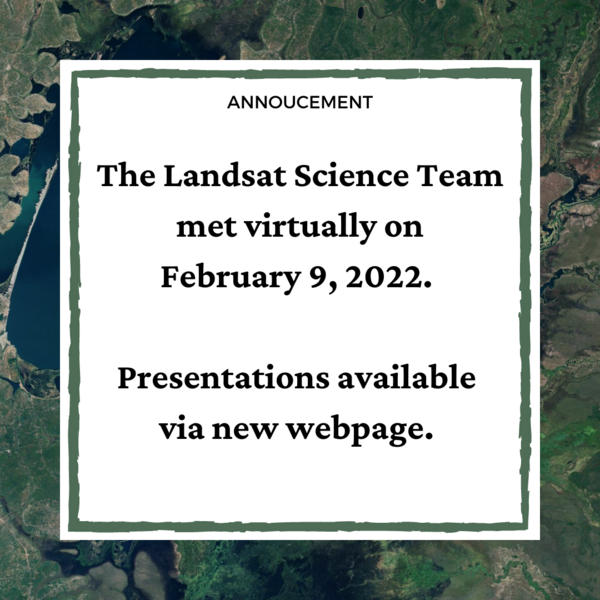
The Landsat Science Team met virtually on February 9, 2022. Topics included, but were not limited to, Landsat 9 operations, calibration, and data release plans; Landsat 7 mission status; Landsat and Sentinel harmonization; and the future of land imaging.
The Landsat Science Team met virtually on February 9, 2022. Topics included, but were not limited to, Landsat 9 operations, calibration, and data release plans; Landsat 7 mission status; Landsat and Sentinel harmonization; and the future of land imaging.
Related Content
Landsat Update March 2022
The latest Landsat Update is available for the public. Text on image reads: "Landsat Update: March 2022. Learn the latest Landsat information and news. What's inside? Pecora 22 upcoming meeting, Landsat 9 mission status, Landsat 9 data available, Collection 2 Level 3 products available, Archive reaches 10 million scenes, Landsat Science Team meeting.
The latest Landsat Update is available for the public. Text on image reads: "Landsat Update: March 2022. Learn the latest Landsat information and news. What's inside? Pecora 22 upcoming meeting, Landsat 9 mission status, Landsat 9 data available, Collection 2 Level 3 products available, Archive reaches 10 million scenes, Landsat Science Team meeting.
February Landsat Social Media Posts
Social media posts from February for the March 2022 Landsat Update. Available via Landsat Missions.
Social media posts from February for the March 2022 Landsat Update. Available via Landsat Missions.
Flyer 2 Pecora 2022 Award Call for Nominations
Description of the Pecora Award. This image details the procedure for nominations, eligibility, and privacy statement.
Description of the Pecora Award. This image details the procedure for nominations, eligibility, and privacy statement.
PECORA award
Pecora 2022 award flyer announcing call for nominations, due April 15, 2022.
Pecora 2022 award flyer announcing call for nominations, due April 15, 2022.
Landsat Science Team Meeting Presentations Available
The Landsat Science Team met virtually on February 9, 2022. Topics included, but were not limited to, Landsat 9 operations, calibration, and data release plans; Landsat 7 mission status; Landsat and Sentinel harmonization; and the future of land imaging.
The Landsat Science Team met virtually on February 9, 2022. Topics included, but were not limited to, Landsat 9 operations, calibration, and data release plans; Landsat 7 mission status; Landsat and Sentinel harmonization; and the future of land imaging.