
HVO staff are conducting the annual Mauna Loa GPS campaign. During the survey, GPS instruments are deployed at established benchmarks so that their recorded positions can be compared with those from previous years to discern subtle patterns of ground deformation associated with volcanic activity.
Multimedia
Images

May 13, 2024 — Annual Mauna Loa GPS campaign underway
HVO staff are conducting the annual Mauna Loa GPS campaign. During the survey, GPS instruments are deployed at established benchmarks so that their recorded positions can be compared with those from previous years to discern subtle patterns of ground deformation associated with volcanic activity.

May 13, 2024 — Annual Mauna Loa GPS campaign underway
GPS campaign equipment being staged prior to deployment on Mauna Loa for the annual survey. Temporary GPS receivers and antennas are placed on tripods centered over benchmarks, which serve as a reference point for centering of the antenna. The equipment is left in place to collect data for a couple of days at each site.
GPS campaign equipment being staged prior to deployment on Mauna Loa for the annual survey. Temporary GPS receivers and antennas are placed on tripods centered over benchmarks, which serve as a reference point for centering of the antenna. The equipment is left in place to collect data for a couple of days at each site.

May 13, 2024 — Annual Mauna Loa GPS campaign underway
A benchmark on Mauna Loa being surveyed by GPS campaign instruments. The metal disk on the ground beneath the tripod is the benchmark, which is cemented to the lava flow surface. USGS photo by A. Ellis.
A benchmark on Mauna Loa being surveyed by GPS campaign instruments. The metal disk on the ground beneath the tripod is the benchmark, which is cemented to the lava flow surface. USGS photo by A. Ellis.

May 5, 2024—InSAR image of deformation during Kīlauea upper East Rift Zone swarm
This map shows recent deformation at Kīlauea from April 19 to May 5, 2024, as recorded by the Italian Space Agency's (AGI) Cosmo-SkyMED satellite. Colored fringes denote areas of ground deformation, with more fringes indicating more deformation. Each color cycle represents 1.5 cm (0.6 in) of ground motion indicative of inflation as the magma reservoi
This map shows recent deformation at Kīlauea from April 19 to May 5, 2024, as recorded by the Italian Space Agency's (AGI) Cosmo-SkyMED satellite. Colored fringes denote areas of ground deformation, with more fringes indicating more deformation. Each color cycle represents 1.5 cm (0.6 in) of ground motion indicative of inflation as the magma reservoi

April 24, 2024 — Webcam upgrades on Mauna Loa's Southwest Rift zone
Aerial view of cone that the new MLDcam is located on, on the Southwest Rift Zone of Mauna Loa. An HVO geologist and field engineer installing the camera are silhouetted on top of the cone against the cloudy backdrop.
Aerial view of cone that the new MLDcam is located on, on the Southwest Rift Zone of Mauna Loa. An HVO geologist and field engineer installing the camera are silhouetted on top of the cone against the cloudy backdrop.

Distribution of HVO permanent and survey seismic stations
Distribution of permanent seismic stations and previously deployed seismic nodes in southern half of the Island of Hawai‘i. Shaded regions display the total footprint that nodal deployments this spring and summer will occupy.
Distribution of permanent seismic stations and previously deployed seismic nodes in southern half of the Island of Hawai‘i. Shaded regions display the total footprint that nodal deployments this spring and summer will occupy.
Videos

Mauna Loa 2022 Eruption Anniversary
Mauna Loa 2022 eruption anniversary video. Mauna Loa is Earth's largest active volcano and covers just over half of the Island of Hawaiʻi. It erupted most recently in November-December 2022, and it will erupt again.
Mauna Loa 2022 eruption anniversary video. Mauna Loa is Earth's largest active volcano and covers just over half of the Island of Hawaiʻi. It erupted most recently in November-December 2022, and it will erupt again.
Mauna Loa 2022 Eruption Anniversary (AD)
Mauna Loa 2022 eruption anniversary video. Mauna Loa is Earth's largest active volcano and covers just over half of the Island of Hawaiʻi. It erupted most recently in November-December 2022, and it will erupt again.
Mauna Loa 2022 eruption anniversary video. Mauna Loa is Earth's largest active volcano and covers just over half of the Island of Hawaiʻi. It erupted most recently in November-December 2022, and it will erupt again.

December 9, 2022 — Mauna Loa Fissure 3
Aerial view of fissure 3 erupting on the Northeast Rift Zone of Mauna Loa on December 9, 2022. The eruption continues but the vigor has greatly reduced over the past 24 hours. USGS video by M. Patrick.
Aerial view of fissure 3 erupting on the Northeast Rift Zone of Mauna Loa on December 9, 2022. The eruption continues but the vigor has greatly reduced over the past 24 hours. USGS video by M. Patrick.

December 9, 2022 — Mauna Loa Fissure 3 Lava Channel
Aerial view of the upper lava channel from fissure 3 on the Northeast Rift Zone of Mauna Loa. On December 9, 2022, Hawaiian Volcano Observatory geologists noted a reduced output of lava at fissure 3 and this photo shows that the level of lava in the channel is the lowest it has been since the eruption started. USGS video by M. Patrick.
Aerial view of the upper lava channel from fissure 3 on the Northeast Rift Zone of Mauna Loa. On December 9, 2022, Hawaiian Volcano Observatory geologists noted a reduced output of lava at fissure 3 and this photo shows that the level of lava in the channel is the lowest it has been since the eruption started. USGS video by M. Patrick.

December 8, 2022 — Mauna Loa Fissure 3
During a morning overflight on December 9, 2022, Hawaiian Volcano Observatory geologists noted a reduced output of lava at fissure 3 on the Northeast Rift Zone of Mauna Loa. The lava fountain is much lower than yesterday and the lava in the channel is much lower than the levees. USGS video by M. Patrick.
During a morning overflight on December 9, 2022, Hawaiian Volcano Observatory geologists noted a reduced output of lava at fissure 3 on the Northeast Rift Zone of Mauna Loa. The lava fountain is much lower than yesterday and the lava in the channel is much lower than the levees. USGS video by M. Patrick.

December 8, 2022 — Mauna Loa Fissure 3
The Northeast Rift Zone eruption of Mauna Loa continues with a major change overnight. The fissure 3 (F3) vent continues to erupt but the supply of lava appears to be much reduced this morning. Lava is overtopping channels near the vent with flows extending no farther than 2.5 mi (4 km) from the vent.
The Northeast Rift Zone eruption of Mauna Loa continues with a major change overnight. The fissure 3 (F3) vent continues to erupt but the supply of lava appears to be much reduced this morning. Lava is overtopping channels near the vent with flows extending no farther than 2.5 mi (4 km) from the vent.
Webcams

[MDLcam] The Upper and Middle Parts of Mauna Loa's Southwest Rift Zone
Live image of Mauna Loa's upper and middle Southwest Rift Zone from Dandelion Cone along the middle part of the rift zone [MDLcam]. This camera is a pan-tilt-zoom model and the view may change depending on activity.
Disclaimer
Live image of Mauna Loa's upper and middle Southwest Rift Zone from Dandelion Cone along the middle part of the rift zone [MDLcam]. This camera is a pan-tilt-zoom model and the view may change depending on activity.
Disclaimer

[MSPcam] Mauna Loa's Southwest Rift Zone from the South Point area
Live image of Mauna Loa's Southwest Rift Zone from the South Point area [MSPcam]. This camera is a pan-tilt-zoom model and the view may change depending on activity.
Disclaimer
Live image of Mauna Loa's Southwest Rift Zone from the South Point area [MSPcam]. This camera is a pan-tilt-zoom model and the view may change depending on activity.
Disclaimer

[HLcam] Live Image of Mauna Loa's northwest flank from Hualālai volcano
Live view of the northwest flank of Mauna Loa; the view is from the southeast flank of Hualālai [HLcam]. This camera is a pan-tilt-zoom model and the view may change depending on activity.
Live view of the northwest flank of Mauna Loa; the view is from the southeast flank of Hualālai [HLcam]. This camera is a pan-tilt-zoom model and the view may change depending on activity.
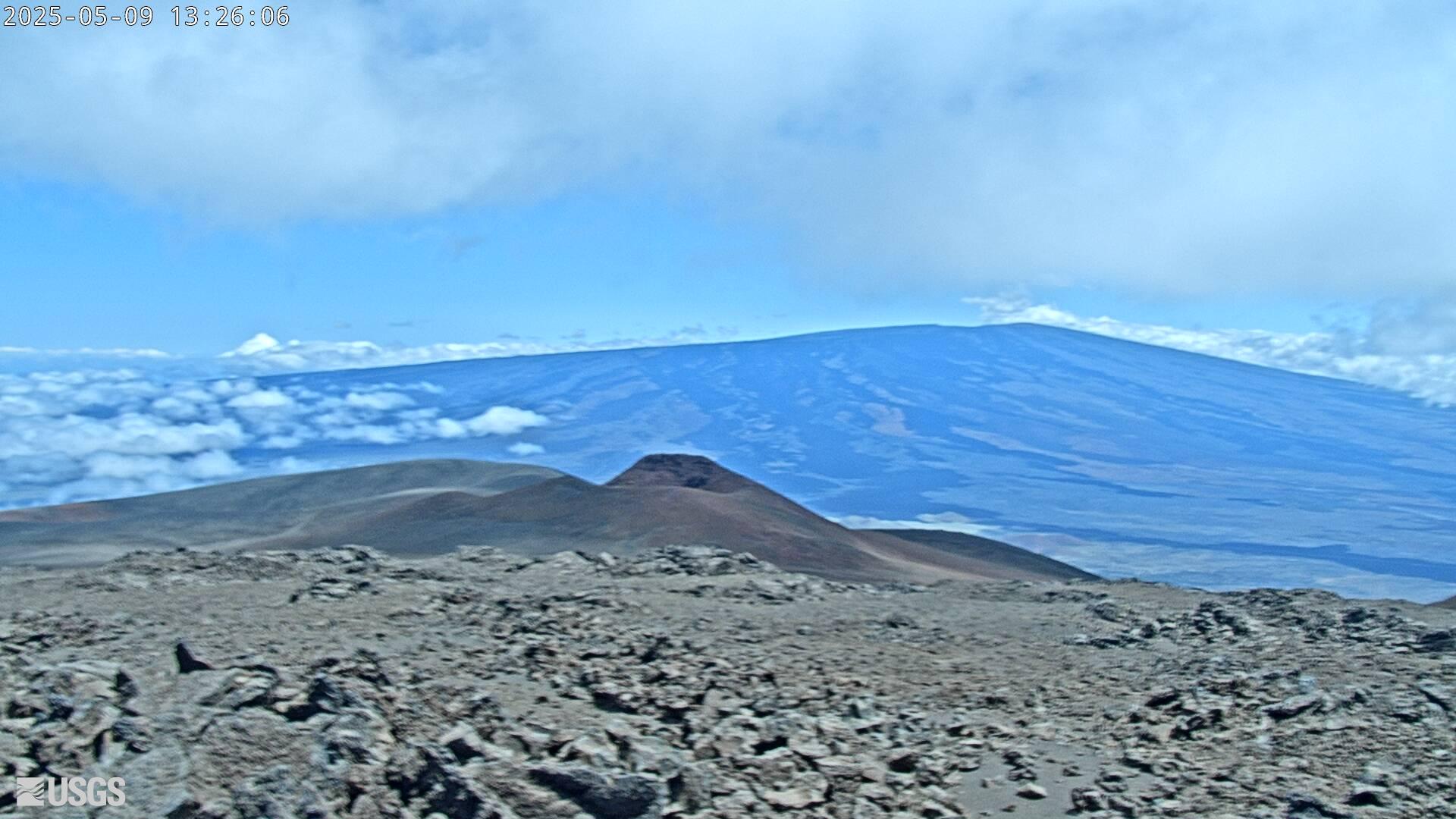
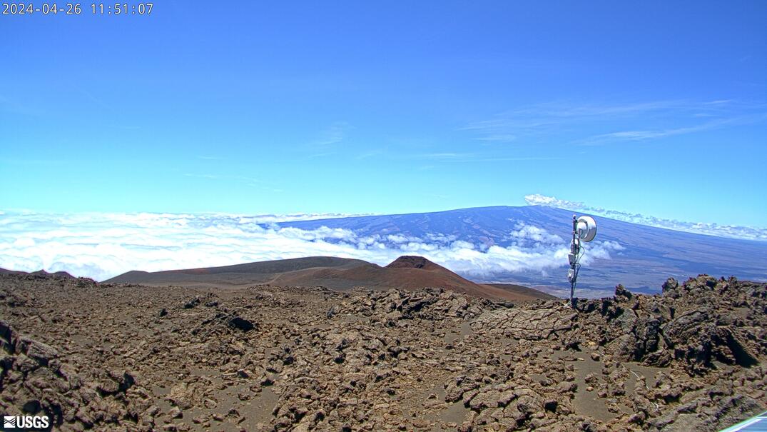
[MK2cam] Mauna Loa's Summit and Northeast Rift Zone from Mauna Kea
Live Image of Mauna Loa's Summit and Northeast Rift Zone from Mauna Kea [MK2cam]. This camera is a pan-tilt-zoom model and the view may change depending on activity.
Live Image of Mauna Loa's Summit and Northeast Rift Zone from Mauna Kea [MK2cam]. This camera is a pan-tilt-zoom model and the view may change depending on activity.
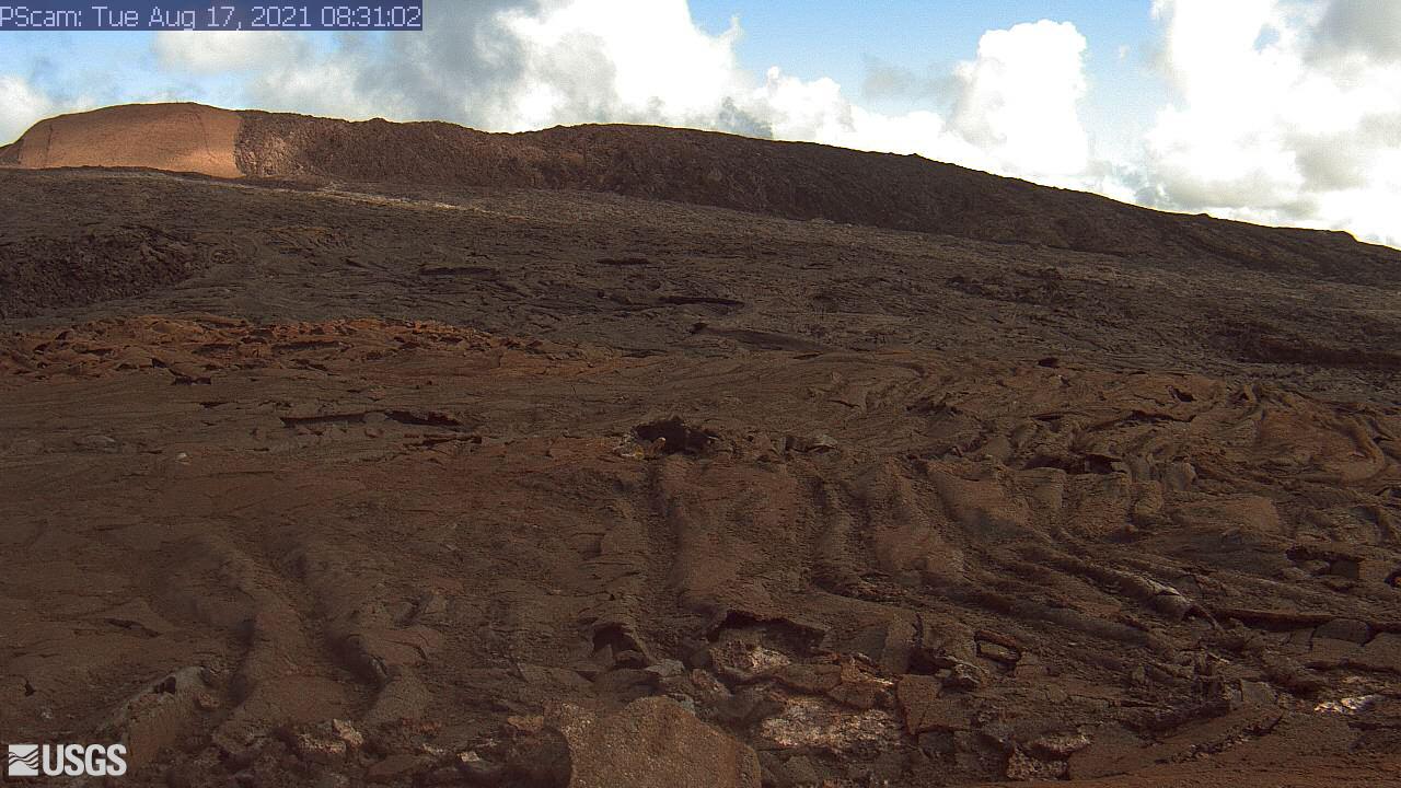
[PScam] Puʻu ʻŌʻō South Flank from the South Rim
This image is from a temporary research camera positioned just south of Puʻu ʻŌʻō, looking north at the southern flank of Puʻu ʻŌʻō's cone.
Disclaimer
This image is from a temporary research camera positioned just south of Puʻu ʻŌʻō, looking north at the southern flank of Puʻu ʻŌʻō's cone.
Disclaimer
[MKcam]: Mauna Loa's Summit and Northeast Rift Zone from Mauna Kea
Live Image of Mauna Loa's Summit and Northeast Rift Zone from Mauna Kea [MKcam].
Live Image of Mauna Loa's Summit and Northeast Rift Zone from Mauna Kea [MKcam].