


USGS fire science informs land, water, and emergency management decisions. Each year tens of thousands of wildfires cause billions of dollars of damage.
Southwest Fire Innovation Landscape Network: Advanced tools for fuel monitoring and assessment of wildfire risk
Active
By Southwest Biological Science Center
April 7, 2025
The USGS Southwest Biological Science Center is coordinating the Southwest Fire Innovation Landscape Network to prepare fire and natural resource managers for rapidly changing fire landscapes by conducting research and building science-management partnerships.
The network develops advanced tools and technologies to assess fuel loads and the effectiveness of fuel treatments, understand wildfire risk and behavior, and mitigate the impacts of catastrophic fire on society and ecosystems.
This work supports Department of the Interior, Department of Defense, US Department of Agriculture, state, and Tribal agencies, and serves to help protect the American public within the wildland-urban interface of the southwestern US.


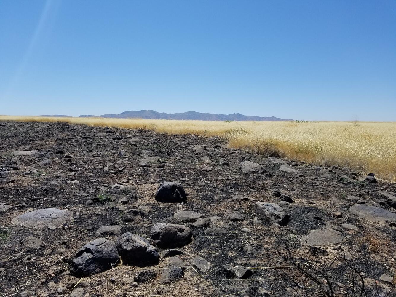
The risk of large and severe wildfires has steadily increased throughout the United States, posing critical threats to human life, infrastructure, and ecosystem productivity.
Decades of fire suppression have increased fuel load, and when coupled with the spread of invasive species, drying fuels, shifts in fire weather, and changing land-use have enhanced wildfire risk.
To address increases in wildfire risk, fire and natural resource managers are charged with assessing fuel conditions and planning fuel treatments to mitigate risks to valued assets.
Media

Sources/Usage: Public Domain. View Media Details
Sources/Usage: Public Domain. View Media Details

The tools, expertise, and data needed to ensure managers can perform these assessments to protect the American public are in high demand.
The USGS Southwest Biological Science Center has initiated the Southwest Fire Innovation Landscape Network to prepare fire and natural resource managers for increasing wildfire risk in southwestern US ecosystems.
Sources/Usage: Public Domain. View Media Details

Objectives and Methods
Objectives and Methods
To meet a growing need to assess fuel conditions, evaluate treatment effects, and determine potential exposure to wildfire, work at the Southwest Fire Innovation Landscape addresses the following objectives:
1. Develop useable and updateable models of fuel conditions at high spatial resolution and temporal frequency across Southwest landscapes.
2. Simulate wildfire behavior using next-generation models and evaluate fire metrics to inform vulnerability to extreme fire behavior.
3. Synthesize fuel treatment information and assess changes to wildfire risk based on different treatment scenarios.
4. Incorporate fire environmental conditions to assess wildfire exposure and prescribed fire windows and forecast extremes in fire behavior.
5. Review best science and monitoring practices for each landscape for use in fire and land management plans.
Sources/Usage: Public Domain. View Media Details
Working across agencies and land ownership boundaries within the southwestern U.S., we develop, integrate, and apply high-resolution measurements of fuel conditions, advanced fire behavior simulations, and monitoring of ecological systems to evaluate management strategies and treatment effectiveness.
We are employing light detection and ranging (LiDAR), unoccupied aerial systems, high-resolution satellite imagery, advanced wildfire simulation models, and other new technologies and methods to provide the latest information on fuels and potential wildfire exposure.
Sources/Usage: Public Domain. View Media Details

We are training fire and natural resource managers on the use of these new tools to meet on-the-ground demand for their applications.
Current work includes:
Current work includes:
- Conducting three-dimensional measurements of fuel and vegetation with terrestrial LiDAR across the Fort Huachuca Sentinel Landscape
- Developing multi-year, high-resolution fuel models for the Buenos Aires National Wildlife Refuge and surrounding Altar Valley with satellite imagery
- Evaluating potential burn severity and post-fire debris flow before a fire occurs in the Upper Colorado River Basin
- And training San Carlos Apache, Fort Apache, and other Tribal agencies on new fuel monitoring capabilities and advanced analysis to evaluate fuel treatment effectiveness.
Media

Sources/Usage: Public Domain. View Media Details
Sources/Usage: Public Domain. View Media Details

New 3D fuel monitoring datasets collected with terrestrial LiDAR are made available through the Interagency Ecosystem LiDAR Monitoring (IntELiMon) interactive viewer.
The Interagency Ecosystem LiDAR Monitoring (IntELiMon) interactive tool can be accessed at https://dmsdata.cr.usgs.gov/lidar-monitoring/viewer.
The IntELiMon program seeks to develop efficient methods for monitoring natural and cultural resources and provide effective decision support tools to land managers.
The multidisciplinary team seeks to integrate LiDAR data and modeling techniques to monitor fuels and ecosystems and link fire modeling for land management decision support and to standardize cross agency monitoring programs with consistent terminology, methods, and data analysis.
More information on the application of LiDAR monitoring is available at https://dmsdata.cr.usgs.gov/lidar-monitoring.
Sources/Usage: Public Domain. View Media Details

New Tools for Modern Land Management Decisions
In an era of rapid land use changes and shifting climates, it is imperative that land managers and policymakers have actionable and current information available for decision processes. In this work, we seek to meet these needs through new data products and decision support tools built on digital soil mapping, new vegetation cover maps, agency inventory and monitoring data sets, and cutting-edge...
The Innovation Landscape Network
As public lands continue to experience rapid change brought on by fire, invasive species, and climate change, there is a growing need for science-management partnerships to apply innovative research, technology and adaptation strategies to support decision-making at an accelerated pace.

Wildfire Stats
USGS fire science informs land, water, and emergency management decisions. Each year tens of thousands of wildfires cause billions of dollars of damage.
The USGS Southwest Biological Science Center is coordinating the Southwest Fire Innovation Landscape Network to prepare fire and natural resource managers for rapidly changing fire landscapes by conducting research and building science-management partnerships.
The network develops advanced tools and technologies to assess fuel loads and the effectiveness of fuel treatments, understand wildfire risk and behavior, and mitigate the impacts of catastrophic fire on society and ecosystems.
This work supports Department of the Interior, Department of Defense, US Department of Agriculture, state, and Tribal agencies, and serves to help protect the American public within the wildland-urban interface of the southwestern US.
The risk of large and severe wildfires has steadily increased throughout the United States, posing critical threats to human life, infrastructure, and ecosystem productivity.
Decades of fire suppression have increased fuel load, and when coupled with the spread of invasive species, drying fuels, shifts in fire weather, and changing land-use have enhanced wildfire risk.
To address increases in wildfire risk, fire and natural resource managers are charged with assessing fuel conditions and planning fuel treatments to mitigate risks to valued assets.
Media
Sources/Usage: Public Domain. View Media Details
Sources/Usage: Public Domain. View Media Details
The tools, expertise, and data needed to ensure managers can perform these assessments to protect the American public are in high demand.
The USGS Southwest Biological Science Center has initiated the Southwest Fire Innovation Landscape Network to prepare fire and natural resource managers for increasing wildfire risk in southwestern US ecosystems.
Sources/Usage: Public Domain. View Media Details
Objectives and Methods
Objectives and Methods
To meet a growing need to assess fuel conditions, evaluate treatment effects, and determine potential exposure to wildfire, work at the Southwest Fire Innovation Landscape addresses the following objectives:
1. Develop useable and updateable models of fuel conditions at high spatial resolution and temporal frequency across Southwest landscapes.
2. Simulate wildfire behavior using next-generation models and evaluate fire metrics to inform vulnerability to extreme fire behavior.
3. Synthesize fuel treatment information and assess changes to wildfire risk based on different treatment scenarios.
4. Incorporate fire environmental conditions to assess wildfire exposure and prescribed fire windows and forecast extremes in fire behavior.
5. Review best science and monitoring practices for each landscape for use in fire and land management plans.
Sources/Usage: Public Domain. View Media Details
Working across agencies and land ownership boundaries within the southwestern U.S., we develop, integrate, and apply high-resolution measurements of fuel conditions, advanced fire behavior simulations, and monitoring of ecological systems to evaluate management strategies and treatment effectiveness.
We are employing light detection and ranging (LiDAR), unoccupied aerial systems, high-resolution satellite imagery, advanced wildfire simulation models, and other new technologies and methods to provide the latest information on fuels and potential wildfire exposure.
Sources/Usage: Public Domain. View Media Details
We are training fire and natural resource managers on the use of these new tools to meet on-the-ground demand for their applications.
Current work includes:
Current work includes:
- Conducting three-dimensional measurements of fuel and vegetation with terrestrial LiDAR across the Fort Huachuca Sentinel Landscape
- Developing multi-year, high-resolution fuel models for the Buenos Aires National Wildlife Refuge and surrounding Altar Valley with satellite imagery
- Evaluating potential burn severity and post-fire debris flow before a fire occurs in the Upper Colorado River Basin
- And training San Carlos Apache, Fort Apache, and other Tribal agencies on new fuel monitoring capabilities and advanced analysis to evaluate fuel treatment effectiveness.
Media
Sources/Usage: Public Domain. View Media Details
Sources/Usage: Public Domain. View Media Details
New 3D fuel monitoring datasets collected with terrestrial LiDAR are made available through the Interagency Ecosystem LiDAR Monitoring (IntELiMon) interactive viewer.
The Interagency Ecosystem LiDAR Monitoring (IntELiMon) interactive tool can be accessed at https://dmsdata.cr.usgs.gov/lidar-monitoring/viewer.
The IntELiMon program seeks to develop efficient methods for monitoring natural and cultural resources and provide effective decision support tools to land managers.
The multidisciplinary team seeks to integrate LiDAR data and modeling techniques to monitor fuels and ecosystems and link fire modeling for land management decision support and to standardize cross agency monitoring programs with consistent terminology, methods, and data analysis.
More information on the application of LiDAR monitoring is available at https://dmsdata.cr.usgs.gov/lidar-monitoring.
Sources/Usage: Public Domain. View Media Details
New Tools for Modern Land Management Decisions
In an era of rapid land use changes and shifting climates, it is imperative that land managers and policymakers have actionable and current information available for decision processes. In this work, we seek to meet these needs through new data products and decision support tools built on digital soil mapping, new vegetation cover maps, agency inventory and monitoring data sets, and cutting-edge...
The Innovation Landscape Network
As public lands continue to experience rapid change brought on by fire, invasive species, and climate change, there is a growing need for science-management partnerships to apply innovative research, technology and adaptation strategies to support decision-making at an accelerated pace.
Wildfire Stats
USGS fire science informs land, water, and emergency management decisions. Each year tens of thousands of wildfires cause billions of dollars of damage.
USGS fire science informs land, water, and emergency management decisions. Each year tens of thousands of wildfires cause billions of dollars of damage.