
Step 2: Check Location
This section will walk you through the process of verifying the location an existing structure point.
Back to: How to Edit an Existing Structure | Previous: Step 1: Check Name and Address | Next: Step 3: Save Changes to Existing Point
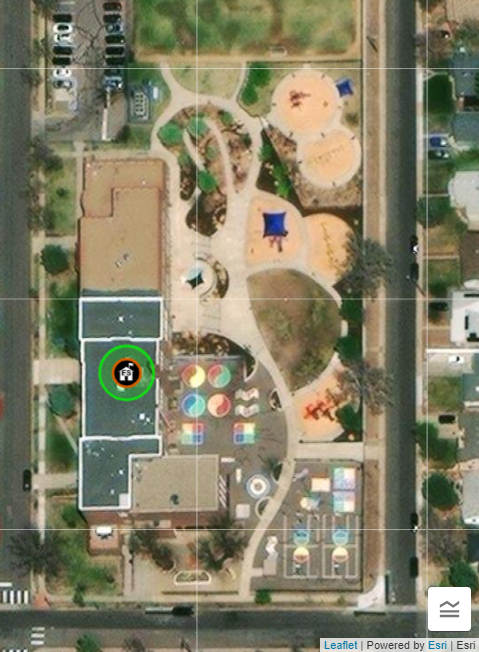
Points that already exist on the map aren’t always placed in the correct location in the imagery, so additional research is required to determine if a point is or is not on the correct building or cemetery grounds. If the point is centered on the correct building or cemetery grounds, it does not need to be moved. If it is not centered on the correct building or cemetery grounds, it needs to be moved. You can move points by clicking and dragging them.
Using an aerial imagery map layer, examine the location of the point. Even if it appears to be correctly located in the imagery, additional research is still required.
NOTE: Remember to ZOOM IN all the way when examining or placing points. Zooming in allows for the most accurate placement of structure points. You might need to switch between map layers if the imagery takes too long to load.
If the feature has an address from an authoritative source, you can do a search using an online map search engine. This allows you to compare the imagery in the online editor to the imagery in the online map search engine. Street level views can also be helpful for determining the correct building. If the feature does not have a complete physical address, you can copy the point’s coordinates and search for them using an online map search engine.
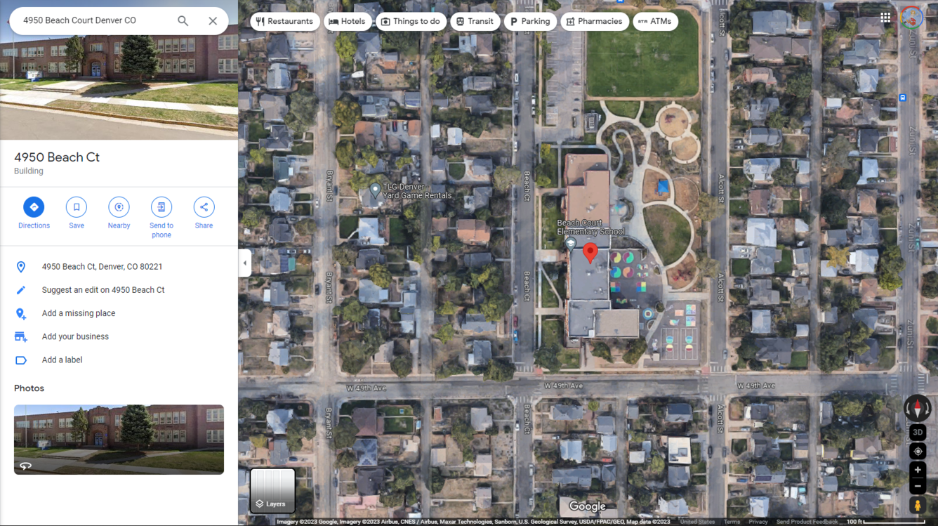
After searching a commercial mapping service for either an address or set of coordinates, examine the search results, either by using a street level view (if available), using aerial imagery identification techniques (which might include identifying certain elements associated with a certain structure – e.g., playground equipment at a school), or comparing elements identified in aerial imagery to images of the structure published by an authoritative source.
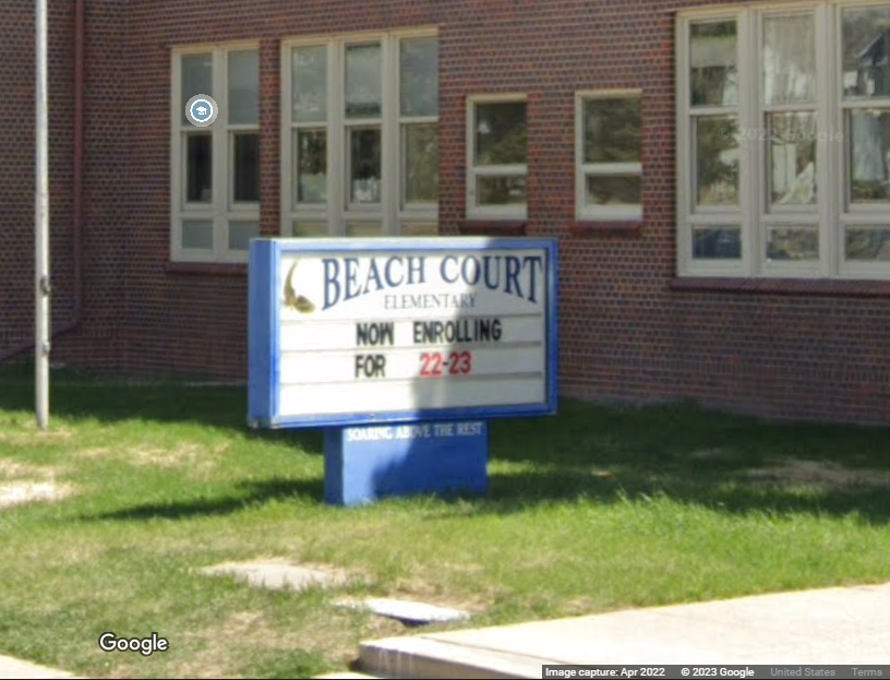
NOTE: We will be utilizing Google Maps™ in our examples, however we do not endorse the use of any particular third-party company or website providing map services. Never take information directly from a commercial mapping service without cross-referencing that information with an authoritative source. Commercial mapping services should ONLY be used to confirm information found on authoritative sources.