
2016 East Bay Seismic Study
Detailed Description
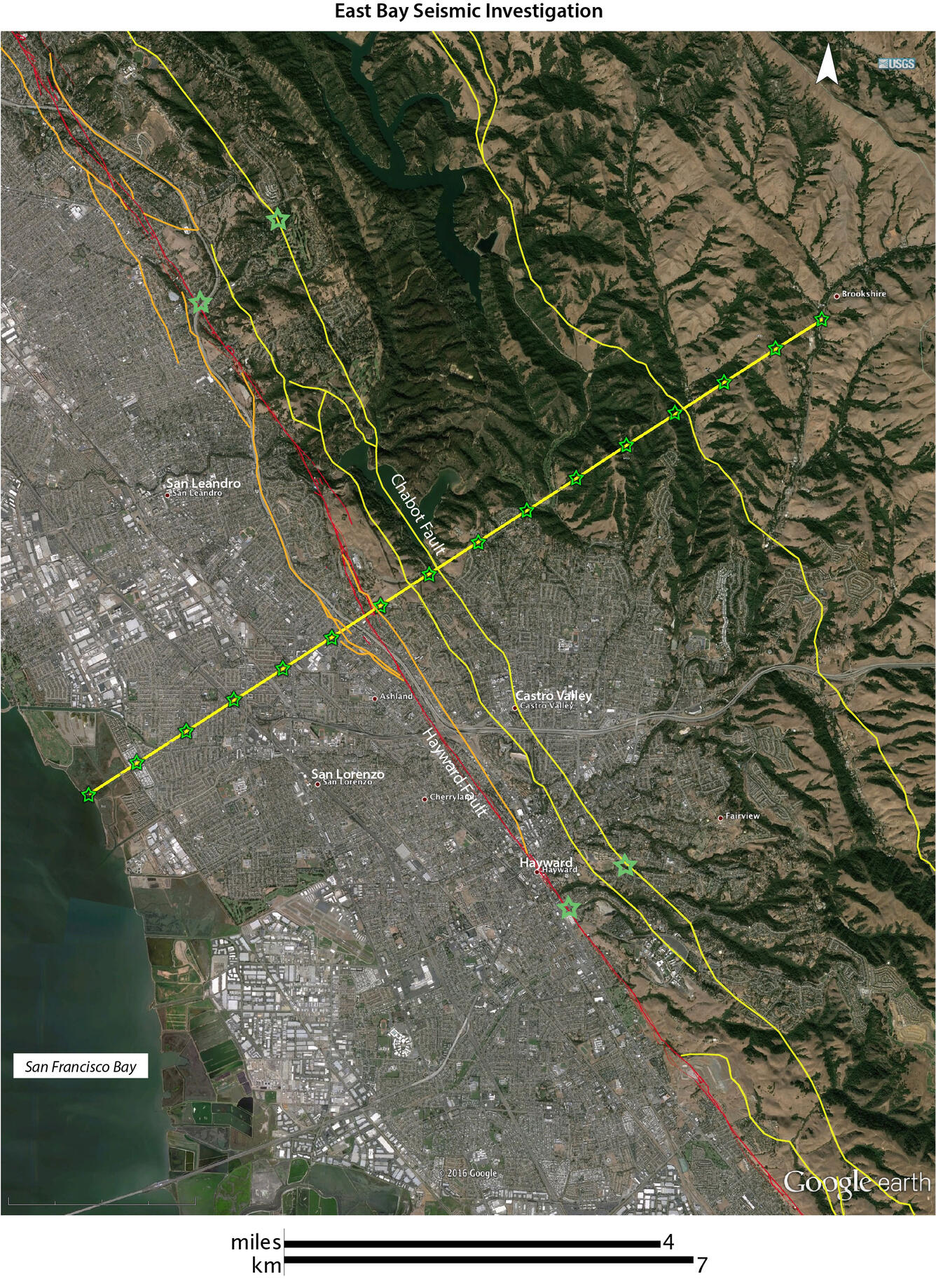
Satellite image of the eastern part of San Francisco Bay Area. Built up urban areas are in gray. The survey line, shown in yellow cuts across several faults through the cities of San Leandro and Castro Valley. The green stars are shot-point locations to be used during the experiment. Approximately 500 temporary seismographs will be deployed along the same yellow line. The seismographs will record the small charges, and any natural earthquakes, giving scientists an idea of how the ground material behaves when shaken, and will give scientists a two-dimensional, vertical cross section through the Earth, similar to an ultrasonic image. The red line is the most-recently-active trace of the Hayward Fault.