
Acoustic backscatter

Detailed Description
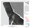
Smaller version of Acoustic Backscatter (Sheet 3) from USGS Scientific Investigations Map 3225, California State Waters Map Series—Hueneme Canyon and Vicinity, California, as an example of the different kinds of maps (“sheets”) produced within a coastal map “block”.
Sources/Usage
Public Domain.