
Aerial imagery from Anne Arundel County, Maryland

Detailed Description
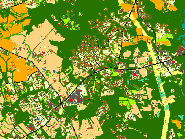
The animation in the figure shows aerial imagery from Anne Arundel County, Maryland, collected by National Agricultural Imagery Program (NAIP), followed by 1-meter Chesapeake Bay Land Cover (13 classes) and Land Use/Land Cover (54 classes) data products.
Sources/Usage
Public Domain.
Related Content

Chesapeake Bay Land Use and Land Cover data is now published in additional formats
The Chesapeake Bay Land Use and Land Cover (LULC) database was developed by the University of Vermont’s Spatial Analysis Laboratory in cooperation with Chesapeake Conservancy (CC) and U.S. Geological Survey (USGS). The high-resolution land data were developed as part of a 6-year Cooperative Agreement between Chesapeake Conservancy and the U.S. Environmental Protection Agency (EPA), and a separate...
Related Content
Chesapeake Bay Land Use and Land Cover data is now published in additional formats
The Chesapeake Bay Land Use and Land Cover (LULC) database was developed by the University of Vermont’s Spatial Analysis Laboratory in cooperation with Chesapeake Conservancy (CC) and U.S. Geological Survey (USGS). The high-resolution land data were developed as part of a 6-year Cooperative Agreement between Chesapeake Conservancy and the U.S. Environmental Protection Agency (EPA), and a separate...