
Aerial imagery of Kīlauea summit activity

Detailed Description
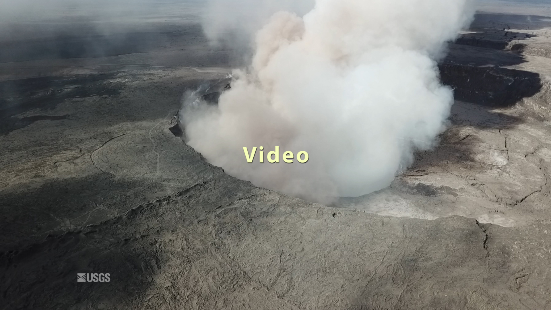
This video was filmed on May 21, 2018, with a UAV (unmanned aerial vehicle). Limited UAV flights above the hazardous Kīlauea summit area, which is currently too dangerous for geologists to enter for ground observations, are conducted with permission from the National Park Service. The overflights collect visual information on what is happening at this rapidly changing vent. The information is used to quantify change and informs our assessment of hazards, which is shared with the National Park Service and emergency managers.
At Kīlauea Volcano's summit, a nearly continuous plume of gas and steam billows out of the Overlook vent and drifts with the wind. Explosions are occurring about two times a day, producing ash that rises to a height of between 8,000 to 10,000 feet above sea level. Small ash emissions occur more frequently. The larger explosions produce ash that is blown downwind, and trace amounts have fallen in nearby communities.
Sources/Usage
Public Domain.