
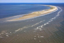
Aerial photograph of Breton Island, Sept. 7, 2016

Detailed Description
Aerial photograph of Breton Island, Sept. 7, 2016. The USGS Coastal and Marine Hazards and Resources Program studies changes to coastal landscapes such as barrier islands.
Sources/Usage
Public Domain.