
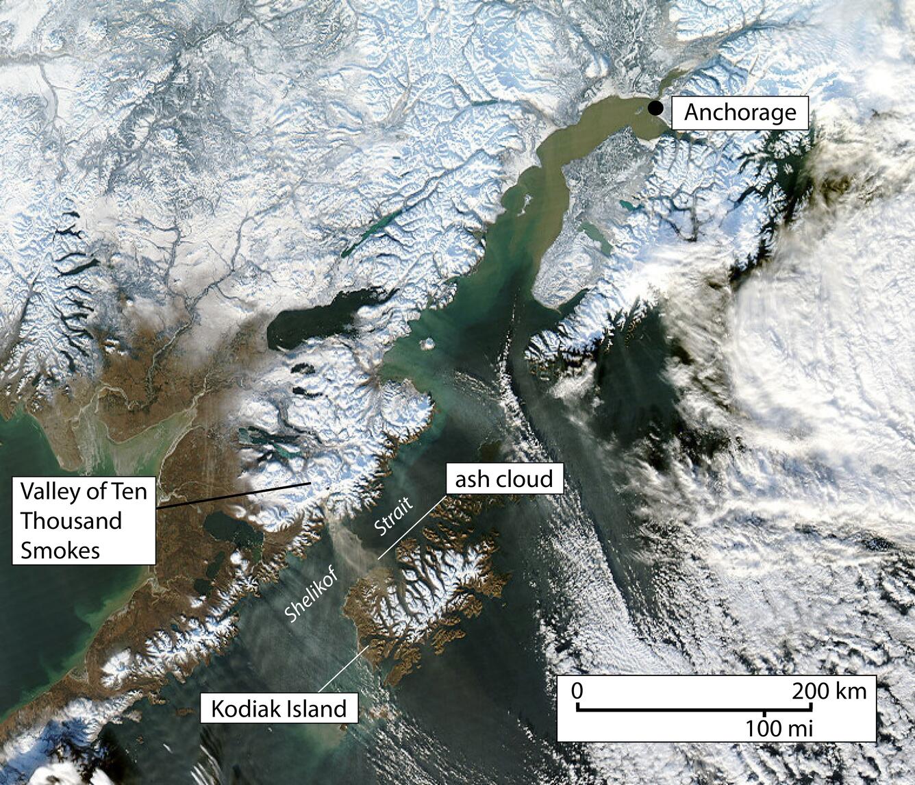
Annotated Satellite Image of southern Alaska Showing Anchorage and Kodiak Island
Detailed Description
This MODIS Aqua 1-km-resolution, true-color satellite image shows a resuspended ash cloud generated from high winds scouring the dry, unvegetated deposits in the Valley of Ten Thousand Smokes. The cloud stretches across Shelikof Strait to western Kodiak Island.
Location: south-central Alaska, from Kodiak to Anchorage
Sources/Usage
Public Domain.