
Arctic Ostracode Database Sample Locations
Detailed Description
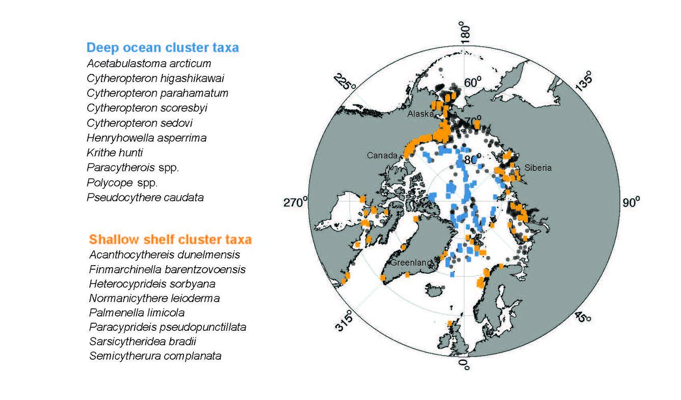
The Arctic Ostracode Database (AOD) provides modern census data of benthic marine ostracodes in surface sediment samples collected from shallow to deep areas of the Arctic Ocean. The dots designate the sample locations, with specific taxa groups color-coded by deep-sea (blue) and coastal (yellow) areas. Map courtesy of Huai-Hsuan M. Huang.
Huang, H-H. M., M. Yasuhara, D. J. Horne, V.Perrier, A.J. Smith, S.N. Brandão. 2022. Ostracods in databases: State of the art, mobilization and future applications, Marine Micropaleontology, 174. https://doi.org/10.1016/j.marmicro.2022.102094.
Cronin T.M., L. Gemery, W.M. Briggs, Jr., E.M. Brouwers, E.I. Schornikov, A. Stepanova, A. Wood, M. Yasuhara, S. Siu. 2021. Arctic Ostracode Database 2020. NOAA's National Centers for Environmental Information (NCEI). https://www.ncdc.noaa.gov/paleo/study/32312
Sources/Usage
Map Courtesy of Huai-Hsuan M. Huang.