
ATRIS system specifications

Detailed Description
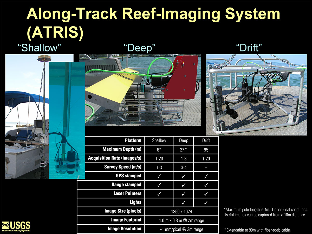
Shallow, Deep, and Drift ATRIS (Along-Track Reef Imaging System) and system specifications.
Sources/Usage
Public Domain.
Related

Advanced Remote Sensing Methods for Coastal Science and Management
This project focused on developing algorithms for quantifying benthic habitat complexity from images, modeling the structural complexity of the seafloor, and using fluorescence signatures to classify coral reef habitats.

Along-Track Reef Imaging System (ATRIS)
ATRIS is a benthic-survey tool that simultaneously acquires geo-located, color, digital images with corresponding water depths.
Related
Advanced Remote Sensing Methods for Coastal Science and Management
This project focused on developing algorithms for quantifying benthic habitat complexity from images, modeling the structural complexity of the seafloor, and using fluorescence signatures to classify coral reef habitats.
Along-Track Reef Imaging System (ATRIS)
ATRIS is a benthic-survey tool that simultaneously acquires geo-located, color, digital images with corresponding water depths.