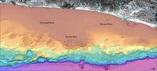
Bathymetric map of offshore Oregon

Detailed Description
Bathymetric map of offshore Oregon with Stonewall, Heceta, and Siltcoos Banks labeled.
Sources/Usage
Public Domain.

Official websites use .gov
A .gov website belongs to an official government organization in the United States.
Secure .gov websites use HTTPS
A lock () or https:// means you’ve safely connected to the .gov website. Share sensitive information only on official, secure websites.
Bathymetric map of offshore Oregon with Stonewall, Heceta, and Siltcoos Banks labeled.
Public Domain.