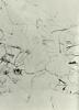
The Bridger-DeSmet map, drawn in 1851.

Detailed Description
The Bridger-DeSmet map, drawn in 1851. It marks a volcanic region in the heart of Yellowstone. Courtesy of Saint Louis University.
Sources/Usage
Public Domain.
Saint Louis University

Official websites use .gov
A .gov website belongs to an official government organization in the United States.
Secure .gov websites use HTTPS
A lock () or https:// means you’ve safely connected to the .gov website. Share sensitive information only on official, secure websites.
The Bridger-DeSmet map, drawn in 1851. It marks a volcanic region in the heart of Yellowstone. Courtesy of Saint Louis University.
Public Domain.
Saint Louis University