
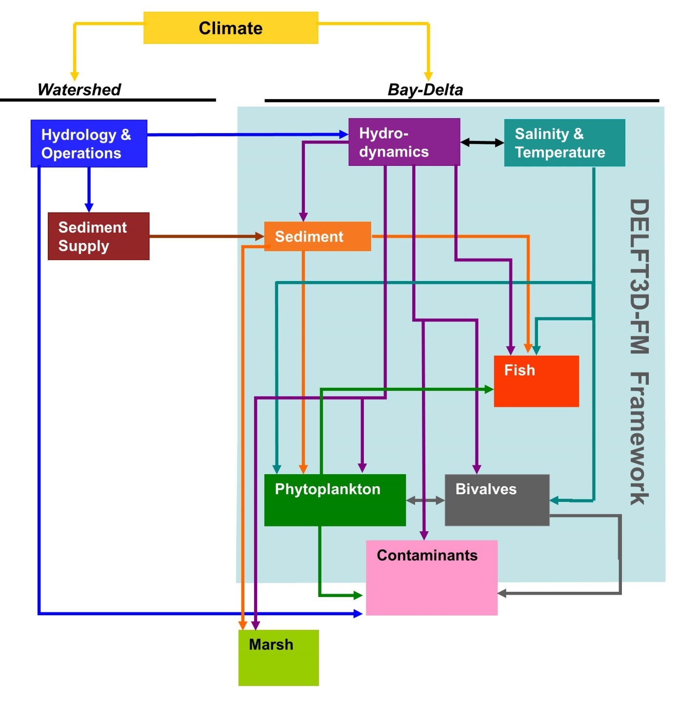
CASCaDE2 Modeling Flowchart

Detailed Description
CASCaDE2 modeling flowchart showing the system of linked models being used to evaluate scenarios of climate and infrastructure change. The light blue background indicates a framework of mutually compatible models developed by Deltares and USGS and applied by CASCaDE2 team members to the Bay-Delta.
Sources/Usage
Public Domain.